
Heatwave continues! 40’s reached in Interior
Valid: Sunday, August 16th, 2020
Meteorologist: James Follett
Issued: Sunday, August 16, 2020 - 11 PM
Day 3 of Mid and Upper 30’s Tomorrow.
what was the hottest day of the year so far with several towns and city’s approaching the 38 to 41*C range, elsewhere it was still in the mid to high 30’s, coolest along the coast, but even at the coast temperatures were into the high 20’s to near 30.
Here is a look at Today’s highs! Lytton being the hot spot at a sizzling 41.2 degrees Celsius or 107 degrees Fahrenheit.

Lytton………… 41*C
Ashcroft……. 40*C
Lillooet………. 39*C
Kamloops…. 38*C
Warfield……. 38*C
Osoyoos……. 38*C
Merritt……….. 38*C
Princeton…. 38*C
Penticton…. 37*C
Vernon………. 36*C
Kelowna…… 36*C ( University of British Columbia Okanagan )
Hope…………. 36*C
Pemberton… 36*C
Tomorrow will not be as Hot, but still far above the average and many towns and cities look to reach the mid and upper 30’s again at least through Tuesday. It is all thanks to this very large dome of High pressure that is trapping us with some sunny & Hot conditions.

The ridge that has brought us the Sizzling heat from the desert will be slowly moving Tomorrow and continue through the week as a trough off the Pacific will push the dome of heat to the South and East, but because it is moving slowly the cooling trend will be slow. Highs Tomorrow are expected to be in the mid and upper 30’s, by Wednesday & Thursday we will see the cool down where Interior is a comfortable warm 30 degrees, and the coast in the low 20’s.
The ridge does move up again by late next week and weekend, where temperatures in the Interior will reach the mid to upper 30’s and wouldn’t surprise me if some local towns hit 40 again.
Ridge moves East as Coastal trough moves South
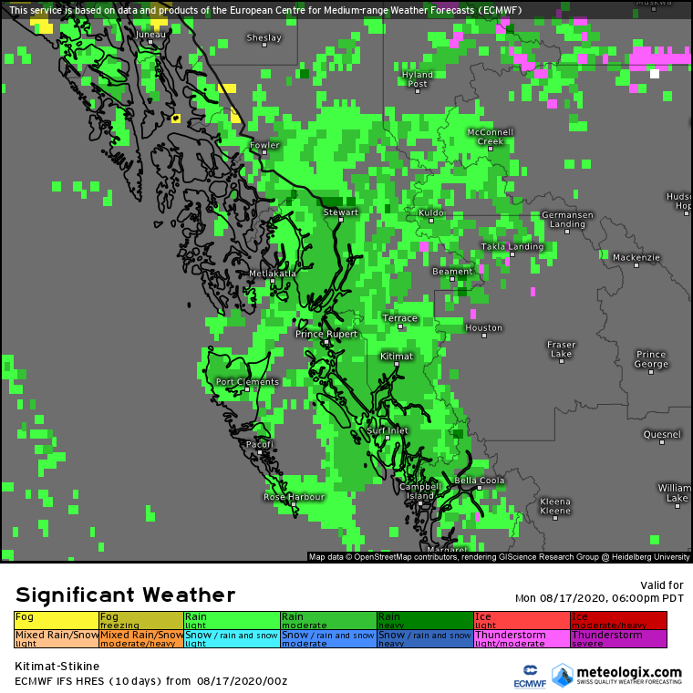
Continued Heavy rain for Queen Charlotte Islands and NW Coast to Alaska Border

In the past 24 hours, The Queen Charlotte Islands and much of NW BC and Alaska Border have received continuous amounts of heavy rain. Prince Rupert already picking up nearly 60 mm of rain in 24 hours and there is more rain on the way! Sandspit recording 21 mm in 24 hours, Terrace only at 8 mm.
Here is a look at the FutureCAST Infrared Satellite showing us the cloud cover over next 24 to 48 hours.


We will see some breaks in the clouds and rain later tomorrow, but another wave from that Pacific trough will bring more heavy rain for later Tomorrow Night into Tuesday.
Let’s now take a look at the FutureCAST showing when and where the rain will fall over next several hours.


Rain will continue much of the day Tonight & Tuesday. So how much rain will fall by time it is all said and done?
though Tonight and Tomorrow Night, another 20 to 40 mm is expected highest near the Alaskan Border. about 5 mm more for Haidi Gwaii.

