
Southern Ontario: Heavy Rainfall To Start Off the Weekend With Up to 20-40mm of Rain Possible by Saturday
/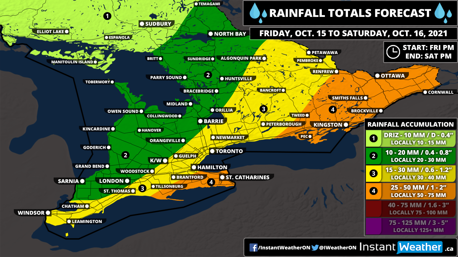
Forecast Discussion
A low-pressure system is expected to move into Southern Ontario bringing with it some scattered non-severe thunderstorms and heavy rainfall to Southern Ontario late Friday. This will continue into the overnight hours before another round with more organized bands of rainfall moves across the more eastern section of the region during the day on Saturday. We expect the highest rainfall totals along the Lake Erie shoreline and into Eastern Ontario where between 20-40mm (locally up to 50mm) is possible. Further west, we will see lower totals through Southwestern and Central Ontario with rainfall totals ranging from 10-20mm (locally up to 25mm). The rainfall will come to an end late Saturday although we may see some more rain on Sunday.
Keep in mind that this forecast is just a rough idea of the expected rainfall totals. Due to the rainfall being connected to thunderstorm activity, some areas may overperform this forecast should the thunderstorm activity shift around. There may also be some underperformance with the forecast due to the localized nature of the storms.
