Snow Squalls Brings Snowy Blast to Parts of the Snowbelt Around Lake Huron and Georgian Bay on Monday With Locally Up to 15–25cm Possible
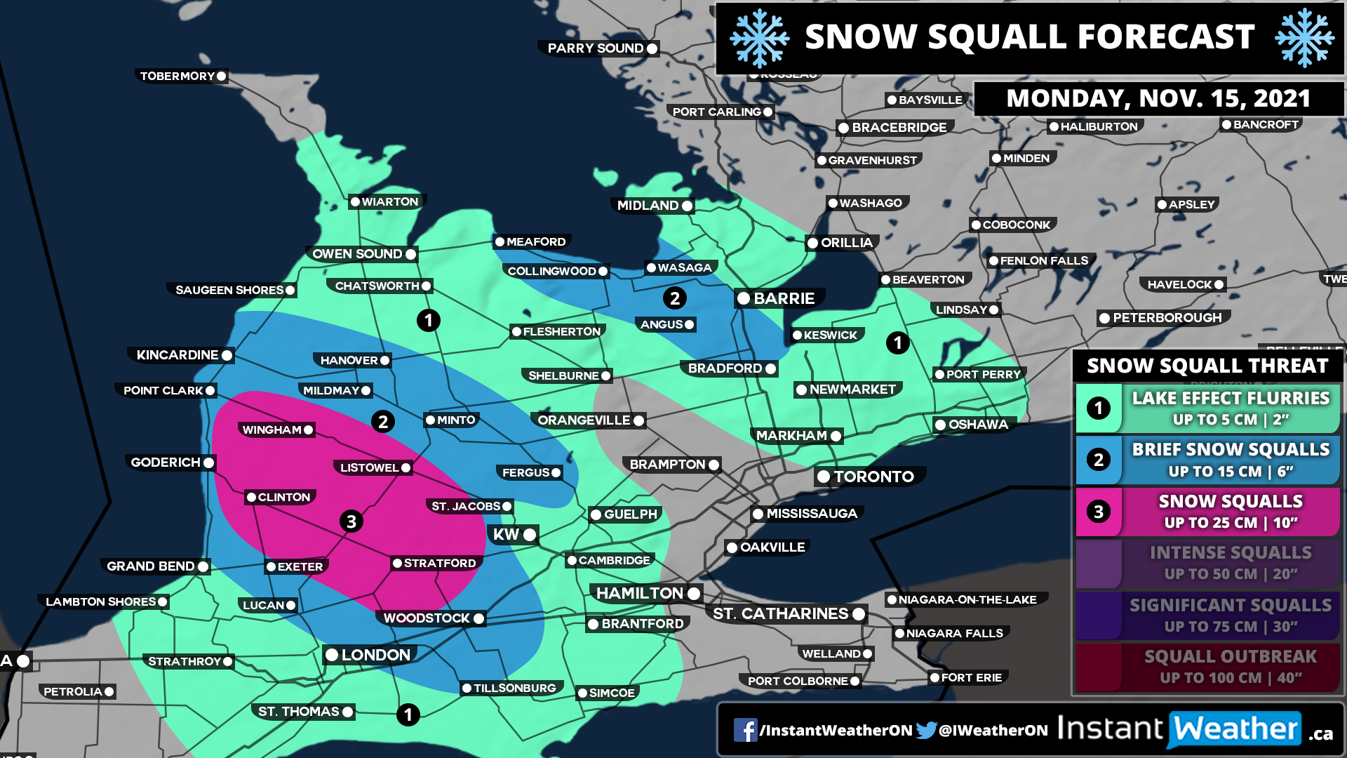
/The start of the week through parts of the traditional snowbelt southeast of Lake Huron and Georgian Bay will get off on a snowy note as some organized lake effect snow and localized squalls are expected to develop early Monday. Current indications suggest that a fairly strong squall could develop off Lake Huron during the mid to late morning hours on Monday stretching from Goderich and further inland towards Stratford.
In addition to this, we will see some lake effect activity off Georgian Bay during the late morning affecting the Collingwood and Wasaga area along with the Hwy 400 corridor between Barrie and Bradford. This will continue throughout the day and may even linger into the overnight hours into predawn Tuesday. However, it should dissipate by mid-Tuesday morning so it shouldn’t have a significant impact on the morning commute.
As is typical with lake effect snow events, predicting the exact accumulation is very tricky as it depends on how strong the bands are and where exactly they lock-in. We do believe there is the potential that someone just to the southeast of Goderich including Clinton, Wingham, Listowel and Stratford could pick locally up to 20-25cm, but general snowfall amounts around 10-20cm are more likely. Surrounding regions including the Lake Huron shoreline where temperatures will be slightly warmer can expect between 5-10cm with locally up to 15cm. The Collingwood and Angus corridor could see around 10-15cm in the hardest-hit locations. The City of Barrie should escape the worst although the south end of the city could pick up near 10cm with around 5cm in the north end.
Travel conditions throughout the day on Monday will likely be very poor within the affected regions so be sure to take your time and maybe avoid travelling until conditions improve. Snow squalls can cause rapid reductions in visibility and make it hard to adjust to conditions.


