Autumn Sets In Across Ontario With a Significant Cooldown & the First Snowfall of the Season
/As we head deep into the fall season with the arrival of October, it’s expected to see some colder air and even the risk of the familiar white flakes we haven’t seen in a while. For most, it still comes as a shock especially considering how warm the start of fall has been across the region. The rude awakening will occur later this week as a cold front ushes in colder temperatures across Northern and Southern Ontario. You still have time to get out there and enjoy the nice fall weather - double-digit daytime highs are expected to continue on Wednesday for all of Ontario and Thursday for Southern Ontario.
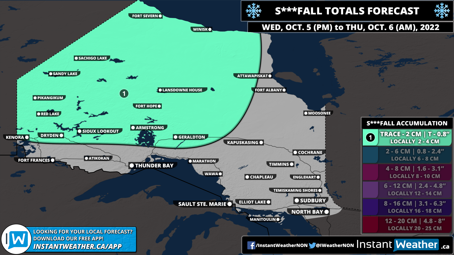
We will see the colder air making its way into Northwestern Ontario by late Wednesday as the cold front moves through. The cold front will also be accompanied by some light precipitation, initially coming down as rain showers. However, with temperatures expected to drop to near the freezing mark overnight Wednesday into Thursday morning, it could transition over to some wet snow. This is predominantly for Northwestern Ontario along the Manitoba border where the temperatures will be cold enough for snow. We don’t expect much in terms of accumulation since the ground will still be fairly warm and any snow will melt on contact.
The cold front will continue to progress to the southeast throughout the day on Thursday. This will bring the risk of some wet snow to parts of Northeastern Ontario overnight Thursday as temperatures hover near the freezing mark. There is some indication that the snow could be quite heavy at times so it may leave some minor accumulation through Chapleau and Timmins with up to 2-4cm possible. However, this is questionable so it’s not guaranteed to accumulate and will come down to exactly how cold it can get.
For Southern Ontario, the story for most of the week will be almost perfect fall weather with mild temperatures in the high teens or low twenties and not much in terms of rain. By Friday this will change with the arrival of the cold front early Friday which will result in a rapid drop in temperatures. The daytime high on Friday will be around 10 degrees colder than just 24 hours earlier! It will get even colder overnight into Saturday morning with many areas at or slightly below the freezing mark leading to the widespread risk of frost.
It appears that Southern Ontario should avoid the season’s first snowfall for the most part. There still could be some flurries early in the morning on Friday through North Bay and into Algonquin Park, but it shouldn’t be widespread. Temperatures will moderate somewhat heading into next week which should ensure we don’t get any snow just yet. It’s only a matter of time though and it does look colder towards the middle and end of October so there might be a chance for many areas to see their first flakes of the season.
Here is another advertisement so we can pay other bills:


