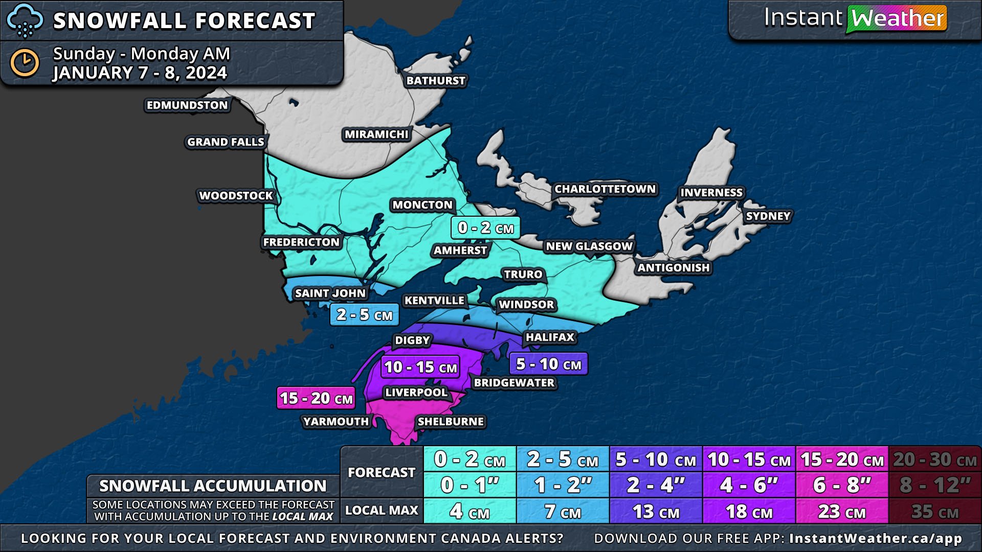
First Significant Snowfall of the Year Is on the Way for Nova Scotia With Up to 20cm of Snow Starting Sunday
/NOTE: YOU CAN CLICK ON THE MAP TO OPEN A ZOOMABLE IMAGE WHICH WILL BE EASIER TO READ.
As we finish the first week of 2024, the Maritimes, Western Nova Scotia in particular, can expect their first significant snowfall of the new year. This storm, which is already impacting New England, will pass to the south of Nova Scotia, clipping the western half of the province with snow beginning Sunday morning and continuing through to early Monday morning.
The morning will start with some light snow as the storm pushes its way into the region. A large swath of the Maritimes, mainly Central Nova Scotia and Southern New Brunswick, will see some light snow from this storm, but not much in terms of accumulation.
In Western Nova Scotia, the snowfall is expected to intensify in the afternoon and peak in the evening, bringing snowfall rates around 2-4cm/hr and ramping up the accumulation. The South Shore will be the hardest hit area, where 15-20cm of snow is forecast to fall and there is the possibility of up to 25cm locally.
As the storm passes, wind gusts up to 70km/h will coincide with the snow so reduced visibility due to blowing snow will result in hazardous travel conditions. Luckily these conditions will be fairly short-lived and will improve by Monday morning.


