
Another Dumping of Snow on the Way for Nova Scotia With Up to 30cm Possible Starting Tuesday
/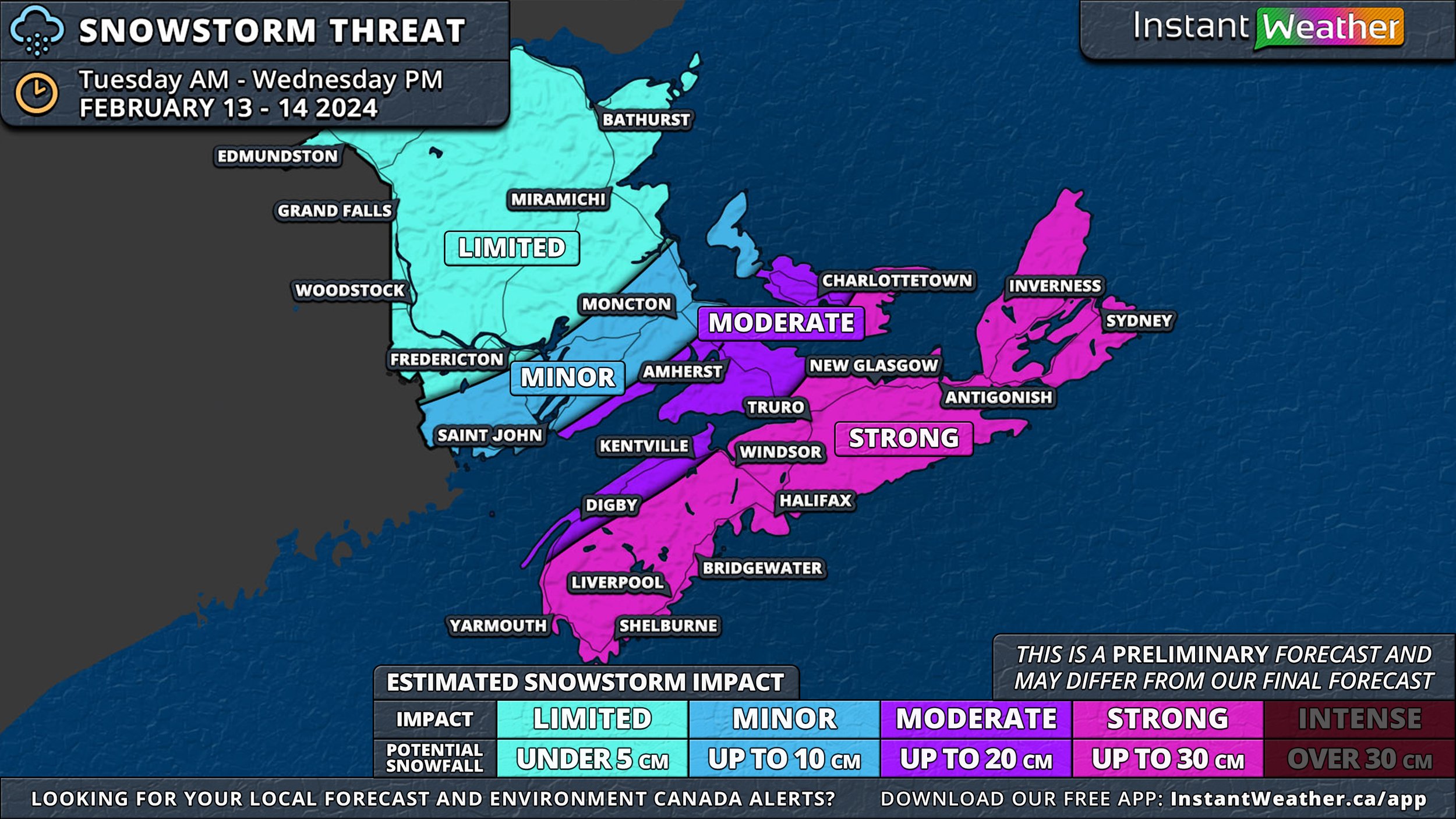
NOTE: YOU CAN CLICK ON THE MAP TO OPEN A ZOOMABLE IMAGE WHICH WILL BE EASIER TO READ.
The upcoming snowstorm poised to strike Nova Scotia is quickly on its way, and while there remains some uncertainty regarding the precise path of the storm and the expected snowfall amounts, it's becoming increasingly apparent that it will have significant impacts on the province.
Fortunately, this storm isn't anticipated to be as severe as the one experienced earlier in the month. Nevertheless, we aim to give you a glimpse into the potential effects of this storm before releasing our comprehensive forecast tomorrow.
As it stands, we're expecting that most Nova Scotia will see snow accumulations of 20-30cm from Tuesday morning through Wednesday. The Annapolis Valley and Cumberland County are the exceptions, where snowfall is projected to be in the range of 10-20cm.
Accompanying wind gusts could reach up to 80km/h, raising concerns about blowing snow again. Please remember, that this initial outlook is subject to change as we gain a clearer picture of the storm's trajectory.
Despite the storm's uncertain path, the timeline is clearer. Snow is expected to sweep in from the west late Tuesday morning and early afternoon, spreading eastward across the province during the afternoon and evening. The peak of the snowfall, along with the strongest winds, is expected to occur Tuesday evening, continuing into the night. The storm is forecasted to taper off from west to east starting Wednesday morning and into the afternoon.
In the aftermath of the storm, coastal areas of Pictou and Antigonish Counties, as well as Northern Cape Breton Island, are likely to experience onshore flurries that will persist through Thursday. These areas could receive an additional 30+ cm of snow, which is not accounted for in the accumulations depicted on the Snowstorm Threat map.
