Severe Thunderstorm Risk Returns to Southern Ontario on Wednesday and Thursday
/
NOTE: YOU CAN CLICK ON THE MAP TO OPEN A ZOOMABLE IMAGE WHICH WILL BE EASIER TO READ.
The first full week of September has begun with unusually warm temperatures, bringing some of the hottest weather we've experienced all summer in Southern Ontario. This hot and humid air is a crucial ingredient in thunderstorms, and it will certainly play a significant role over the next two days, with the risk of severe storms returning to our region later this afternoon and again on Thursday.
As of early Wednesday afternoon, we are currently seeing the development of storms over Michigan, which are tracking into Southwestern Ontario. These storms will continue tracking to the northeast, with more pop-up activity anticipated around Georgian Bay by late afternoon. The daylight heating that fuels these storms will begin to wane in the early evening once the sun sets, leading to a gradual weakening in the storm activity around 8 or 9 PM.
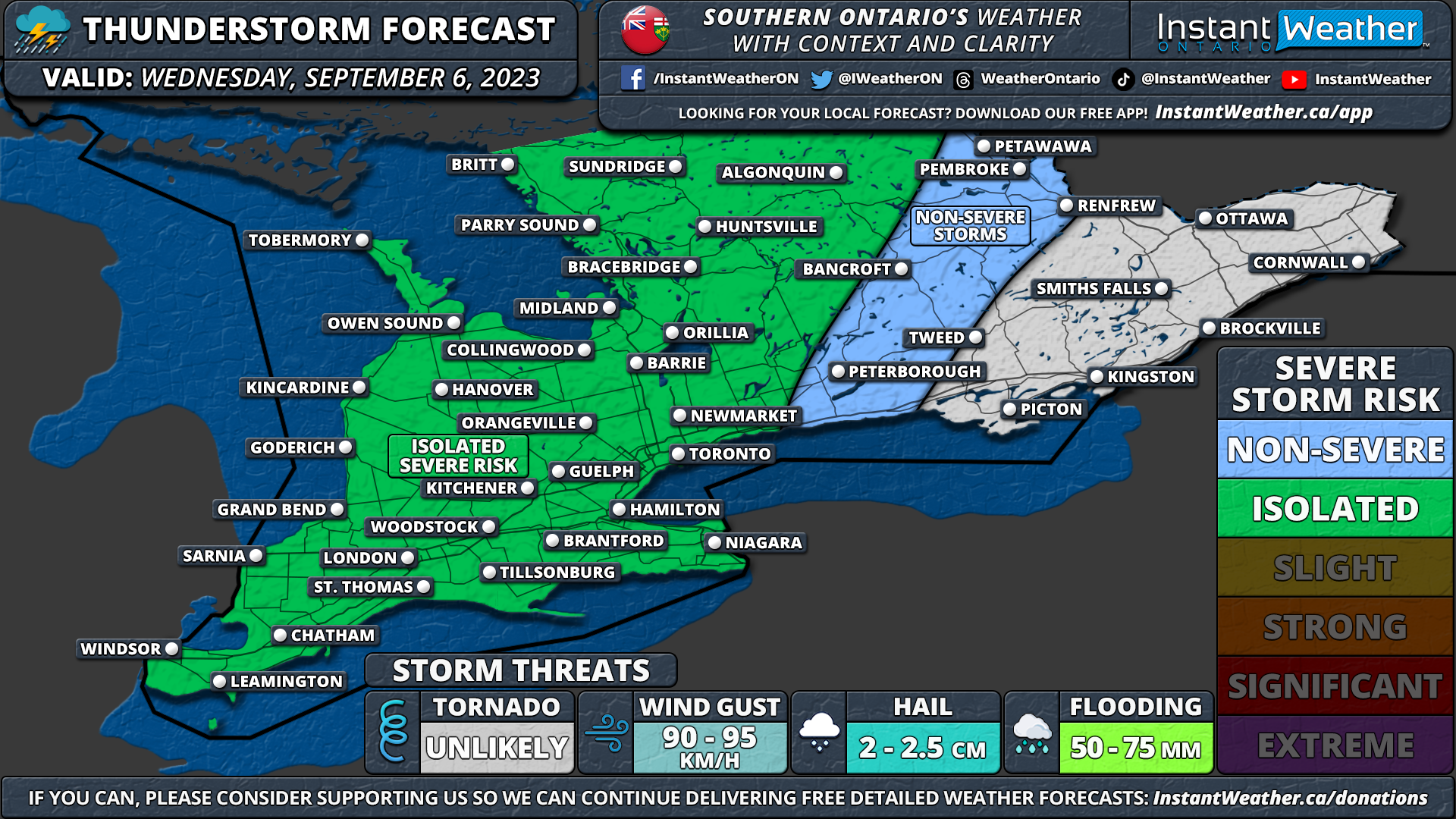
For the most part, these storms should remain non-severe; however, we can't rule out the possibility of a few isolated severe storms. The primary concern will be damaging wind gusts exceeding 90 km/h, and there is also a chance of small hail up to the size of dimes along with heavy rainfall. While the tornado risk for all of Southern Ontario is relatively low, we can never entirely dismiss the possibility of an isolated tornado if the right conditions come together.
It's crucial to note that while we have an expansive isolated severe risk, not all areas within the forecast will experience severe weather. The environment is conducive to severe storms, but pinpointing exactly where these storms will occur remains challenging.
Similar dynamics will be in play on Thursday afternoon and evening. The focus of tomorrow's risk will be in Central and Eastern Ontario, although the development of storms is less certain. The storm mode is expected to be more discrete, increasing the potential for hail and tornadoes compared to today.
There are still many uncertainties, so we are awaiting more data before putting together a forecast for the storms on Thursday. Stay tuned for a detailed forecast, which we will provide either later today or early tomorrow.
