
The Nightmare Before Christmas; Major Snowstorm Set to Dump Up to 50cm of Snow on Southern Alberta Including Calgary Between Monday and Tuesday
/
With only days to go until Christmas, a powerful snowstorm is setting its sight on parts of Southern Alberta beginning late Monday morning along the Rockies and later Monday for other areas. Heavy snowfall will be ongoing throughout the day on Monday and extending into Tuesday as moisture from the Pacific Ocean is drawn into the province.
To make matters worse, the low-pressure system bringing all this weather will further intensify causing wind gusts to pick up into the 40-60km/h range with stronger gusts overnight into Tuesday. Blowing snow and hazardous driving conditions are likely during this time so avoid all non-essential travel if possible. Snowfall will begin to come to an end later in the day on Tuesday as the system moves out over Saskatchewan although flurries will likely continue through the evening and maybe even into early Wednesday.
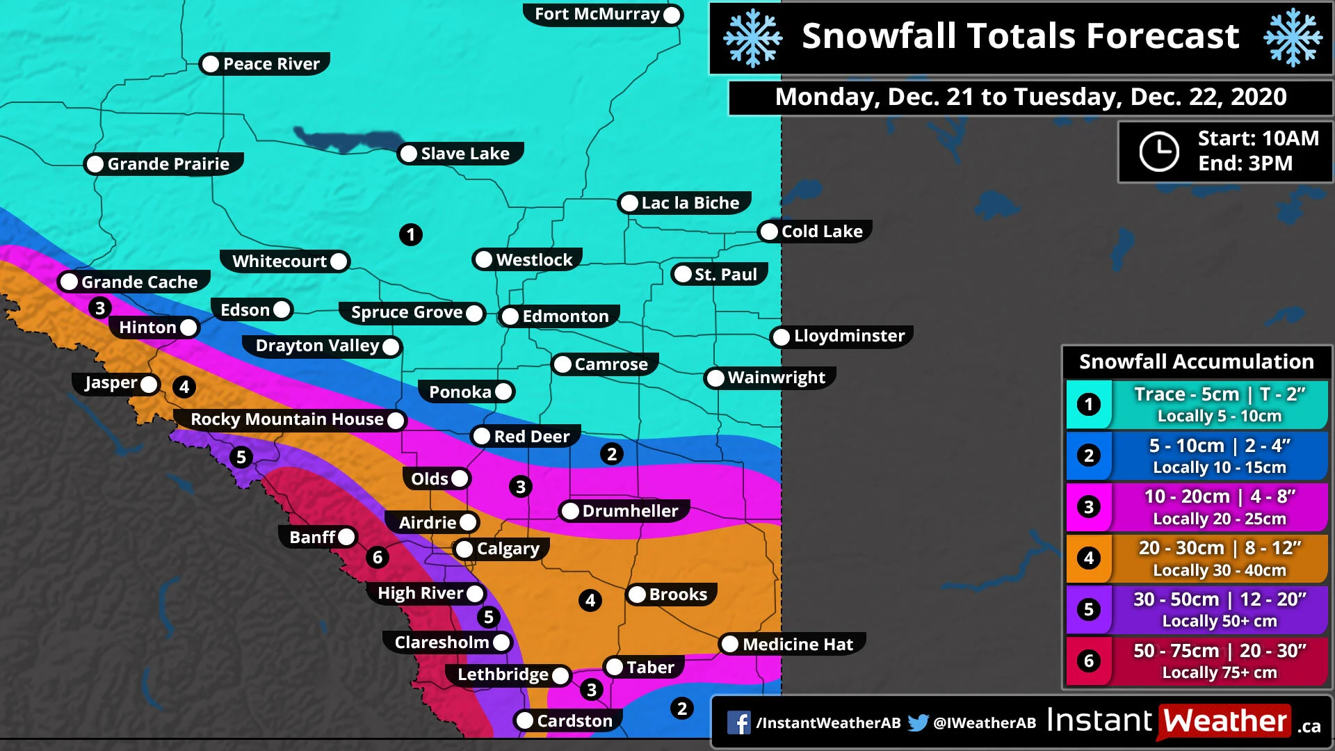
As with most snowstorm that affects Alberta, this will be a very elevation dependent storm when it comes to accumulation. The highest snowfall totals will of course be found through the Rockies to the southwest of Calgary including the Banff area with between 50-75cm of accumulation possible. A small area just to the south of Calgary that is slightly more elevated including the Foothills such as High River and Claresholm has the potential for between 30-50cm of snowfall accumulation.
Outside of the elevated areas, we expect between 20-30cm through the City of Calgary and eastward towards the Saskatchewan border including Brooks and Medicine Hat. Lower totals closer to 5-15cm is expected to the southeast of Lethbridge. And further north the accumulation will also be lower with less moisture to work with so Olds and Drumheller will see between 10-20cm while Red Deer gets around 5-10cm. Edmonton and Northern Alberta will see little to no snowfall from this event.
