
Post-Tropical Cyclone Teddy sets eyes on Newfoundland
/Updated: September 22, 2020 @ 11PM
Valid: September 22, 2020 @ 11 PM
Forecasters: James Follette & Alannah Franks

What was once Hurricane Teddy is now a monster sized and very powerful Post-Tropical Cyclone is currently pummeling the Atlantic Canada with Tropical Storm conditions in Nova Scotia, PEI, New Brunswick and Southern Maine.
As of 9 PM, Tropical Storm conditions have started moving into Port-Aux Basques and St. Pierre.
The Track is expected to take it over Cape Breton and then stay just offshore of Western Newfoundland as a strong Post Tropical Storm.
Heavy flooding rain is expected over the Avalon and Burin Peninsula as well as all of Southern Newfoundland through Port-Aux Basques and up to Clarenville. the least rainfall will be in Northern and Western Newfoundland with 15 to 30 mm, Up to 75 mm can fall in Eastern Newfoundland and up to 50 mm in Southern.
As for winds now, Winds will be the strongest in the West and the lightest in the East.
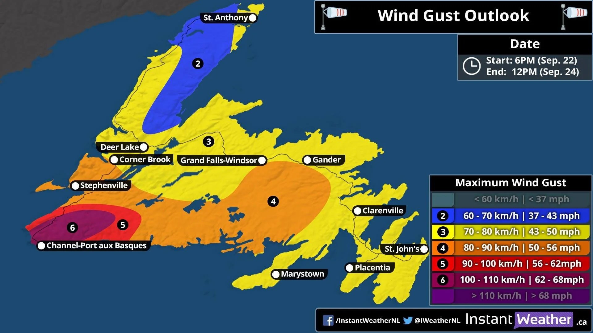
Winds in SW will be as high as 110 km/h, much of Western and Central will see Gusts up to 90 km/h, then further away, Northern Newfoundland, only up to 70 km/h and wide swath of up to 80 km/h for the Avalon, Burin Peninsula, Clarenville, Gander, GFW, Deer Lake, Corner Brook all will see Gusts up to 80 km/h.
With the Heavy rain and high winds, Scattered to widespread power outages is possible, The storm will arrive on Wednesday and last through Thursday.
Tropical Storm warnings are already in effect for South Western Newfoundland, large waves and rip currents, Storm surge is also expected.
