
The Battle of the Seasons With Accumulating Snow and Temperatures Near 20°C in the Coming Days for Southern Ontario
/
NOTE: You can click on the map to open a zoomable image which will be easier to read.
After we had a relatively mild start to fall, the past week or so has been dominated by a taste of wintery weather. Over the last few days, we’ve seen near-freezing temperatures and the first snowfall of the season in some parts of Southern Ontario. If you weren’t quite ready for this blast of wintery weather, you won’t like what is ahead for the next 24 hours with more snow and chilly temperatures. The good news is that there is light at the end of the tunnel as we see the return of milder air in time for the weekend.
Precipitation aided by lake enhancement off Lake Huron and Georgian Bay continues to linger across Southern Ontario on Wednesday. With temperatures expected to slide close to the freezing mark overnight, the precipitation will transition over to some light to moderate snow. This will be especially the case in the higher elevations of the Dundalk Highlands and into northern parts of Muskoka where even some accumulation is possible. Wet snow will continue into Thursday morning with the heaviest snow located east of Georgian Bay as a somewhat intense band of lake effect snow sets up over the Huntsville area. Reduced visibility and slushy roads will result in poor driving conditions throughout the affected region so be sure to take your time if you have to travel in the morning.
In terms of accumulation, this is very tricky to forecast as temperatures will be right near the freezing mark. Some of the models we review to create our forecast are showing significant totals of up to 15-20cm for parts of Muskoka by the end of Thursday. However, this isn’t realistic as it doesn’t account for most of the snow melting on contact as it falls onto the ground. We are going with a maximum of 4-8cm for total accumulation, but it’s important to note that this could be an underestimate if temperatures are slightly colder than expected.
Outside of that localized region, those who see snow over the next day will experience very little accumulation if anything at all. There could be a few centimetres of accumulation in parts of the Dundalk Highlands including Hanover, Shelburne and the Blue Mountains. The snow will come to an end by the afternoon on Thursday as temperatures slowly warm up and the snow transitions over to rain. Another night of near-freezing temperatures is expected as we go into Friday morning, but the lake-effect precipitation will have tapered off so we shouldn’t see any snow.
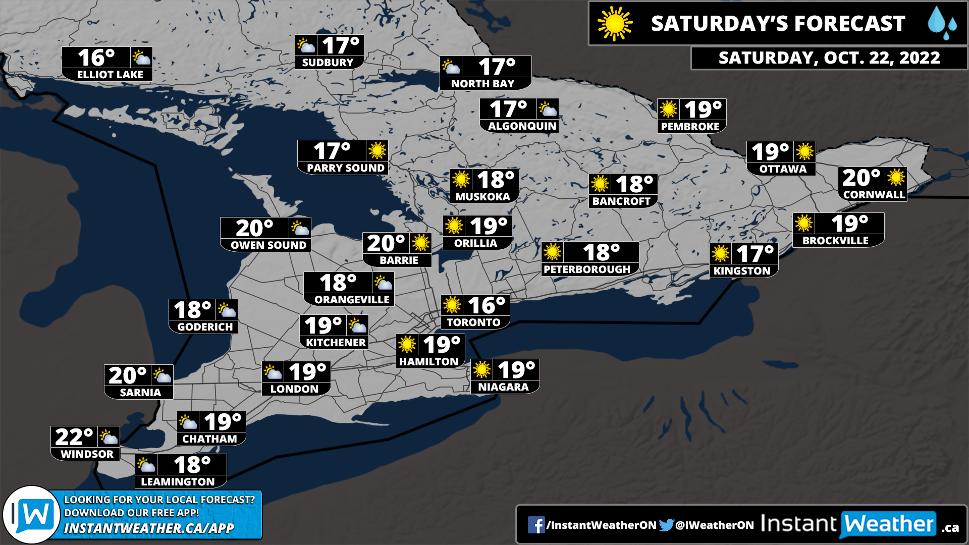
NOTE: You can click on the map to open a zoomable image which will be easier to read.
As our focus turns towards the weekend, we are watching what will be a radical change in our weather with the arrival of milder air which will push the temperatures into the double digits on Friday with even more of a warm-up on the weekend. If you have any activities you wanted to get done before winter comes then this weekend would be the perfect time to get them done.
Both Saturday and Sunday will feature well above seasonal temperatures pushing into the 20s which is quite uncommon this late in the season along with sunny skies. Even if you can’t get out and enjoy the weather this weekend, it will be sticking around for at least a few more days into early next week. It looks like more seasonal temperatures will return by the end of next week.
Here is another advertisement so we can pay other bills:
