Widespread Snowfall With Strong Winds and Frigid Temperatures on the Way for Southern Ontario; Up to 6-12cm Possible Between Thursday and Friday

A Colorado Low is expected to impact Southern Ontario beginning Thursday evening bringing with it the threat of widespread accumulating snowfall to some parts of the region. General snowfall accumulation ranging from 6-12cm is expected by the end of Friday. Lower amounts are expected around Lake Erie and Lake Ontario shoreline due to some rain mixing in as temperatures temporarily rising above the freezing mark early Friday morning. We will also see strong wind gusts develop early Friday morning particularly around the Georgian Bay and Lake Huron shoreline reaching as high as 60-80km/h. Blowing snow and reduced visibility is possible throughout the day on Friday.

This system will also serve as a preview of what will dominate the weather story across Southern Ontario the next week starting with bone-chilling Arctic air flowing in behind the system as it moves out by late Friday into Saturday. Very cold temperatures combined with the Great Lakes that are still mostly ice-free will provide the optimal environment for snow squalls to impact the typical snowbelts starting Saturday morning. Current indications suggest these squalls could be quite prolonged and could last all the way into the middle of next week.

The precipitation associated with this Colorado Low will start to enter the province from Michigan sometime late Thursday evening just before midnight. As is usual, Windsor and Sarnia will be the first to be affected which is expected to come down as mainly snow although some data suggest some brief freezing rain could also occur. Precipitation will continue on its eastward trek encompassing all of Southern Ontario south and east of Lake Simcoe around midnight with snowfall continuing throughout predawn on Friday.

As mentioned, temperatures will be very close to the freezing mark as the system ushers in some warmer air just for Friday morning. So some areas mainly through the GTA and Niagra region may see some rain mix in which would reduce the potential snowfall accumulation. This system will also be weakening as it moves across Southern Ontario so by the time it reaches Eastern Ontario around sunrise of Friday, it will mostly be just light snow or flurries. For Southwestern Ontario into the GTA, we’ll see the snow start to taper off late Friday morning with it linger through Central and Eastern Ontario until around the lunch hour. The worst conditions will be found early Friday morning where strong wind gusts could result in some blowing snow and drifting snow. Be sure to leave plenty of time for your commute on Friday, but major impacts like school bus cancellations aren’t expected at this time.

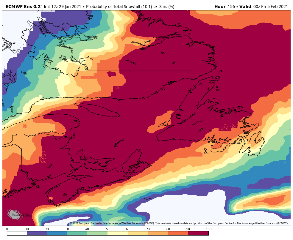
Most areas throughout Southern Ontario will end up with total accumulation between 6-12cm and a few localized pockets picking up as much as 15cm. However, there are a few exceptions such as along the Quebec border, the GTA/Niagara region and around Georgian Bay which will likely not reach the 6cm mark due to the lack of moisture or rain mixing in. Those areas can expect around 2-6cm although those right near the lakeshore may even struggle to get up to 2cm if it comes down as mostly rain.

In the wake of the system, we’ll see temperatures plunge well below the freezing mark overnight Friday setting the stage for a very cold weekend. Many areas will see lows over the weekend flirt with the -20°C mark especially on Sunday and into next week. Extremely cold wind chills will likely be found on several mornings making it feel like below -30°C.

This will all set the stage for what could be a pretty prolific snow squall outbreak off the Great Lakes beginning on Saturday. The threat for squalls will continue on and off all next week as well with the current data pointing to a consistent southwesterly and westerly flow during this time. This would mean areas east of Georgian Bay (Muskoka, Parry Sound) along with northern sections of Grey-Bruce counties will likely be the hardest hit from these squalls. Snow totals this weekend and all next week could exceed 75-100cm in some of these areas although that may change and it depends on if the squalls lock in for a prolonged time. Squalls off Lake Ontario and Erie will mostly affect Upstate New York but with a southwesterly flow, they may drift far enough north to affect the Niagara and Kingston region at times. Wouldn’t be surprised to see some of those areas pick up 10-25cm of snow over the next 5 days.

Of course, the lake effect snow event is still several days away and there’s still a lot of details to work out so this is subject to change. We’ll have a more precise forecast in the coming days including forecast maps but we thought it was significant enough to give a heads up so you can plan accordingly.

Groundhog Day Nor’easter To Cause Darkness for Many!

Issued: February.2nd, 2021 @ 04:15 AM

Updated: February. 2nd, 2021 @ 04:15 AM

Forecaster James Follette

Power Outage forecast.JPG

A Nor’easter that is bringing Tropical storm to Hurricane-Force wind gusts, heavy snow of up to 8-10” and Rainfall as much as 4” or more will be pounding the province and will be testing the power company today.

With the heavyweight of snow, ice & rain then being battered by high winds of up to 100 or greater in many areas, especially in the Les Suetes where gusts are expected to climb past 150 km/h which is expected to cause widespread power outages and damage.

Areas that will see winds gusting to 80-100+ but have lot’s of snow, ice, and rain on trees and wires are at risk for power outages.

The greatest risk for very likely widespread power outages covers almost all of the province except parts of Western, as winds will be not as strong, and not as much snow expected.

The greatest risk of power outages will be all day today and tonight.

Please have your storm kit on you, and extra blankets, food, and batteries in case of a power outage and be sure to have a generator on stand by if possible.

Wicked Winds of Up to 110 km/h Gusts & Up to 170 km/h in Les Suetes! Expected for Tonight Into Tomorrow!

Issued: February 2nd, 2021 @ 2:30 AM

Updated: February 2nd, 2021 @ 2:30 AM

Forecaster: James Follette

Monday Overnight winds.JPG

The Nor’easter continues to come closer to the province with snow and increasing winds, and through the night tonight, winds will be very strong on the south shores.

Winds of up to 105 km/h are expected to waken Barrington to Clark’s Harbor and while not as strong as the small islands and coast, up to 90-95 km/h gusts are expected for Shelburne and inland Yarmouth, in the town of Yarmouth, the winds are expected to gust as high as 70 km/h, this also goes for Halifax, Liverpool & Bridgewater of reaching gusts up to 70 km/h. Digby to Greenwood and Kentville and even Truro & Sydney, they can see gusts up to 60 km/h.

These are strong wind gusts that are in the Tropical Storm-Force category, but these will be nothing compared to what it will be like in the morning!

Ruesday morning winds.JPG

While the overnight hours will be gusty.. the Morning hours will be VERY WINDY! Wind gusts of 100+ km/h are expected to spread across much of the province, Yarmouth to Halifax can be seeing 90-105+ km/h wind gusts that will be capable of downing trees, breaking windows, ripping sidings and roof shingles from homes, throw objects not tied down far away and possibly can injure someone, and with snow still falling for the first part, it will look like a blizzard at times, and then when it rains, it will look like a tropical system or Hurricane was overhead. Power outages are very likely as strong winds whipping up powerlines coated in heavy wet snow, heavy rain, and some ice as well, but also down trees coming on wires.

For Greenwood, Kentville, and coastal areas of Western Cape Breton, winds will only gust to 70 km/h in the morning but still gusty enough to cause power outages and blizzard-like conditions in the snow. Lesser winds can be expected elsewhere with winds approaching only gusts up to 60 km/h.

Updated Snowfall Map! Up to 20cm for Some on the Mainland (Copy)

Issued: February 2nd, 2021 @ 12:45 AM

Updated: February 2nd, 2021 @ 12:45 AM

Forecaster: James Follette

Groundhog Day Snowfall map.JPG

A new updated snowfall forecast has just been made as new weather data came in, and the heavy rain and speed of the system took into account.

Rain is already approaching parts of the extreme South east portions of the province and this would cut back on snowfall totals lower than models predicted.

Up to only 6cm is forecast for that area in the south-east.

Up to 12cm for Yarmouth to Kentville, Bridgewater and Liverpool as well as much of Cape Breton.

Up to 20cm can be expected for a big chunk of the province, Cumberland, Colchester, Pictou, Hants, Halifax and Halifax Metro, Antigonish and Guysborough.

Up to 30cm can be expected for NW Cape Breton this includes North Mountain to Cheticamp.

Sydney can only see up to 6cm of snow.

Updated Snowfall Map! Up to 20cm for Some on the Mainland

Issued: February 2nd, 2021 @ 12:45 AM

Updated: February 2nd, 2021 @ 12:45 AM

Forecaster: James Follette

Groundhog Day Snowfall map.JPG

A new updated snowfall forecast has just been made as new weather data came in, and the heavy rain and speed of the system took into account.

Rain is already approaching parts of the extreme South east portions of the province and this would cut back on snowfall totals lower than models predicted.

Up to only 6cm is forecast for that area in the south-east.

Up to 12cm for Yarmouth to Kentville, Bridgewater and Liverpool as well as much of Cape Breton.

Up to 20cm can be expected for a big chunk of the province, Cumberland, Colchester, Pictou, Hants, Halifax and Halifax Metro, Antigonish and Guysborough.

Up to 30cm can be expected for NW Cape Breton this includes North Mountain to Cheticamp.

Sydney can only see up to 6cm of snow.

Wintry Blast to Hit PEI

Valid: Monday Feb 1, 2021

Wintry Blast to hit PEI

The one thing we know for sure is that the system we will see on Tuesday afternoon into Wednesday morning is going to be a messy one.

TIMING:

Snow will begin around noon on Tuesday across the Island and should be all down by early evening. This is where the mess begins. Snow will change over to ice pellets around 5-6 pm and some areas around Kensington may see some freezing rain for a brief period during the change over. Rain will quickly set in across the province in the early evening and will continue until Wednesday morning.

TOTAL AMOUNTS ACROSS THE PROVINCE:

The models are still not in total agreement, but what we can see at this time is the following accumulation amounts. Higher snow accumulation areas will be in Prince County.

Snow

Prince County – 25-35 cm

Queens County – 10-20 cm

Kings County – 5-15 cm

Ice Pellets

Prince County – 1 cm

Queens County – 1 cm

Kings County – 1-2 cm

Rain

Prince County – 15-20 mm

Queens County – 15-20 mm

Kings County – 20-25 mm

WIND: Winds will be a factor with this system. Many areas of the Province will experience blowing and drifting snow.

Wind will start increasing early afternoon on Tuesday and diminish overnight into Wednesday morning. Mid afternoon when the snow is coming down, the province should see winds of 40-50 km/h. Wind gusts of 70-90 km/h can be expected in the late evening hours of Tuesday until just after midnight.

TEMPERATURE: We will start the day across the province at around -5 to -7 C. We will see a gradual warming across the province from East to West starting mid afternoon and by early evening hours the entire province should be experiencing temperatures around +2 C. The warmup will continue overnight and by Wednesday morning we could be waking up to temperatures near +5 to +7 C.

With the increasing winds and snow, visibility will be diminished in areas during the mid afternoon to suppertime area. Please exercise caution on the roads throughout the evening hours of Tuesday.

If you want to clear your driveways and sidewalks, you are going to want to get that done before the rain starts in the early evening (around 8pm).

As always, be safe and let us know what you are experiencing in your areas.

Storm chip Probability: 40%

PEIBW Team (Mike S, Harry S)

Groundhog Day Storm

Valid Monday Feb 1, 2021

It's looking unlikely that the Ground Hog will see his shadow tomorrow, as there's a winter storm on the way. So, if the groundhog sees his shadow it's 6 more weeks of winter. If he doesn't, it's only a month and a half? haha

This system will bring a mixed bag of precipitation to New Brunswick. It's likely to get messy.

Early Tuesday morning, snow will begin in the Southwest corner of the province, spreading Northeast. This snow could be heavy at times and mixed with the wind, there could be some blowing and drifting. This would reduce visibility and make driving more difficult. Snow amounts are likely to be a general 10-20cm throughout the province, with 30cm or more possible in the Northeast corner.

Through the afternoon, snow in the southeast will gradually start to switch over to ice pellets and/or a little freezing rain, as it transitions to rain. While rainfall with this system could be significant, the higher amounts (10-30mm) are possible near the Fundy shore.

Wind could also be an issue with this system. Winds are likely to be 20-40km/h with gusts from 50 to possibly 90km/h at times near the Fundy shore.

This system should be gone by early Wednesday morning.

As always, be safe and let us know what you're experiencing in your area.

Storm chip probability: 40%

~ IWNB team,

Mike & Harry

IW Storm Watch! Everything You Need To Know Before, During & After!

Issued: February, 1st. 2020 @ 4:30 PM

Updated: February, 2nd. 2020 @ 12:30 AM

Forecaster: James Follette

Winter Storm II.jpg

Good Afternoon! Welcome to IW Storm Watch of the Nor’easter on par to hit the province in a matter of hours which will bring heavy snow late this evening and overnight and into the early morning on the south coast before very quickly moving north spreading further across the province.

For updates on the storm from Alerts to latest updates, Traffic alerts, Power Outages and closures will all be posted right here! and updated frequently before, during and after the storm!

We’ll start Storm watch with the latest alerts that are issued across the province!

image.0.png

We have a new alert just issued recently, A special weather statement regarding higher than normal water levels expected. Higher than normal Waters levels and large waves are expected along the mainland Atlantic Coast near high tide Tuesday night.

This is to include:

East Of Porters Lake

  • Guysborough County

  • Halifax County

  • Halifax Metro And Halifax County West

  • Lunenburg County

  • Queens County

  • Shelburne County

  • Yarmouth County

Coastal flooding, beach erosion, and dune erosion are very possible in the mentioned areas.

image.0 (1).png

We have a continued Flood warning ( Rainfall warning) issued for the following areas:

Nova Scotia except Inverness County - Mabou and North.

Snow will change to rain, at times heavy, Tuesday morning in the Southwest and Tuesday afternoon in the northern mainland and Cape Breton. The rain will taper to showers Wednesday morning.

25 to 80 mm, with the highest amounts along the Atlantic Coast, are expected.

The combination of the heavy snowfall amounts, Heavy rainfall, mild temperatures along with potential coastal flooding from large waves, high tide, and heavy rainfall. Flash flooding, Coastal flooding, and urban and street flooding is likely.

image.0 (2).png

We also have snowfall warnings that are issued! For Victoria County, 15 to 30cm can be expected, with possible higher amounts over higher terrain. The heavy snowfall is expected to cause very dangerous travel and with winds expected to gust over 100 km/h, white outs and low visibility is expected to cause near blizzard like conditions at times.

This will be for Tuesday Afternoon and persisting through Tuesday night.

image.0 (3).png
image.0 (4).png

We also have high wind warnings in effect!

Easterly 80 km/h, except 100 km/h along with parts of the Coast, potentially higher gusts.

This is in effect for the Atlantic Coast of mainland Nova Scotia and Cape Breton.

Tuesday morning and afternoon for Western Nova Scotia, Tuesday afternoon through to Wednesday morning over eastern Nova Scotia.

These winds are capable of causing power outages, and structural damage to windows, roof shingles, sidings and can toss small loose objects that can potentially cause injury or death. The winds expected can also bring down large tree branches and small trees, potentially large trees due to a very saturated ground prior to the coming storm, the near 80mm of rain, 20-30 cm of snow, and winds of 100+ can enhance a greater threat of saturation at the point of uprooting large trees.

image.0 (5).png

We also have Les Suetes wind warning in effect for Inverness county!

Dangerous wind gusts causing widespread damage are expected

Maximum Les suetes gusts: 140 km/h Tuesday afternoon increasing to 170 km/h Tuesday night.

Tuesday afternoon and Tuesday night, diminishing early Wednesday morning.

Be prepared to adjust your driving with changing road conditions due to high winds. Very strong wind gusts can damage buildings, down trees, and blow large vehicles off the road.

We have a change to the snowfall map! Looking like slightly lower amounts for the south, but still looking at up to 20cmfor the big chunk of the province, and still a foot or more in Western CB.

Groundhog Day Snowfall map.JPG

A Major Winter Storm Will Be Bringing 20–30cm of Snow Before a Change Over to Ice and Rain!

Issued: February 1st, 2021 @ 2 AM

Updated: February 1st, 2021 @ 2 AM

Forecaster: James Follette

Groundhog Day Snowfall map.JPG

The Major winter storm that we have been watching for a week now is approaching New England, NY, and surrounding areas as we speak and will intensify this evening as it begins to pull away from Boston.

Massachusetts could see up to 14” of snow which is 40cm, and depending on the track it takes, the province may also see a similar snowfall.

Areas in Orange which in include: Yarmouth, Digby, Greenwood, Kentville & Sydney, we’re looking at 12 to 20cm with potential for some local spots to get up to 25cm, This also depends on the intensity of the snow bands and the timing of the changeover.

Areas in Purple, which is a big chunk of the province, 20 to 30cm with local amounts up to 35cm is likely. These areas will be in the snow the longest but also will see very heavy snow and potential for thundersnow!

Areas in Red, which is a small section just Cheticamp and North Mountain and surrounding areas. 30 to 40cm with locally up to 40+cm is likely.

Severe Threat Level.JPG

The Storm Threat risk has continued to risen yesterday from high to extreme, at 11. This means that 1. The Major storm is imminent or very likely to impact the province. 2. There is a very high risk of a severe weather impact, 3. There is a very high risk of power outages, disruptive travel, and other severe weather impacts.

Precipitation Types Monday Night 11pm-2am.JPG

Snow will start in the south very late in the evening or overnight hours around 11 pm and will continue through 2 am.

Precipitation Types Tuesday Morning 2am-8am.JPG

Between the hours of 2am and 8am, we would see the heavy snow advance much further north into Truro, still snowing heavy all the way down to Yarmouth. Light snow approaches Amherst, New Glasgow & Antigonish.

Precipitation Types Tuesday Morning 8am-2pm.JPG

As we enter the morning hours and early afternoon. We’ll see snow change over to rain and quickly spread north. so by 9-10am then further north by 2pm in Halifax. Rain mixed with light snow before change over to fully rain. Rain in Halifax, Liverpool, Yarmouth, Bridgewater & Digby. Meanwhile we are seeing snow continue in Greenwood and Kentville and continue north as heavy snow will dominate that area, all of Cape Breton seeing heavy snow action in the morning and early afternoon. Mixing and Freezing rain! Kentville, Truro and Amherst!

Precipitation Types Tuesday afternoon 2pm-8pm.JPG

As we now enter into the afternoon and evening hours, The warm air would now extend all the way towards east Cape Breton, Almost all of the province has changed to rain by this time with the exception of Sydney and Western Cape Breton where some Snow, Ice pellets and heavy Frz Rain is still taking place.

Precipitation Type Tuesday Evening 8pm-2am.JPG

Getting into the evening and overnight hours now, we still have rain continuing across the province, Sydney and much of Cape Breton has finally switched over to rain, except for North Mountain and Cheticamp where the mixing of everything is now a mix of rain and snow.

Precipitation Types Tuesday overnight 2am-8am.JPG

As we move into Day 2 of the storm for some, Rain has ended in the Tri-Counties, South Shores, Annapolis Valley, Kings, Hants, Cumberland and Colchester, and soon Pictou.

Mixing over Cheticamp and North Mountain where they finally change over to rain! rain at times heavy and showers will persist over Halifax to Antigonish and Cape Breton.

Precipitation Types Wednesday morning 8am-2pm.JPG

Wednesday morning into the afternoon hours, we will see rain continue to push out of the province only leaving New Glasgow, Antigonish and Cape Breton left with showers and rain at time s heavy through lunch.

By 2-4pm, the system pulls out and we will see much clearing behind the low.

For another update on snowfall, timing, wind gusts, power outages and more, you can come back at 4pm as we will begin storm coverage and we’ll have short small updates through out the day today if any changes.

Nor’easter Risk Threat Continues to Climbs As It Eyes on Atlantic Canada

Issued: January 31st, 2021 @ 3:30 AM

Updated: January 31st,2021 @ 3:30 AM

Forecaster: James Follette

Severe Threat Level.JPG
screenshot-1612078925971.jpg

A Very powerful storm is crippling the mid western states today and will be picking up speed tonight and soon be on New York and Boston footsteps by Monday morning! From there it will move over the waters and picking up intensity to make it become a Nor’easter, and this Nor’easter is not a very nice one!

screenshot-1612078969401.jpg

Very early this morning the Nor’easter risk threat continued to climb from 9 to a 10, which is High, nearing Extreme risk once reaches 11/12.

10 means there is a HIGH risk from a very strong system or Nor’easter that threatens the province and is capable of disrupting travel, causing power outages, and significant weather conditions that can be quite dangerous.

A Nor’easter is still planned to begin in the southwest shores late-night or overnight Monday, and progress further inland through the day on Tuesday and Wednesday.

Groundhog Day Snowfall map.JPG

The Nor’easter can dump as much as 15 to 30cm of snow and up to 60mm of rain in some areas, Winds across the province are likely to gust 90-110 km/h.

Along with that, there are also coastal impacts, such as potential storm surge, Beach erosion, Coastal flooding, and as well as 20 to 40-foot waves combined with high tide.

We will continue to monitor the storm over the rest of the weekend and as the days come closer to the event!

Updated Snowfall Map: Not Much Change, Majority of the Province To See 15cm or More.

Issued: January 29th, 2021 @ 10:30 PM

Updated: January 29th, 2021 @ 10:30 PM

Forecaster: James Follette

Groundhog Day Snowfall map.JPG

Not much has changed on the snow map, There looks to be a great idea that much of the province will see between 10 and 20cm, but also some heavier snowfall amounts over North West Cape Breton, amounts of 20cm or more is very likely. Then we go to the South eastern tip of Nova Scotia for towns like Barrington, Clark’s Harbor and similar areas will see up to 10cm, however some local spots could get up to 15cm.

ecmwf-ensemble-avg-labrador-snow_ge_3-2483200.png

Here is the probability of 3”+, Looking like pretty much everyone has an excellent 90-100% chance of seeing 3 inches or more. The only exception would parts of inland Yarmouth where there is still a good 80-90% probability of over 3”. Also further south where there will be less snow and more rain, Extreme coastal areas of South Shores has an 80-90% probability of seeing 3” or greater.

ecmwf-ensemble-avg-labrador-snow_ge_6-2483200.png

Ensemble models showing the probability of 6”+, Much of the province has a very good probability of getting over 6” or 15cm. For Southern areas, Yarmouth, Digby, Shelburne have the lowest probability of seeing 6” or more, the probability there is still a modest 40-50%, the small area on the bottom for Barrington, Clark’s Harbor, and surrounding areas less than 30%.

For the South Shores Queens and Lunenburg, there is a 60-70% probability of seeing more than 6” of snow, there is a small area that has a 70-80& probability.

For Annapolis and Kings, There is an 80-90% probability for Kings and a 70-80% probability of seeing 6”

For Cumberland, 70-80% probability of seeing 6” or more

For Colchester, Pictou, Hants, and parts of Halifax about a 50-70% probability of seeing 6” or more.

Guysborough & Antigonish, looking at 70-80%

Inverness and Victoria can see a 90-100% probability of seeing over 6” but heading south and it diminished to 70-80%

Cape Breton County and Richmond, 50-70% probability of seeing over 6”

Correction: This Morning Maps That Show 2020, Is for This Year 2021

Issued: January 29th, 2021 @ 6: 50 AM

Updated: January 29th, 2021 @ 7 AM

Forecaster: James Follette

Next week Storm Peak Wind Gusts.JPG

The Maps that have been posted earlier this morning is the correct latest maps for the up coming system, There was an error in typing up the date showing 2020 instead of not 2021. We have fixed the wind map, however the other maps would have to be remade on the next update shortly after lunch hour.

But, yes the maps that say 2020 is really 2021!

We apologize for any inconvenience this may have caused!

Halifax Weekend Forecast: Fairly Dry, but Remaining Cloudy and Cold!

Issued: January 29th, 2021 @ 6:15 AM

Updated: January 29th, 2021 @ 6:25 AM

Forecaster: James Follette

Weekend Forecast!.JPG

It’s Friday!!! The weekend is here, and we’re looking at a fairly dry but rather cloudy and cold weekend.

For today, we could see a chance of flurries early on today but other than that just cloudy, highs only getting up to around -3.

By Saturday, we will see clearing skies, and lot’s of sunshine later in the day, this will be the pick of the weekend, because it will have the most sunshine, however remains cold! temperatures once again at -3 and starting the day at -7.

By Sunday, we’ll see cloudy skies return, another cold one with highs staying into the low -5’s, a high of -3.

Sneak peak into Monday… Looking at partly sunny skies! and cold still, highs around -2!

Groundhog Day Storm To Bring Tropical Storm Force Like Winds of Up to 115 km/h, and Possibly Hurricane-Force Like Winds to Western Cape Breton Reaching Up to 130 km/h or Higher.

Issued: January 29th, 2021 @ 5:45 AM

Updated: January 30th, 2021 @ 6 AM

Forecaster: James Follette

Next week Storm Peak Wind Gusts.JPG

High winds are very likely expected for Groundhogs Day from a very large and powerful storm system.

A large portion of the province will see lot’s of winds over 80 km/h, especially over Cape Breton, Northern and southern parts of the province have the best shot at gusts over 100 km/h and 130 km/h over extreme parts of the province, lighter winds but still strong and Gusty up to 80 km/h.

Mid-Week Storm Threat Level Raised to “HIGH” 9 on the Scale of 12, As the Storm Continues To Show Signs of Significant Impact for Just in Time for Groundhog Day!

Issued: January 29th, 2021 @ 5:15 AM

Updated: January 29th, 2021 @ 5:15 AM

Forecaster: James Follette

Severe Threat Level.JPG

The weather threat risk scale that shows the threat risk of a weather impacting an area, on a scale of 1-12, continues to climb this morning ahead of a big storm that is very likely to impact the province on Groundhog Day with heavy snow, Ice pellets, Freezing rain and rain along with very strong and damaging winds.

Mid week Storm threats.JPG

The threat level was raised this morning from an 8 to a 9 which is on the High level, this means a high threat risk for the storm to impact the province.

The majority of the biggest threats from this storm so far is the Heavy snow & Wind, which would cause Blizzard conditions for many areas on Tuesday before warmer air flows through and changes snow to rain by late evening into Wednesday before changing back to snow on Thursday into Friday!

There is a Moderate threat risk for Freezing rain, but mainly for Western Cape Breton, as well as a low threat risk for sleet ( Ice pellets) for much of the province, mostly Tuesday night and again on Wednesday night into Thursday morning.

Travel Risk.JPG

If traveling on Tuesday through Friday of next week, be sure to check on IW for the latest updates and advisories! If heading on the road, here are the latest Travel risks to expect!

Snow: High risk… Heavy snow is very likely and could accumulate up to 3”+ with many areas potentially seeing greater than 6-9”+.

Ice: Moderate risk… There is a growing indication of potentially some Ice or Freezing rain and ice pellets through Tuesday overnight into Friday morning.

Rain: Moderate risk…. From Tuesday evening into Thursday mid-day, there is a change over from snow to rain for much of the province. some rainfall amounts could reach over an inch.

Wind: High risk…. Winds over coastal areas and much of Cape Breton and northern portions of the province will reach gusts of very strong to damage with extremely likely gusts of 80-100+ km/h. elsewhere the winds will likely gust 60-80 km/h.

Increasing risk of a major storm for Groundhog Day! and your weekend forecast!

Issued: January 29th, 2021 @ 6 PM

Updated: January 29th,2021 @ 6:00 PM

Forecaster: James Follette

Winter Storm II.jpg

A large storm has pummeled the California state with several feet of snow, over 2-4” of rain and wind gusts that climbed as high as 110 km/h is now leaving California and is on the move to head for the mid-west this weekend to slammer Chicago and Illinois with several inches of snow and over 70+ km/h winds.

Then by Monday it will track up the east coast and make a punch for the province on Groundhog Day and stick around for several days bringing lots of snow, rain, ice, and wind.

xx_sat-en-114-0_2021_01_29_20_20_1256_571.png
xx_obs-en-114-0_2021_01_29_12_00_502_63.png
Severe Threat Level.JPG

The threat level continues to climb as we get nearer to the day of the storm which is expected to arrive early on Groundhog Day...

The threat level is now at "9" Which means there is a high threat of this storm impacting the province with significant snow, ice, rain, and high winds.

Mid week Storm threats.JPG

The biggest threats from this storm will be Snow & Wind, But we also have a moderate threat for Rain, Freezing Rain, and Sleet! ( ice pellets)

Travel Risk.JPG

Travel Risks, An overall Moderate threat right now for Travel, looking at the biggest threats again being snow and wind, but a moderate threat for ice and rain!

So this is a fairly very strong and messy storm, it also will be a very slow-moving and very large storm system where nearly 90% of Atlantic Canada will be impacted in some way! Despite the fact, the track will be offshore and it's slow that we will see the storm continue to roll into Wednesday & Thursday and for some areas, even into early Friday morning!

Tuesday Precipitation type 8 AM-2 PM.JPG

We will start with Groundhog Day on Tuesday at 8 AM until 2 PM, Light snow will start in the south and quickly move far north into Halifax and on the doors of New Glasgow & Antigonish.

Tuesday Precipitation type 2 PM - 8 PM.JPG

As we get into the afternoon and evening hours from 2pm-8pm on Tuesday, We will see snow change over to rain in Yarmouth and southern parts of Shelburne county. Light snow will continue to fall inland areas and the snow will pick up in intensity becoming heavy at times with blowing and drifting snow with high winds stretching from Digby to Southern Cape Breton, and North west sections such as Amherst. Light snow spreads into Truro, New Glasgow and much of Cape Breton including Sydney.

Tuesday Precipitation type 8 PM-2 AM.JPG

As we get into the evening and overnight hours of Tuesday, we’ll start to see the warmer air move in over the province, rain that was falling in Yarmouth now spreads into Digby, Bridgewater, Liverpool, Halifax meanwhile Greenwood & Kentville will continue to see some heavy snow and high winds. Heavy snow will also continue to impact Antigonish and much of Cape Breton. There also will be a wintry mix of snow, sleet, freezing rain and rain from Amherst to New Glasgow and Truro, also parts of Cape Breton including west of Sydney.

Precipitation Types Wednesday 2AM-8AM.JPG

Heading into Day #2, into the very early morning hours of Wednesday from 2am to 8am. Warm air continues to move far inland of the province with rain continuing to fall from Yarmouth to Antigonish and much of Cumberland and Colchester counties. Seeing some light snow still falling over Amherst on Wednesday morning and, North of Antigonish and much of Cape Breton there will still be some very heavy snow still falling in the early morning hours and some pockets of Freezing rain and Ice pellets over Inverness county.

Wednesday Precipitation Types 8 AM- 2 PM.JPG

It’s not until Wednesday morning and early afternoon where the province begins to see all rain and/or Freezing rain or ice pellets such as in Victoria and Northern Inverness County, but no snow.

Wednesday Precipitation Types 2 PM- 8 PM.JPG

Heavy rain continues to fall over much of the province as get into the later part of the day Wednesday with some pockets of ice pellets still falling over Cape Breton.

Precipitation Types Wednesday 8 PM- 2 AM.JPG

Wednesday evening and overnight, we’ll see rain persisting, but as the low begins to finally pull away, we will begin to see the first signs of the colder air on the back side of the storm begin to move back in and that will mean a change over back to ice pellets over New Glasgow and surrounding areas. But everyone else will remain as rain!

Precipitation types Thursday 2 AM- 8 AM.JPG

Now entering Day 3! Thursday. The warm side of the storm begins to finally move out overnight into early morning hours and this will bring a swath of clearing before round 2! Yarmouth, Liverpool, Bridgewater, Truro, New Glasgow, Antigonish & Sydney all will see clearing conditions late Wednesday night into Thursday morning. No clearing for the west side! Rain changes back to snow on the back side of the storm which is the colder side, so Amherst, Kentville, Greenwood will see change back to snow! Still raining in Digby and inland areas.

Precipitation Types Thursday 8 AM- 2 PM.JPG

Moving into the morning to early afternoon hours, we’ll see the rain sink southward into Yarmouth, rain moving into parts of Cape Breton and Guysborough counties. Rain changes back to snow in Digby and snow moves further inland now over Pictou, Colchester, Cumberland, Kings, Annapolis counties!

Pecipitation Types Thursday 2 PM- 8 PM.JPG

Afternoon to evening hours Thursday, as the low continues to pull away there will be colder air moving more southward changing all precipitation to snow for much of the province with exception to only Southern areas and parts along the coast, South of Halifax near the water, and over Cape Breton and Richmond counties of Cape Breton where they will see rain as they are still a little in the warm sector.

Precipitation Types Thursday 8 PM- 2 AM.JPG

It’s not until late Thursday evening into Overnight hours and early morning hours of Friday! that we finally see the storm ending over the province. We’ll have some remaining snow over Inverness and Victoria counties of Cape Breton as well as Antigonish

Precipitation Types Friday 2 AM- 8 AM.JPG

Day 4! Friday early morning now, storm is pretty much done with for majority of the province, snow finally beginning to taper off over Western Cape Breton but still some left over snow bands near Cheticamp and even some snow near the coast East of Sydney. The storm is done with 100% of the province by near noon Friday!

So wow! what a very long duration of a storm! and a big mess!

ecmwf-ensemble-avg-labrador-snow_ge_3-2483200.png

It may still be a bit too early to be more precise in snowfall maps, We forecasters can get a better idea by looking at model ensembles that give a probability of snowfall at a certain amount. An ensemble is a bunch of models altogether and is averaged out.

Here is the first one, This is the ECMWF snowfall probability of snowfall reaching 3"+, The ensembles are indicating a 90-100% probability that 3 or more inches of snow will fall. There is a very small area inland of Yarmouth that has an 80-90% probability of 3 inches or more, either way, this shows that there is a very high likely hood of seeing over 3 inches everywhere in the province!

ecmwf-ensemble-avg-labrador-snow_ge_6-2483200.png

Here is the ECMWF probability of 6”+ or ( 15+cm )

For Southern NS: 30-40% probability of 15cm or greater, this would include Digby, Yarmouth & Shelburne.

For Southern Shores: 50-70% probability of 15cm or greater, this would include Queens county, Lunenburg county, and as well as Halifax county.

For Western NS: 80-90% probability of 15cm or greater, this would include Annapolis and Kings county!

For Central and far Western NS: 60-80% probability of 15cm or greater, This will include Hants, Pictou, Cumberland, Colchester counties.

For Northern NS: Also 60-80% probability of 15cm or greater, This will include Antigonish, Guysborough counties.

For Eastern CB: 60-80% probability of 15cm or greater, This will include Cape Breton and Richmond counties.

For Western CB: 80-100% probability of 15cm or greater, This includes Northern parts of Inverness and Victoria counties, further south, 60-80% probability of 15cm or greater.

ecmwf-ensemble-avg-labrador-snow_ge_12-2483200.png

Finally, here is the ECMWF probability of 12” or greater! and as you can see, The only probability of seeing over a foot of snow is in the Northern sections of eastern Cape Breton. at a low 10-30% probability, there are a few spots where there is a 30-40% probability of over a foot of snow.

So all in all Basically looks like a great chance of everyone seeing at least a half-foot of snow! which is 15cm or 6”. If in Eastern Cape Breton in the northern sections, very high likely chance of seeing 8 to 12”+ or 20 to 30cm or greater.

So expect the high likelihood of seeing a lot of snow!

Next week Storm Peak Wind Gusts.JPG

Now from snow to winds! Winds will be strongest over Cape Breton and along with the coastal areas. Digby, Yarmouth, Liverpool, Halifax, Antigonish, and Sydney will see Damaging wind gusts of 90 to 105 km/h. Inverness and Victoria county will be the hardest-hit areas for snow and wind, where 100-115+ km/h is likely.

For Greenwood, Kentville, Truro, New Glasgow, and Amherst, look for Gusty winds, but not damaging! 60-80 km/h is likely to be expected and then inland areas of Tri-Counties and Southern Shores including Bridgewater, look for potentially damaging winds of 80-100 km/h.

ecmwf-ensemble-avg-labrador-gust_ge_34-2288800.png

Looking at the probability of seeing wind gusts exceeding 34 knots or 65 km/h or greater.

Southern NS and coastal Eastern sections: 80-100% probability of seeing wind gusts exceeding 65 km/h or greater and this includes all of Tri-Counties, South Shores, Halifax, Guysborough counties.

For Western sections: 40-50% probability of seeing Gusts over 65 km/h. This includes Colchester, Cumberland, Hants, Pictou counties!

For Northern sections: Antigonish county looking at 60-80% probability of wind gusts over 65 km/h

For Cape Breton: 70-90% probability of seeing gusts over 65 km/h.

ecmwf-ensemble-avg-labrador-gust_ge_50-2288800.png

Here is the ECMWF Wind gusts probability of seeing gusts over 50 knots or greater, that is 95 km/h or greater. looks like much of the province will see a 10-30% probability of seeing gusts of over 95 km/h, but head south towards Tri-Counties, South Shores, Halifax counties, 30-40% probability of gusts over 95 km/h and even further south towards Barrington, Clark’s Harbour and surrounding islands there is a 50-70% probability of seeing gusts over 95 km/h.

Weekend Forecast!.JPG

Here is your Weekend forecast for the city, looking at a slight chance of flurries today and -3, increasing sunshine tomorrow, but still cold! highs of -3 and cloudy skies on Sunday with highs of -3.

Bone-Chilling Temperatures and Snow Squalls Around Lake Huron and Georgian Bay for the End of January; Up to 30cm of Snow Possible Between Thursday and Friday

After some parts of the snowbelts got pounded with significant snowfall accumulation last week, yet another round of snow squalls is expected to develop Thursday evening and linger into Friday. This time the squalls won’t be as intense or prolonged so it’s unlikely we’ll see totals near 50cm like last time. The target zone of these squalls will be along the southeastern shoreline of Lake Huron and Georgian Bay with accumulation between 20-30cm in the hardest-hit areas by the end of Friday. For the rest of Southern Ontario, we’ll see what is likely the coldest air of the season so far with morning lows near -20°C and the wind chill making it feel close to -30°C both on Friday and Saturday morning.

Some lake effect snow has already developed off Lake Huron and Georgian Bay as of Thursday afternoon and the bands are only expected to become more organized and intense later tonight and into early Friday morning. A particularly strong band is expected to set up stretching from somewhere between Point Clark and Goderich stretching as far inland as Stratford. This band will sink southward later Friday morning and affect areas just to the northeast of London. It will linger throughout the day on Friday before weakening around the dinner hours.

Those closest to Lake Huron including Goderich, Wingham, Stratford, Exeter and Strathroy have the potential to see around 20-30cm of snowfall accumulation with locally over 30cm by the end of Friday. As with every lake effect event, note that not everyone will see these significant amounts and it’s quite hard to pinpoint exactly how much an area could see. Outside of this region, locations such as London, Listowel, Hanover and Kincardine will see around 10-20cm of accumulation. All other areas will receive less than 10cm of snowfall accumulation from the lake effect snow.

Persistent lake effect snow is also expected around the southeastern shoreline of Georgian Bay affecting areas like Collingwood and Angus. A small pocket away from the shoreline south and southeast of Collingwood including Angus could pick up between 20-30cm. The squall may become intense at times and stretch across Hwy 400 into the Bradford and Newmarket area mainly during the early hours on Friday. This could deliver around 5-15cm of fresh snowfall accumulation in only a few hours by sunrise on Friday. The lake effect activity around Georgian Bay could persist well into Friday evening and perhaps even past the midnight hour although it will be mostly contained right along the shoreline.

Small Storm System To Bring Snow and Gusty Winds to Southern and Western Parts of the Province To End the Week and Start the Weekend.

Issued: January 28, 2021 @ 5AM

Updated: January 28, 2021 @ 5 AM

Forecaster: James Follette

nam-218-all-stlawrence-instant_ptype-1611792000-1611813600-1612094400-10.gif

While a small weak trough would bring some snow flurries to Cape Breton today, Much of Western and Southern Nova Scotia will have their own small little storm system to bring some messy weather for Tomorrow & Saturday.

A low-pressure system is expected to develop and quickly explode into a small but powerful coastal storm overnight tonight. The system is likely to develop south of Yarmouth about 500 miles offshore, Because of the High pressure to the East, the system will actually move backwards towards Cape Cod then head far south further out into the ocean.

Depending on how close the storm forms and stays will determine how much snow and wind can be expected. But all indications are this will not be a huge snowstorm, it will cause some traffic headaches and even perhaps have some people plow and shovel.

The storm will be slow-moving at first but will start racing by later on Friday evening.

Friday System 2AM Precip..JPG

Snow will begin overnight tonight for some and pick up in the south. Could see some flakes in Halifax but the main weather will start in Digby county where we could see some mixed precipitation however much of the area will be predominantly snow!

Friday System 5 AM Precip..JPG

By 5 AM, we will see snow spread over much of the southern portions of the province from Kentville and Halifax southward.

Friday System NOON Precip..JPG

As we get into the new hour tomorrow, we’ll see some snow mixed in with rain at times. Road conditions by then expected to be slippery but overall ok.

Friday System 2PM Precip..JPG

As we get into the early afternoon hours, we’ll see predominantly rainfall in the afternoon hours before another quick blast of winter to a much bigger however, some areas sill could see online.

Friday System Snow map.JPG

For the majority, we can see overall a Trace to 2cm, however areas shaded in darker blues have a potential for upwards of 6cm and locally up to 10cm. Another small system could bring additional 10+cm.

A much bigger storm arrives on Groundhog Day with heavy snow, rain, freezing rain, sleet and damaging winds.

A Messy Thursday Commute for Cape Breton

Issued: January 28th, 2021 @ 1:30 AM

Updated: January 28th, 2021 @ 4:00 AM

Forecaster: James Follett

Winter Weather I.jpg

Some more wintry weather would be impacting the province today with more snow, fortunately, this will be a very minor system but could interrupt some travel plans and make for a messy commute all day.

Thursday Precipitation types.JPG

The snow would be thanks to a very small trough that would bring onshore snow flurries and snow squalls. We’ll see the snow begin at 5:30 AM and continue through 5:30 PM in the evening. The early morning commute should be ok, But if leaving after 6:30 AM the roads may become a bit slick.

The main band of snow will occur over Inverness county and Victoria county, some snow flurries are also possible over Richmond county but snowfall amounts are expected to be far less compared to the folks in the West.

nam-218-all-stlawrence-instant_ptype-1611792000-1611813600-1612094400-10.gif

First flakes will enter the island by very early morning commute between 5:30 and 6:30 AM, then persist all the way into the afternoon and begin to move out just at the evening home commute.

So morning drive commute looks to be ok, with exception to a chance of seeing some slick roads, the lunch hour commute will likely be worst driving part of the storm as the snow will be coming down at times and there will be some low visibility at times, especially when some of the heaviest pockets hit and leave, and this is when the roads will likely be slushy and slick.

Evening drive, SHOULD be ok at this time, the snow should leave late afternoon or early evening, and I think visibility will improve by then however roads will likely be slushy and slick.

Tomorrow Winter Weather Threats.JPG

Looking at just a slight threat for some heavy snow and a low Travel threat risk, it’s nothing big some a tiny small nuisance to make a unpleasant day to drive or walk. No Freezing rain or sleet is expected.

Snowfall Map.JPG

So how much snow are we expecting? Well, this is a very minor event, so do not need to worry about using a snowblower, perhaps not even a shovel! We’re looking at very small amounts of generally a trace to 2cm, There could be some inland areas that may pick up 3-6cm, but that would be very isolated and most likely the highest amounts it will go to.

Once this system passes, there will still be leftover flurries from onshore winds but again nothing major, next system will impact Halifax and Southern portions of the province on Friday with snow and perhaps some mix!

There is a much bigger system we are watching that will likely come off as a very nasty nor’easter just in time for Mr. Groundhog! It’s still too early to be precise on that system but there could be a shovable or snow blower snowfall for much of the province along with the risk of some heavy rain, freezing rain and Ice.

There will be more on the Friday system and Groundhog system Later today!

Have a great Thursday!

Return to Winter Across Southern Ontario on Tuesday With Accumulating Snowfall Up to 6-12cm

It has been a slow start to the winter season overall with parts of the province only seeing the temperature dip to -10°C or colder for the first time this season in the last week. The first few weeks of 2021 have been no exception with very little in the way of accumulating snowfall or traditional winter-like weather. We have seen a few systems make their way through Central and Eastern Ontario along with some localized snow squall activity within the snow belts. For Southwestern Ontario and into the GTA, the last major snowfall was actually around Christmas. However, that is expected to change as we head into Tuesday with an approaching system that will bring light to moderate snowfall to a wide swath of Southern Ontario. The precipitation won’t be overly intense and it will taper off by early Wednesday so significant impacts aren’t expected with maybe as much as 6-12cm of snowfall accumulation.

We’ll start to see the first bands of snowfall enter the province from Michigan during the mid to late morning hours on Tuesday with Windsor and Sarnia first in line for the snow. The system will spread to the east throughout Tuesday reaching the GTA by the afternoon and Central/Eastern Ontario around the dinner hour. This will continue into the evening and past midnight before slowly clearing out from west to east during the early morning on Wednesday. By dawn on Wednesday, it should be all cleared out except for some flurries through Eastern Ontario

The heaviest accumulation from this system will stretch from Lake Huron through the GTA and into parts of Eastern Ontario. Widespread totals ranging from 6-12cm are expected although a few localized pockets particularly through the Western GTA and into the Dundalk highlands which may see totals near 15cm. Lesser amounts are on tap for the more northern section of Central Ontario where between 2-6cm of accumulation is possible. For areas near Lake Erie and into Extreme Southwestern Ontario like Windsor, there is some disagreement in the models on exactly how much snowfall could fall with some suggesting near 8-10cm while others show less than 4cm. For that reason, we’ve gone with 2-6cm although note that the overachieving potential is there.

After this system, the rest of the week should be fairly quiet but the very cold air will return later this week and especially over the weekend. This could turn back on the lake effect snow machine starting Friday which we’ll be closely monitoring.