Say It Ain’t Snow! Winter Returns to Southern Ontario With Up to 10-20cm of Snow on Thursday
/February has begun somewhat quietly in terms of active weather across Southern Ontario. The most significant event this month was the record-breaking warmth experienced late last week, with temperatures soaring well into the double digits throughout much of our region. Following Wiarton Willie's bold prediction of an early spring on Groundhog Day, it momentarily seemed as though the famed groundhog was on to something.
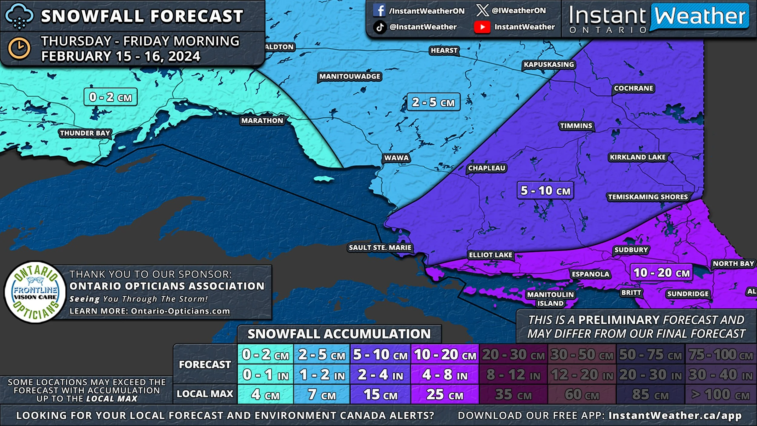
However, the brief taste of spring was merely an illusion, as more typical seasonal temperatures have since made a comeback. We are now tracking a system that poses the first risk of widespread snowfall for the month. Expected to start early Thursday and continue into Friday, this quick-moving system could bring snowfall totals of 10 to 20cm across much of Central and Eastern Ontario.
This weather system is forecasted to move in from the west during the morning hours on Thursday, beginning with areas around Lake Huron and spreading eastward throughout the afternoon. In Deep Southwestern Ontario, including Windsor, Chatham, and along the Lake Erie shoreline, the day could start with mixed precipitation, including freezing rain, before transitioning to regular rain as warmer air prevails.
There's some uncertainty regarding how far north this mixed precipitation will extend. It could result in lower snowfall totals from London through Hamilton and into parts of the Greater Toronto Area, especially near the shoreline.
Central and Eastern Ontario are set to experience moderate to heavy snow, likely impacting the evening commute on Thursday. As this is a fast-moving system, the majority of the snow is expected to fall within a 6-12 hour period during Thursday afternoon and evening.
The snow should begin to taper off just before midnight. However, lingering flurries and light snow may continue to affect Eastern Ontario into the early hours of Friday, with the system expected to exit Southern Ontario by sunrise on Friday.
Due to the dynamic nature of this system, pinpointing exact snowfall totals for each area is challenging, as the moisture content will vary. Currently, a broad swath of Southern Ontario, from the Lake Huron shoreline through Central Ontario and into Eastern Ontario, is projected to receive 10 to 20cm of snow.
It's important to note that the higher end of the 20cm forecast is reserved for isolated areas that may experience lake enhancement, leading to locally heavier snowfall. More commonly, amounts are likely to be closer to 10cm, though some areas may see higher totals.
Snowfall totals are expected to decrease further south, with around 5 to 10cm anticipated for the London, Hamilton, and Toronto regions. This lower accumulation is attributed to the potential for mixed precipitation and lower snowfall ratios.
The Windsor, Chatham, Sarnia, and Niagara regions are forecasted to receive less than 5cm of snow due to even greater mixing and limited opportunities for snow accumulation.
This system is also expected to impact the southern part of Northern Ontario, with Elliot Lake, Sudbury, and North Bay poised to see 10 to 20cm of snow. The rest of Northeastern Ontario, including Sault Ste. Marie, Chapleau, Timmins, and Cochrane, can expect around 5 to 10cm. Northwestern Ontario, including Thunder Bay, is forecasted to receive less than 5cm of snow.


