


Two EF2 Tornadoes Confirmed Near Rocky Mountain House, Alberta After Destructive July 18th Storm
/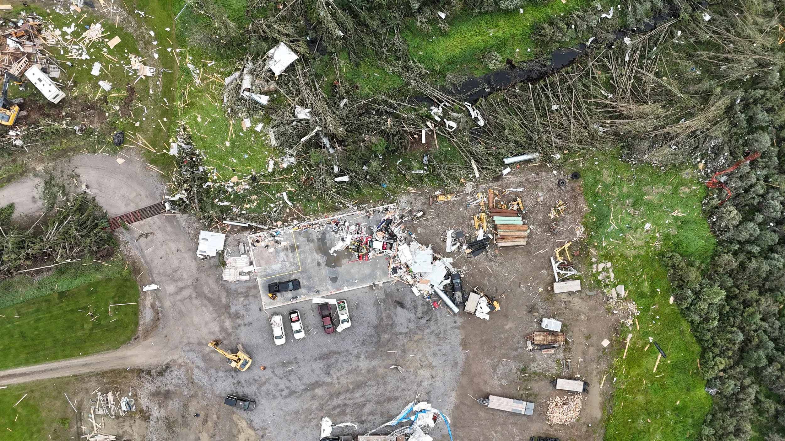
Aerial damage survey showing the destruction of a well-constructed outbuilding, scattered debris and extensive tree damage from the first Rocky Mountain House EF2 tornado. Image: Northern Tornadoes Project.
Two EF2 tornadoes touched down near Rocky Mountain House just 18 minutes apart on July 18th, carving two destructive paths across west-central Alberta and, for a brief period, occurring at the same time.
The Northern Tornadoes Project (NTP) has now confirmed both tornadoes reached EF2 intensity, with estimated peak winds of 190 km/h. The first was already weakening when a second circulation tightened up east of town, creating a brief period of twin tornadoes on the ground at the same time from the same storm.
The damage tells the story: a well-built outbuilding was destroyed, roof sheathing was torn from a home, and large areas of mature trees were snapped or uprooted. Remarkably, no humans were injured but unfortunately, two animals were reportedly injured during the second tornado.
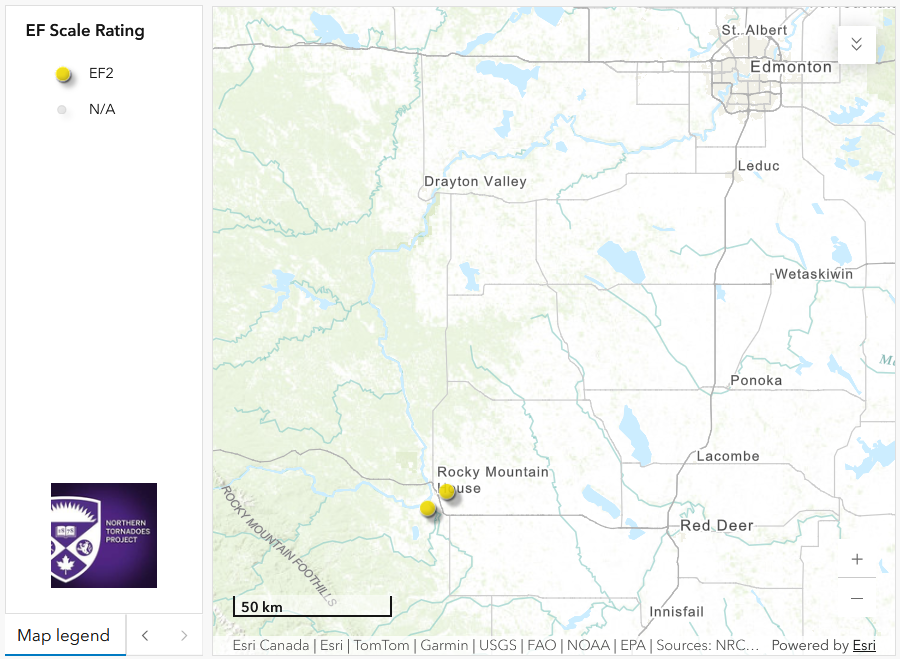
Regional map showing the first and second EF2 tornadoes near Rocky Mountain House. Image: Northern Tornadoes Project.
Two tornadoes in less than 20 minutes
The first tornado began southwest of Rocky Mountain House at approximately 6:18 PM. It tracked toward the southern edge of town before dissipating. The second tornado developed at approximately 6:36 PM, just east of Rocky Mountain House, while the first tornado was still weakening, and continued eastward before dissipating northwest of Leslieville.
That brief overlap is one of the most impressive aspects of this event. Radar imagery from 6:36 PM showed two separate areas of rotation associated with the storm, matching witness photos and videos that suggested two distinct tornadoes occurring for a brief period, otherwise known as ‘twins’.
Rocky Mountain House tornado 1
Start time: Approximately 6:18 PM on July 18th, 2026
Rating: EF2
Estimated peak wind: 190 km/h
Track length: 7.43 km
Maximum path width: 1.04 km
Direction of travel: From the west-southwest at approximately 245 degrees
Start coordinates: 52.3401N, 114.9619W
End coordinates: 52.3722N, 114.8721W
Location of worst damage: 52.3552N, 114.9159W
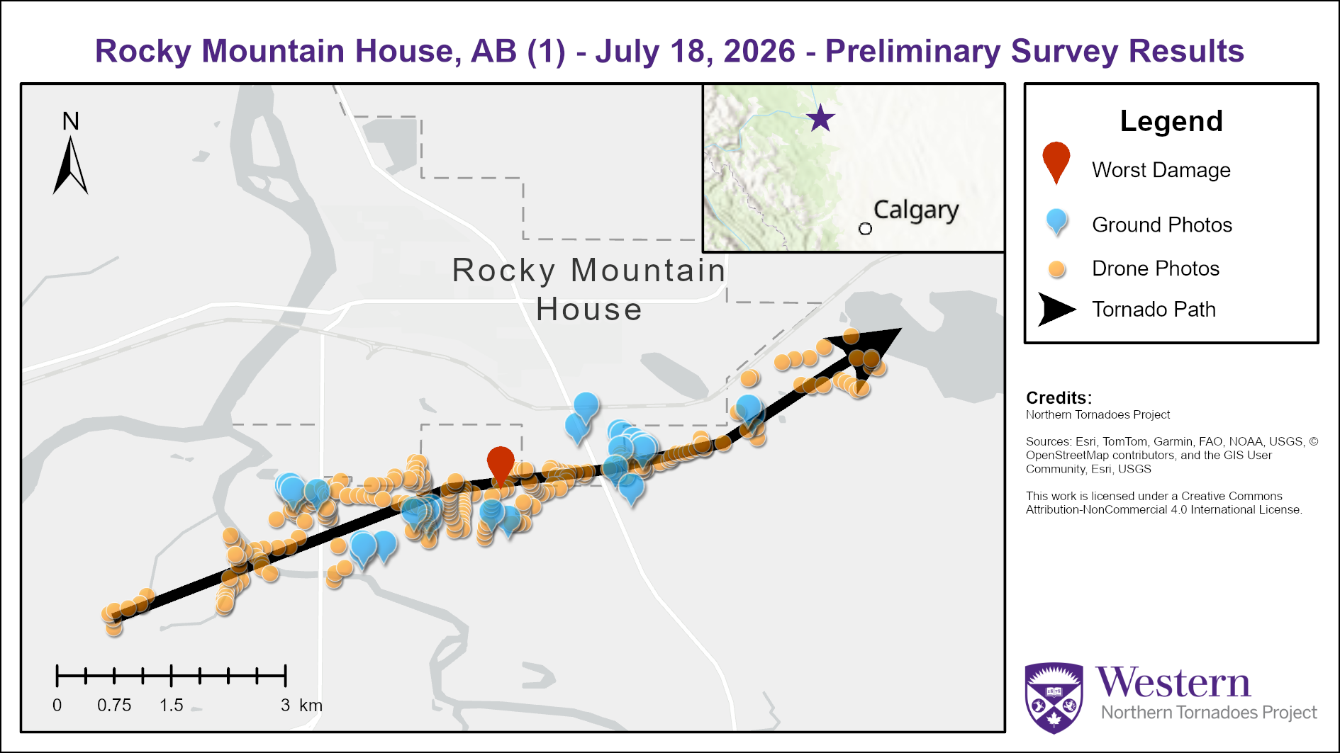
Survey summary map showing the track and documented damage from the first Rocky Mountain House EF2 tornado. Image: Northern Tornadoes Project.
The first tornado moved from the southwest toward the southern edge of Rocky Mountain House, crossing several rural properties along the way. Homes, barns, outbuildings, garages, vehicles and trees were all damaged.
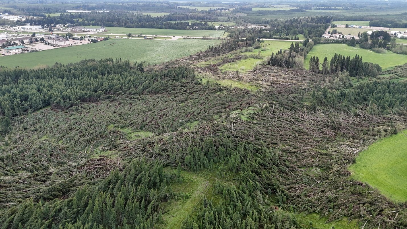
Oblique drone view of extensive tree damage, convergent debris patterns and a sharp damage gradient along the first tornado track. Image: Northern Tornadoes Project.
The drone survey shows just how sharp the damage gradient was. A well-built outbuilding was destroyed and debris was carried into the nearby forest. Investigators also documented converging debris patterns, numerous snapped and uprooted trees, missing roof sheathing on a home, and unmistakable swirl marks.
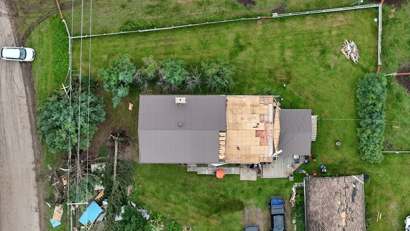
Nadir drone photo showing loss of roof sheathing from a home along the first Rocky Mountain House EF2 tornado track. Image: Northern Tornadoes Project.
NTP crews completed a ground and drone survey of the first track on July 19. Damage to conifer trees supported a C-T/DOD-5 assessment, while the structural damage helped confirm the EF2 rating and estimated 190 km/h peak winds.
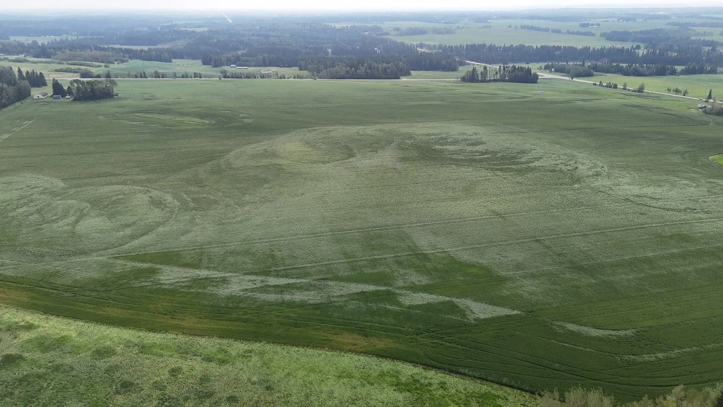
drone photo showing distinct swirl marks left by the first Rocky Mountain House tornado's rotating winds. Image: Northern Tornadoes Project.
Rocky Mountain House tornado 2
Start time: Approximately 6:36 PM on July 18th, 2026
Rating: EF2
Estimated peak wind: 190 km/h
Track length: 10.6 km
Maximum path width: 600 metres
Direction of travel: From the west-southwest at approximately 250 degrees
Start coordinates: 52.3841N, 114.8719W
End coordinates: 52.4132N, 114.7254W
Location of worst damage: 52.3965N, 114.7979W
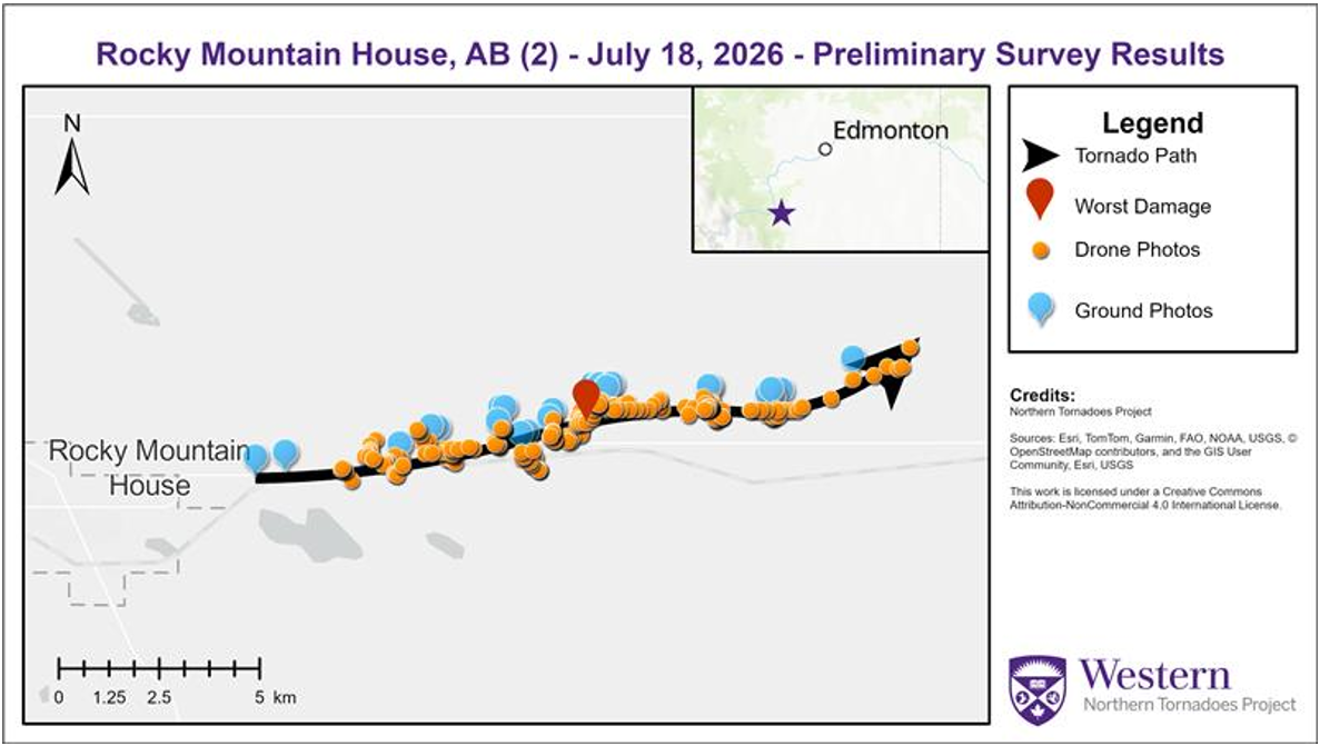
Survey summary map showing the track and documented damage from the second Rocky Mountain House EF2 tornado. Image: Northern Tornadoes Project.
The second tornado formed east of Rocky Mountain House and travelled farther east before dissipating northwest of Leslieville. Its 10.6 km path was more than three kilometres longer than the first tornado's track.
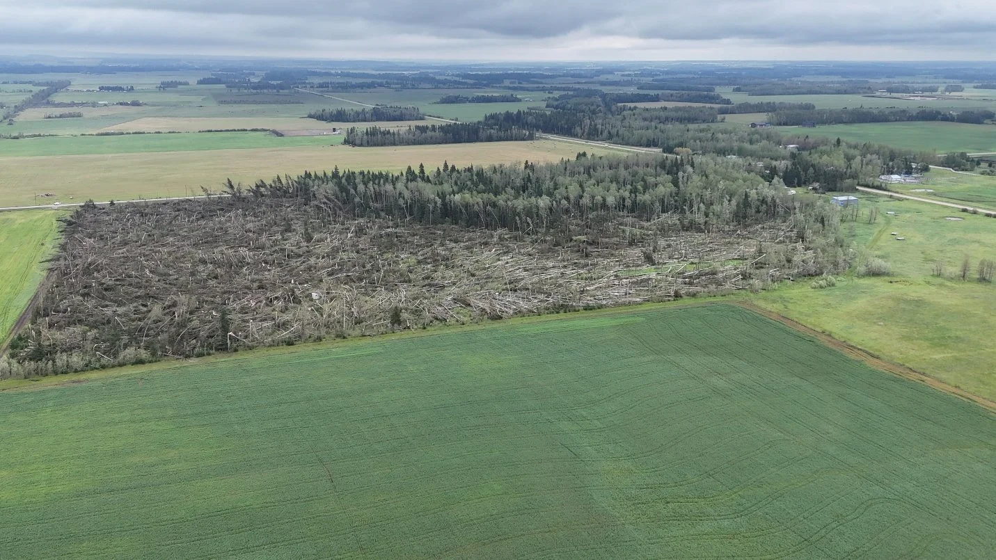
A large swath of mature trees swept down in multiple directions by the second Rocky Mountain House EF2 tornado. Image: Northern Tornadoes Project.
Homes, barns, outbuildings and trees were damaged along the second path. Survey crews found a large swath of mature trees laid down in several directions, along with roof damage to a home.
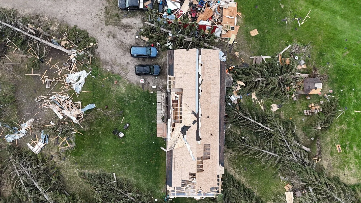
Nadir drone image of FR-12 DOD-4 (EXP) damage caused by the second Rocky Mountain House EF2 tornado. Image: Northern Tornadoes Project.
NTP crews surveyed the second track from the ground and by drone on July 20th. The worst tree damage also supported a C-T/DOD-5 assessment, leading to an EF2 rating and the same estimated peak wind of 190 km/h.
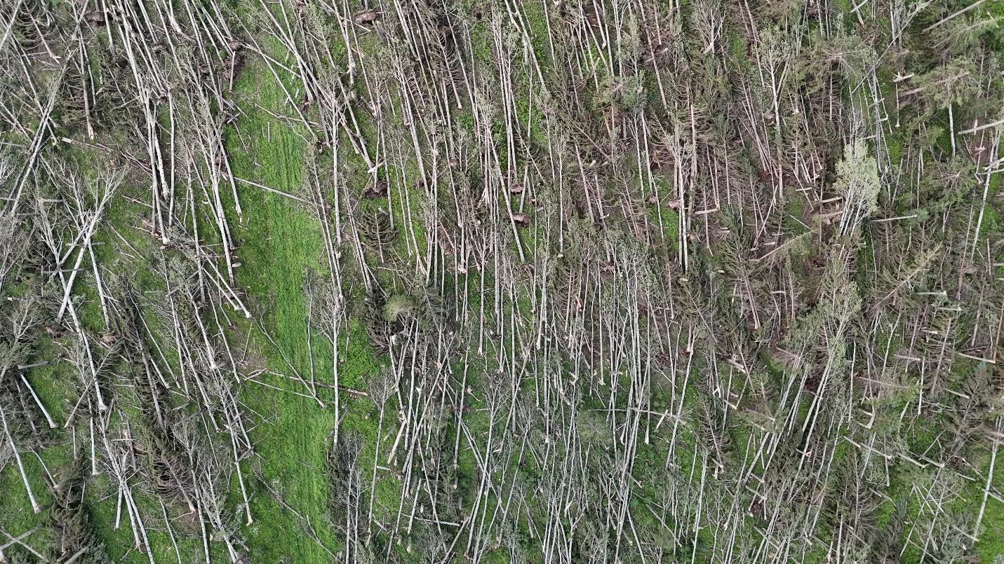
Nadir drone view of the worst tree damage documented along the second Rocky Mountain House EF2 tornado track. Image: Northern Tornadoes Project.
Additionally, Clearwater County confirmed that 51 properties were damaged and 8 homes have been deemed uninhabitable. Approximately 92 hectares of standing tree, vegetation and crops sustained severe damage, with many trees flattened by the storm, shown in the image below.
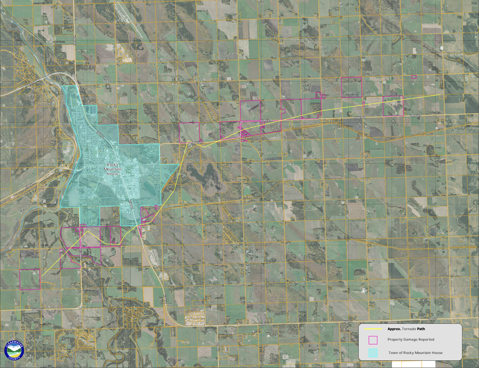
FULL EXTENT OF THE DAMAGE AS PER CLEARWATER COUNTY.
How both tornadoes reached EF2
The Enhanced Fujita scale is based on damage, not a direct measurement of wind inside a tornado. Investigators examine specific damage indicators, including homes, outbuildings and trees, then compare what they find with established degrees of damage.
In this case, the combination of severe tree damage, a destroyed outbuilding and damage to homes supported EF2 ratings for both tornadoes. The 190 km/h estimates represent the wind speeds needed to cause the observed damage.
Radar Analysis
Radar imagery from this supercell offers an important view of how the event evolved. At 6:36 PM, the first tornado was dissipating as the second tornado developed. Reflectivity showed the storm's precipitation structure, while radial velocity data revealed two separate areas of rotation despite several data dropouts.
The two radar circulations below shows the two unique mesocyclones associated with the first and second tornadoes. Their presence, together with witness photos and video helps explain how two tornadoes could briefly be active at the same time in the same general area.
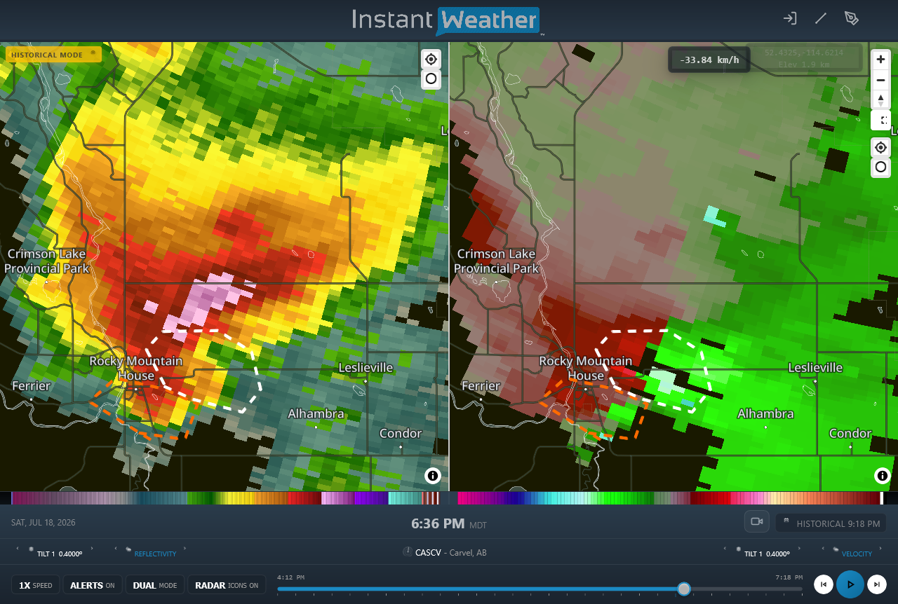
Radar at 6:36 p.m. MDT showing reflectivity at left and radial velocity at right. The orange and white dotted areas mark rotation associated with the first and second tornadoes. Image: Northern Tornadoes Project USING INSTANT WEATHER PRO.
Why the surveys matter
Detailed ground and drone surveys allow investigators to reconstruct a tornado even after the storm has disappeared. The direction in which trees and debris fall can reveal rotation and convergence. Changes in damage severity help define the path width, while carefully documented structural failures support the final intensity rating.
For the Rocky Mountain House event, those surveys mapped two distinct tracks, measured their lengths and widths, identified the locations of the worst damage and confirmed that both tornadoes reached EF2 intensity. Satellite imagery review was still pending when the NTP published its report.
A destructive event with a fortunate outcome
Across the two tracks, more than 18 kilometres of combined tornado damage was documented. The tornadoes affected rural properties, structures, vehicles, crops and extensive forested areas. The fact that no human injuries were reported is remarkable given the intensity of the damage and the proximity of the first track to Rocky Mountain House.
The NTP credited Brad Kraychy, Instant Weather, the Prairie and Arctic Storm Prediction Centre, witnesses and others who supplied timely reports, images and information that helped investigators document the event.
Full technical details are available in the Northern Tornadoes Project report. The tornado tracks can also be explored through the NTP interactive dashboard. Further details are available via the Clearwater County website.
All ratings, times, track measurements and damage findings in this article are based on the Northern Tornadoes Project investigation.



