Up to 15 cm of Snow Possible as Southern Ontario Sees First Lake-Effect Event of the Season
/
NOTE: YOU CAN CLICK ON THE MAP TO OPEN A ZOOMABLE IMAGE
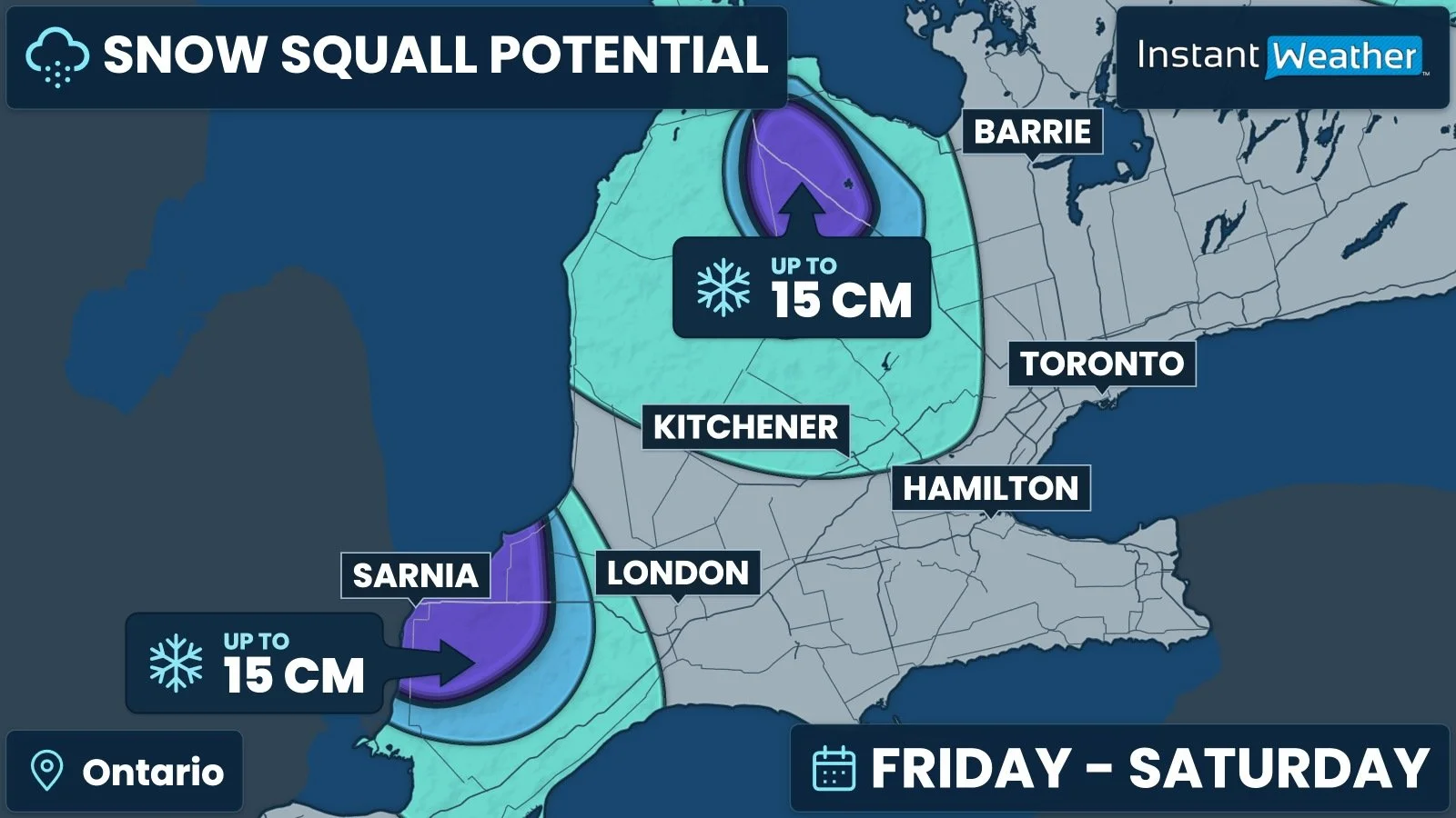
Some parts of Southern Ontario could wake up to a taste of winter as colder air moves across the Great Lakes, setting the stage for lake-effect snow through Friday and into Saturday.
The greatest potential for accumulating snow is in the traditional snowbelt regions southeast of Lake Huron and Georgian Bay, particularly across parts of Lambton County and the higher elevations of Grey County.
Elsewhere, scattered wet flurries are possible, including across portions of Central and Eastern Ontario.
This is not expected to be a widespread snowfall event. Snowfall will be highly localized, and temperatures close to or just above freezing will make a big difference in how much can accumulate.
Some communities could see a burst of snow while nearby areas see little more than rain or a few wet flakes.
Lake-effect snow develops when cold air moves over the comparatively warmer waters of the Great Lakes, picking up moisture that falls as precipitation downwind.
When this precipitation becomes concentrated into a narrow, heavier band, it can produce a snow squall with rapidly changing visibility.
In this case, the air will be only marginally cold enough for snow in many areas. Higher elevations and locations farther inland will have a better chance of seeing snow stick.
Closer to the lakes, precipitation may mix with rain, or the snow may struggle to accumulate.
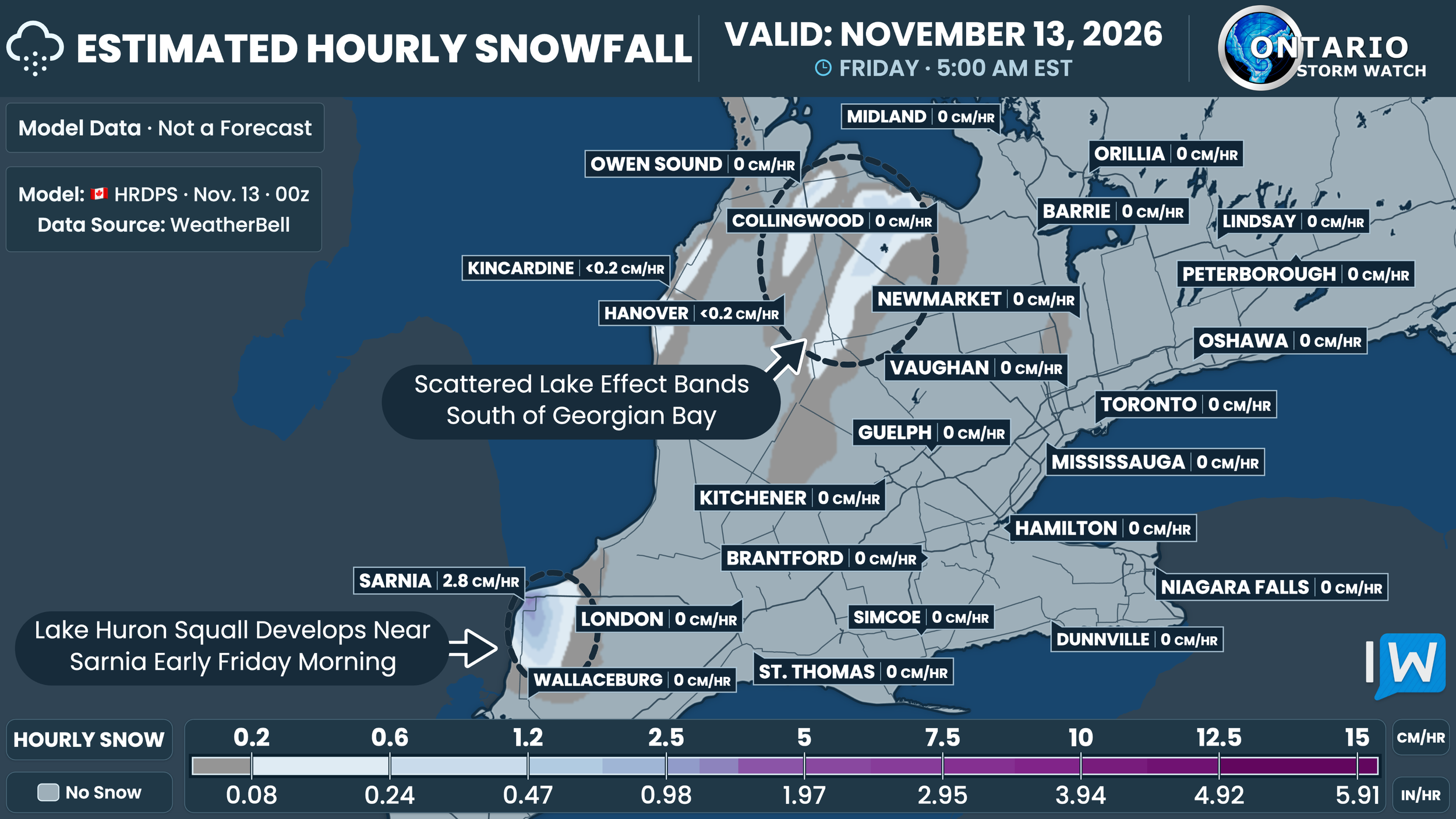
Early Friday morning, a band of lake-effect precipitation could develop off southern Lake Huron and affect portions of the Sarnia area and surrounding Lambton County.
Scattered bands and flurries are also possible southeast of Georgian Bay, including parts of Grey County.
The model shows that a heavier burst is possible within the Lake Huron band, but its exact location and intensity remain uncertain.
Even where snow falls heavily for a short time, mild ground and road temperatures could limit how much is left on the ground.
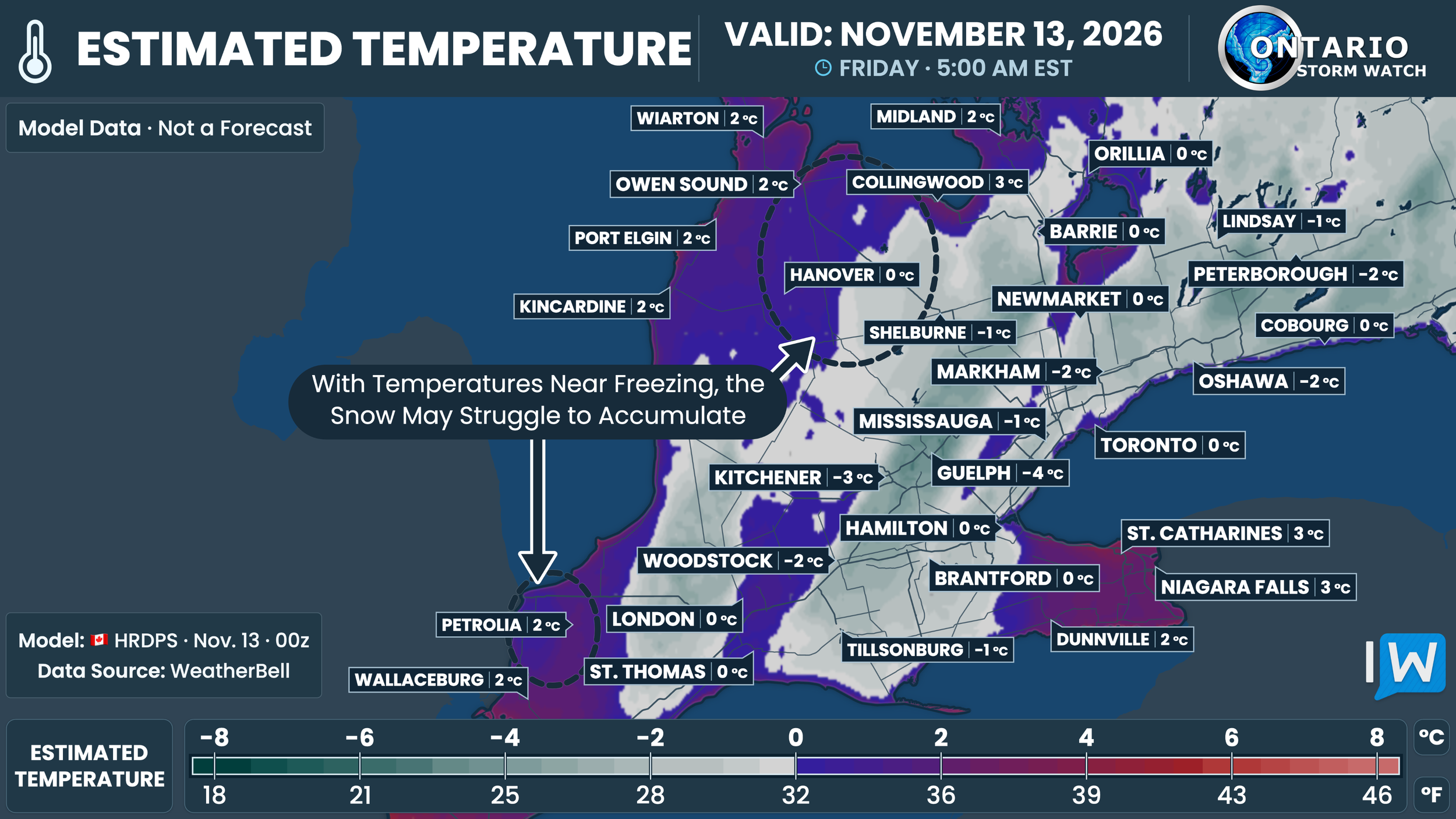
Temperatures near the lakeshores are expected to remain close to or slightly above freezing, while the higher elevations farther inland will be colder.
That relatively small difference could determine whether precipitation falls as rain, wet snow or a mix, as well as whether it accumulates on grassy surfaces.
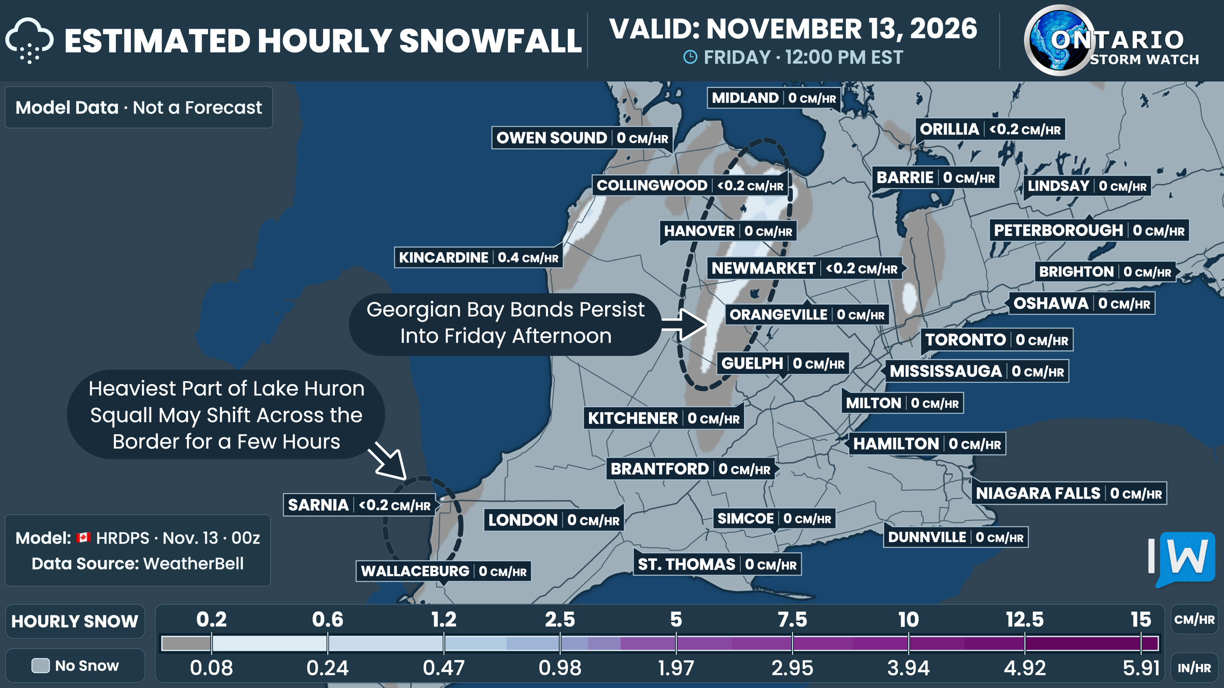
Through Friday morning and into the afternoon, lake-effect bands are expected to shift as winds change direction.
One band off southern Lake Huron could spend some time on the Michigan side of the border, limiting snowfall in Lambton County during that period.
Farther north, scattered snow showers could continue across the higher elevations of Grey and Dufferin counties.
The movement of these bands is one of the biggest questions in the forecast. A small shift in wind direction could change which communities see the most persistent snow and which miss out almost entirely.
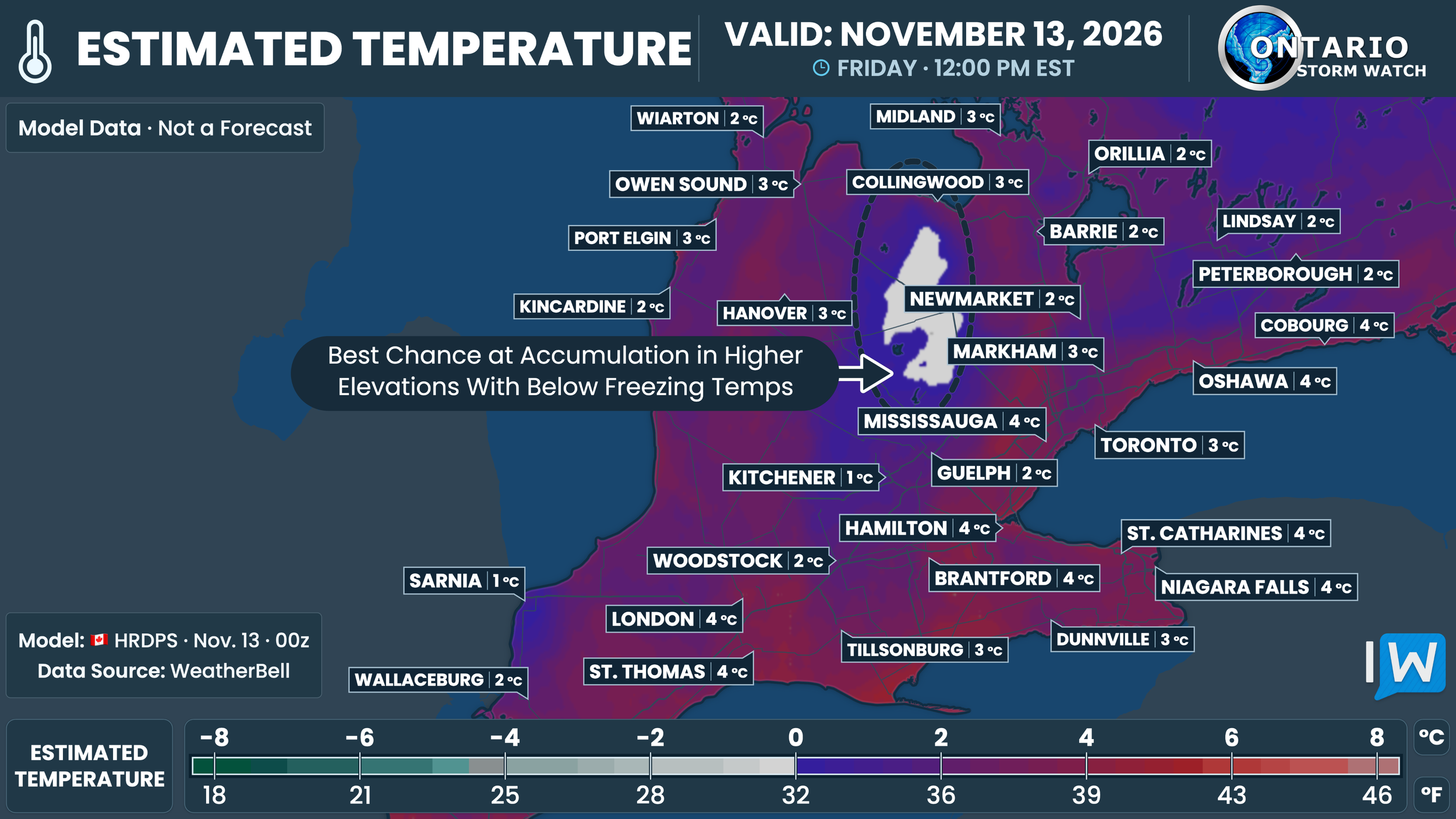
Daytime temperatures will generally be close to or above freezing, although the higher elevations should remain colder.
That will make it difficult for snow to build up in many locations during lighter bursts, especially on roads and other paved surfaces.
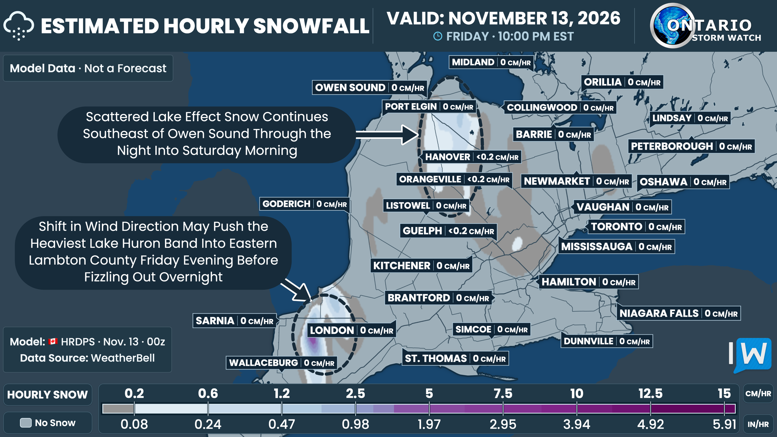
By Friday evening, the Lake Huron band may shift back east into Lambton County before gradually weakening. Snow showers could also continue across the higher elevations of Grey County overnight.
Friday late afternoon and night may offer the best opportunity for snow to stick where a band persists. Brief reductions in visibility and slushy patches are possible under heavier bursts, even if many nearby areas see little accumulation.
NOTE: YOU CAN CLICK ON THE MAP TO OPEN A ZOOMABLE IMAGE
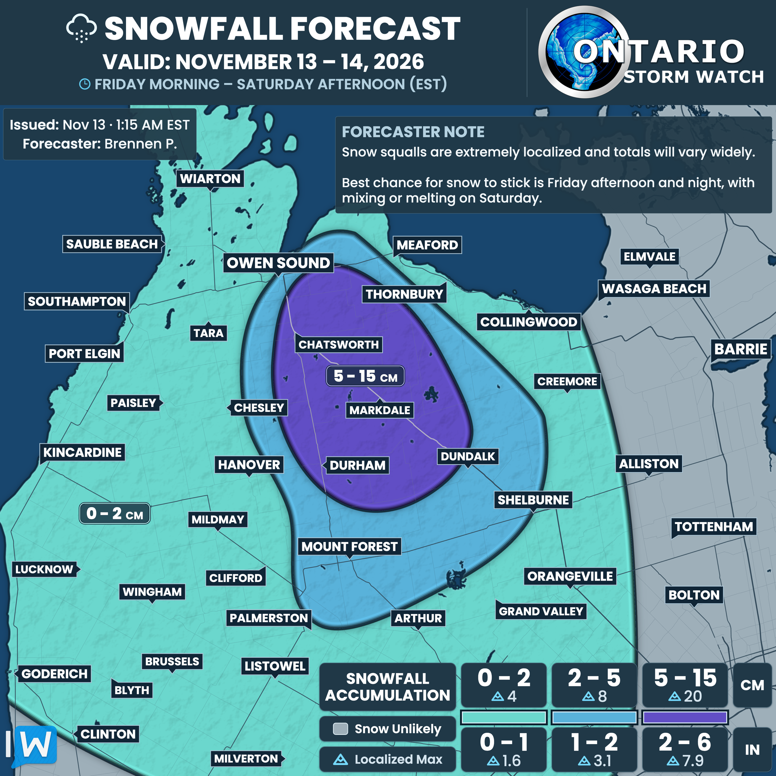
The higher elevations of Grey County have one of the better chances of seeing accumulating snow from this event.
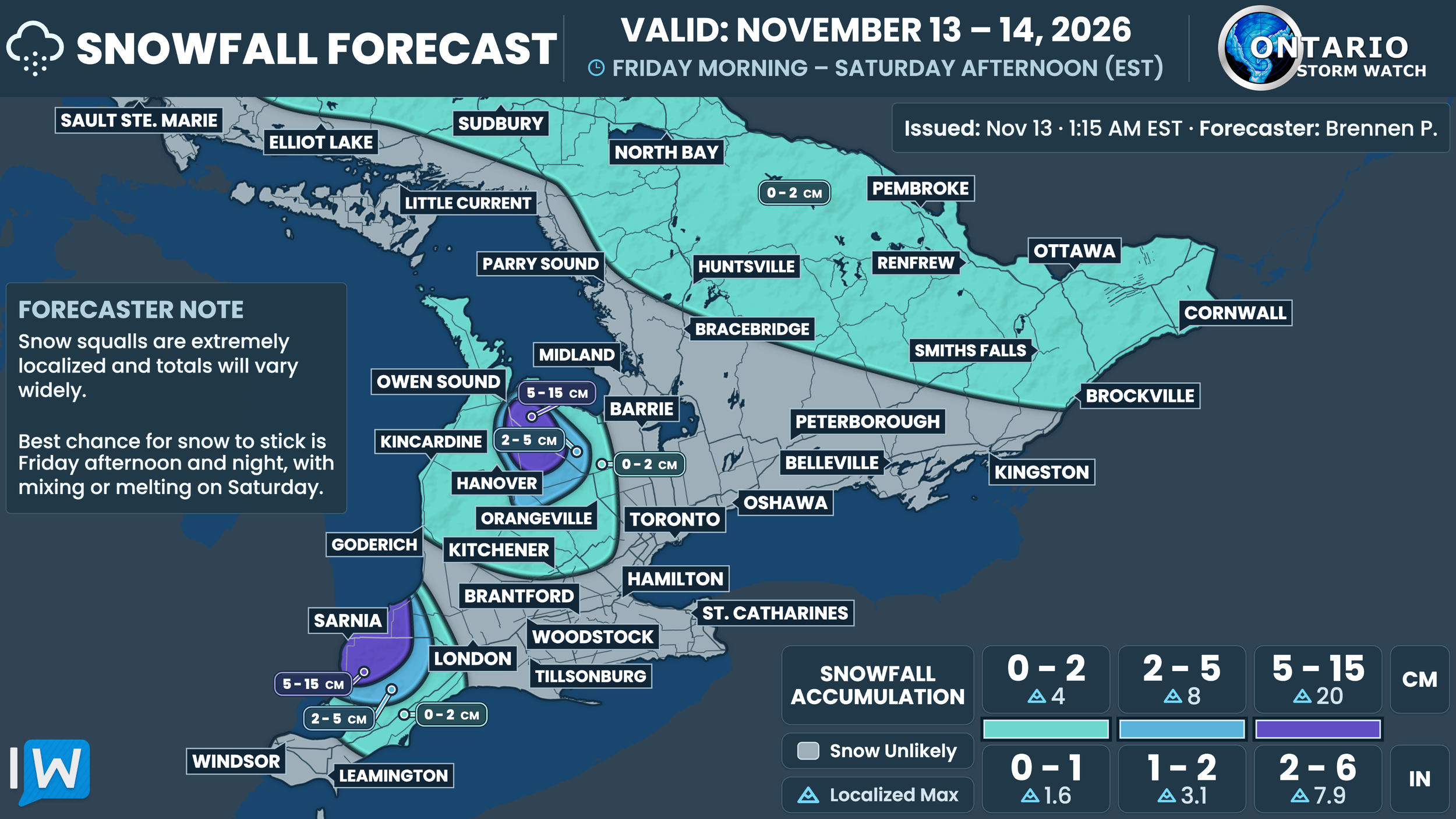
Our forecast highlights the area from around Chatsworth and Markdale toward Durham and Dundalk for 5 to 15 cm. A surrounding zone of 2 to 5 cm extends toward Mount Forest, Arthur and Shelburne.
Amounts should taper off outside the higher elevations, including toward the Lake Huron shoreline and the Collingwood waterfront.
Snowfall will not be uniform across the highlighted zones. The highest amounts depend on a band remaining over the same area long enough for snow to overcome the marginal temperatures.
NOTE: YOU CAN CLICK ON THE MAP TO OPEN A ZOOMABLE IMAGE

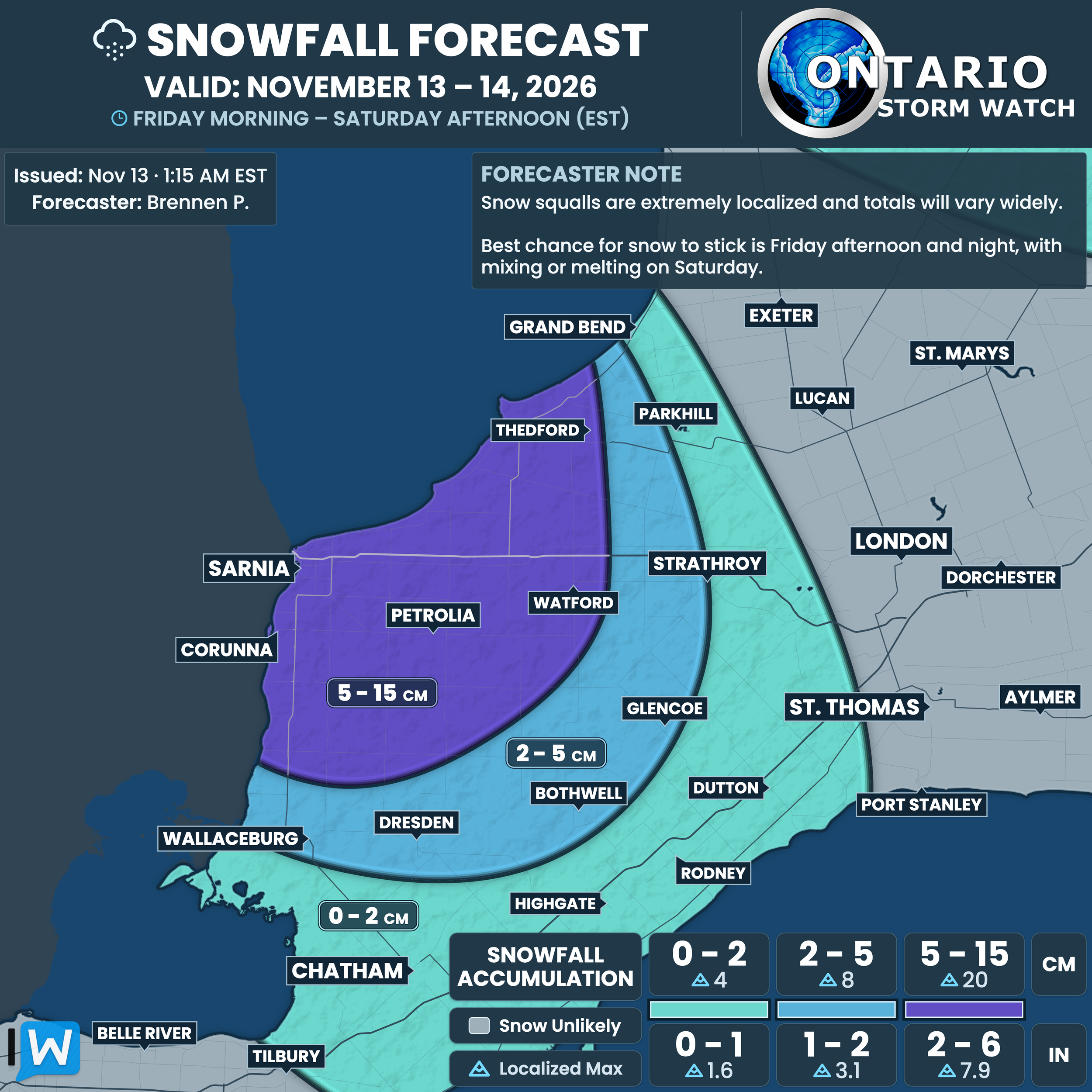
Another area to watch is Lambton County, where our forecast highlights Sarnia, Corunna, Petrolia, Watford and Thedford for 5 to 15 cm.
A broader zone of 2 to 5 cm extends farther inland toward Strathroy, Glencoe and portions of Chatham-Kent.
Confidence in the higher totals is lower here. Some guidance keeps a more concentrated band over Lambton County, while other guidance suggests much lighter amounts or takes the band across the border for part of the event.
A brief shift in the band could leave some places with very little snow, while another community a short distance away sees several centimetres.
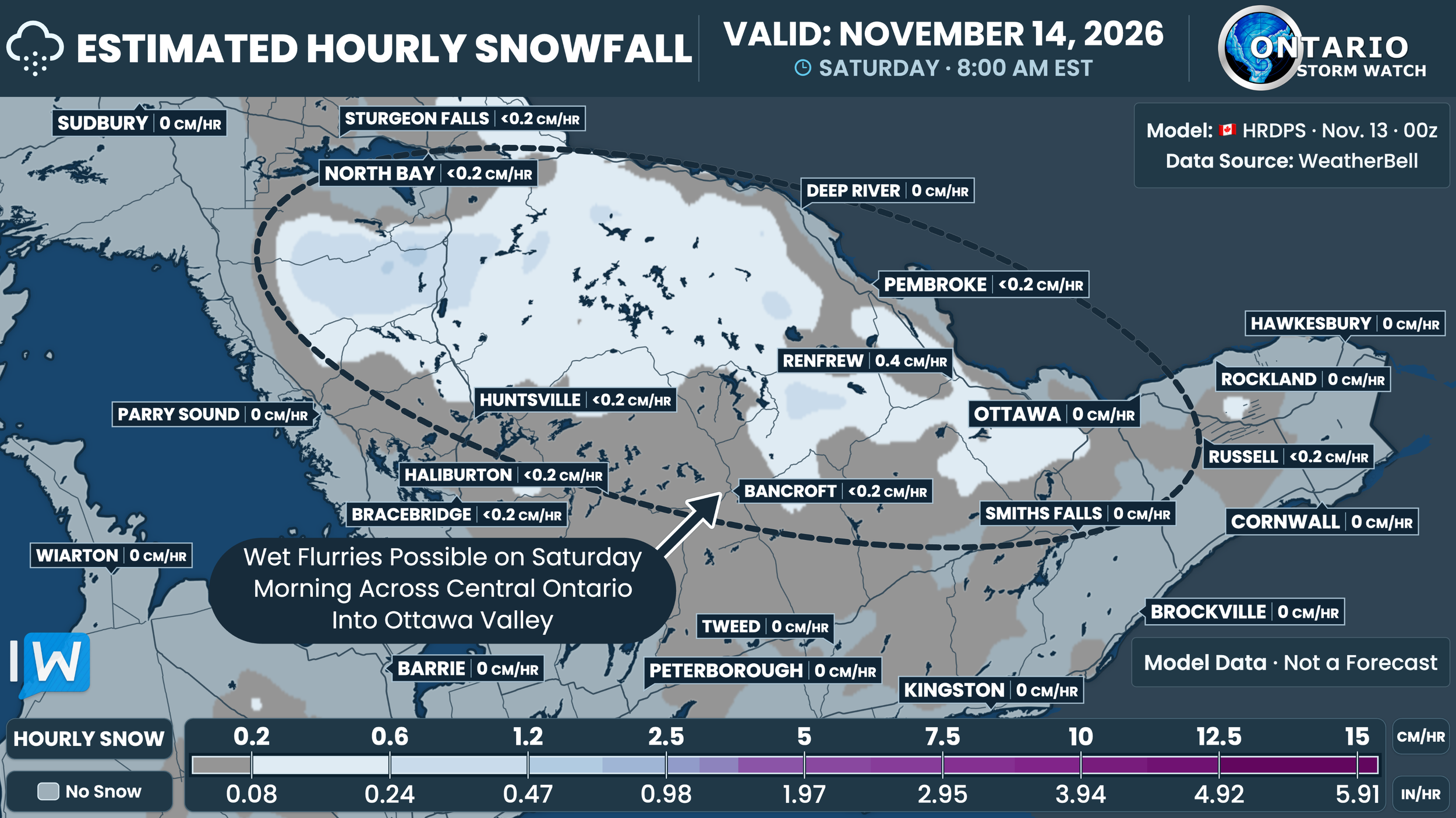
By Saturday morning, scattered wet flurries could extend across parts of Central and Eastern Ontario, including areas around North Bay, Huntsville, Haliburton, Bancroft and the Ottawa Valley.
The model shows generally light precipitation in these areas wrapping in from Quebec, rather than the more concentrated lake-effect bands farther south and west.
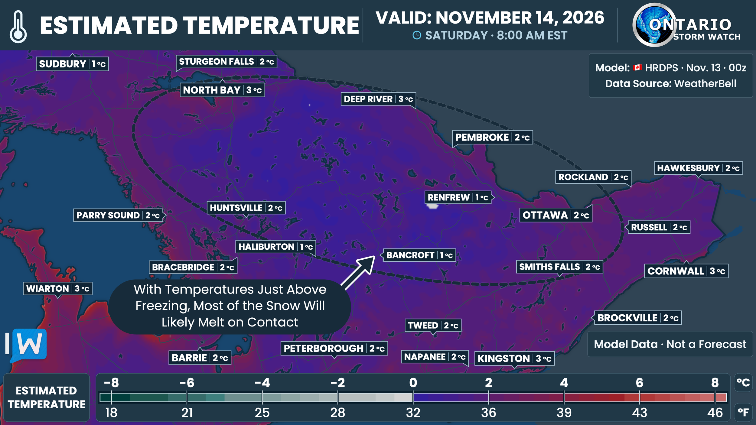
With temperatures generally a few degrees above freezing, most of this snow should have difficulty accumulating.
A light coating is still possible on grass or other colder surfaces, particularly in the higher elevations and where a heavier burst briefly develops.
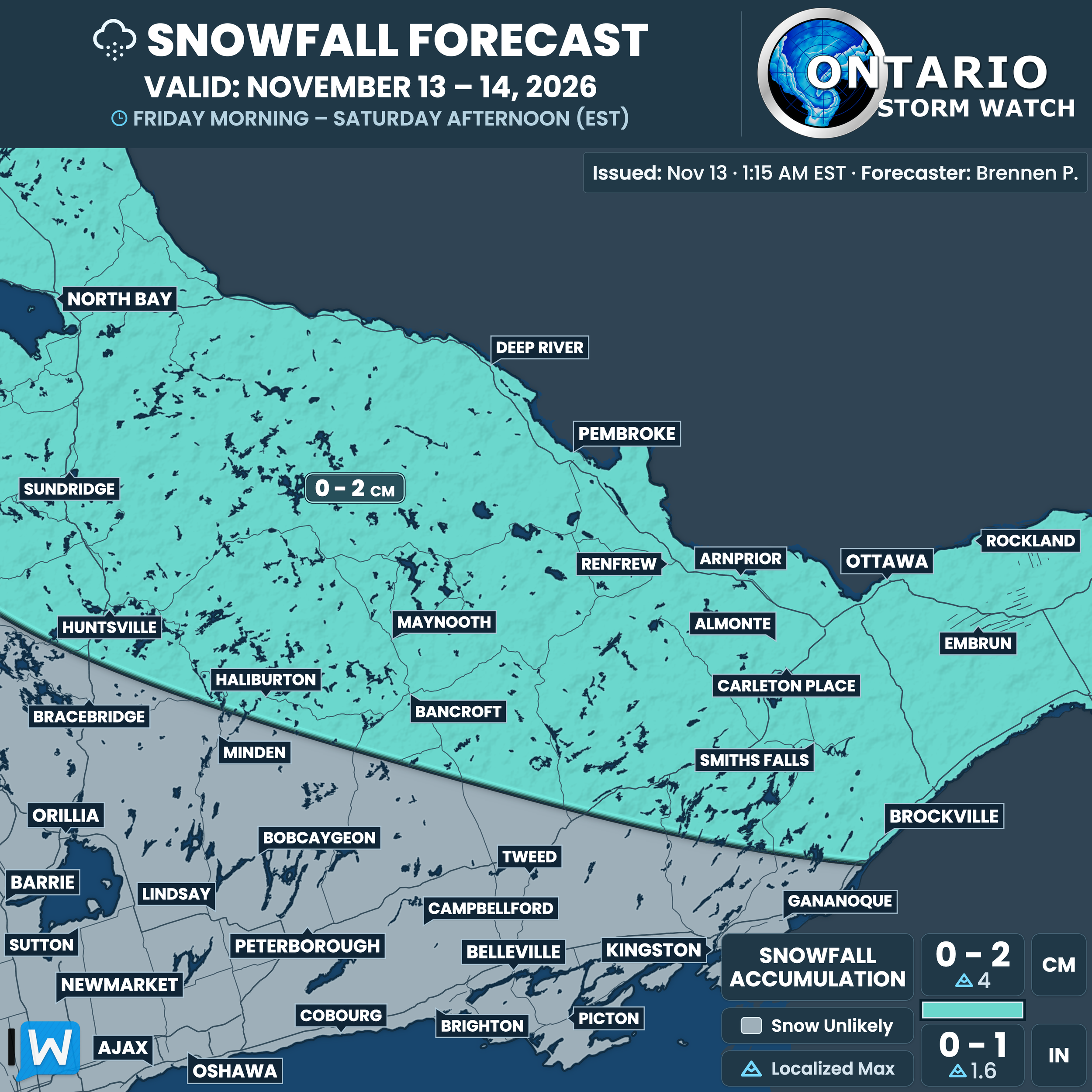
NOTE: YOU CAN CLICK ON THE MAP TO OPEN A ZOOMABLE IMAGE
For the wider area from North Bay and Muskoka through the Ottawa Valley and into Eastern Ontario, our forecast map shows around 0 to 2 cm, with up to 4 cm possible in a few localized spots.
Many communities in this zone may see only flurries and no lasting accumulation.
Conditions should gradually improve into Saturday as temperatures rise and the lake-effect activity weakens or transitions toward rain in some areas.
Anyone travelling through an active band should be prepared for visibility to change quickly over a short distance.