


Ontario Faces 100 km/h Winds, 4 cm Hail and Up to 60 mm of Rain as Heat Builds This Week
/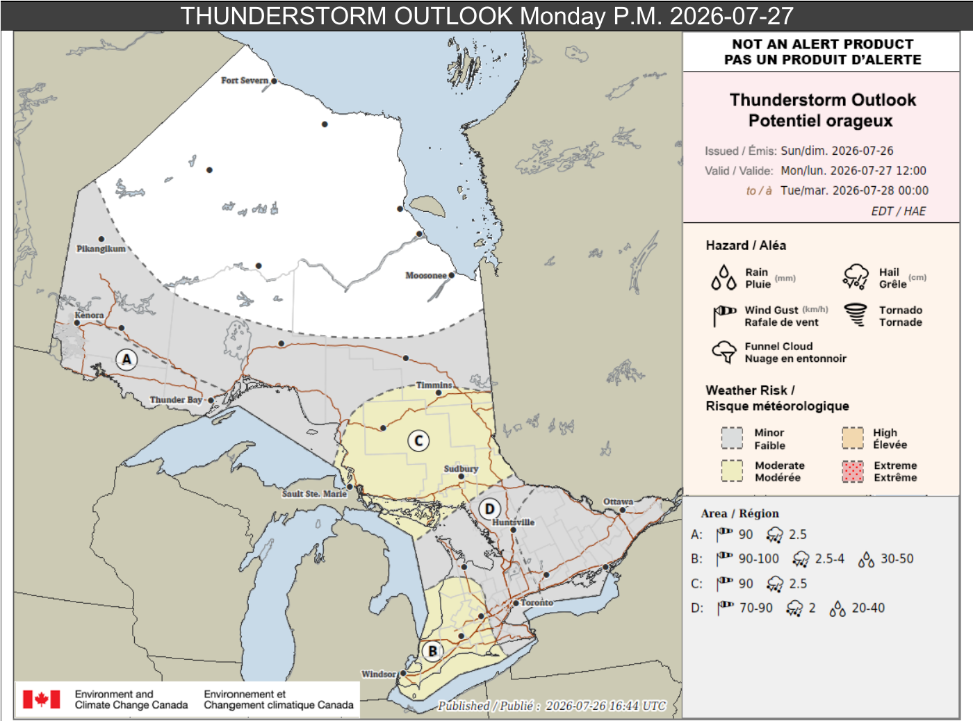
Environment Canada's Monday afternoon and evening thunderstorm outlook highlights the most significant severe-weather risk in southwestern Ontario, with additional storm areas across northeastern, northwestern and ALL OF southern Ontario.
A stormy start to the week is taking shape across Ontario, with multiple rounds of thunderstorms capable of damaging winds, large hail and torrential rainfall. At the same time, hot and humid conditions will continue across northwestern Ontario and may intensify by the middle of the week.
Environment Canada's latest forecast, issued Sunday afternoon, places the greatest severe-weather concern on Monday afternoon and evening. Parts of southwestern Ontario could see wind gusts up to 100 km/h, hail as large as 4 cm and rainfall totals near 50 mm. A separate heavy-rain threat could bring up to 60 mm to parts of southern Ontario on Tuesday, although the exact locations remain uncertain.
To clarify, these outlooks are not alerts. They highlight areas where significant weather may develop and where conditions should be watched closely.
Monday, July 27th
Monday brings several separate concerns, beginning with lingering overnight thunderstorms and continuing with a more substantial severe-weather threat during the afternoon and evening.
Hot and humid conditions are possible across parts of northwestern Ontario. Maximum temperatures of 27 to 29°C are forecast, with overnight lows near 18°C. The heat may increase the risk of heat-related illness, including heat stroke.
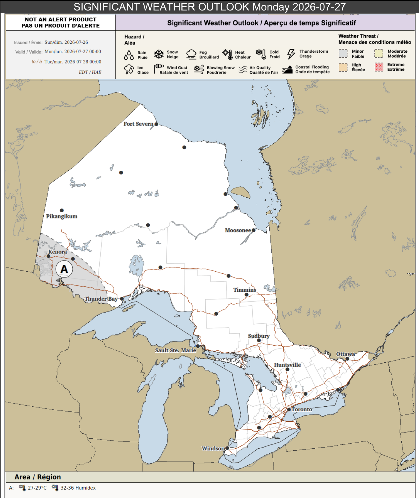
Monday's significant weather outlook highlights heat across parts of northwestern Ontario, where temperatures of 27 to 29°C and overnight lows near 18°C are possible.
Overnight and morning thunderstorms
Thunderstorms producing strong winds and small hail could continue overnight near the Minnesota border. Local rainfall totals may reach 40 mm, with up to 20 mm falling in one hour. Loose objects may be tossed, plants and crops could be damaged and power outages are possible.
Across parts of southwestern Ontario, thunderstorms may continue overnight into Monday morning. Strong winds and small hail are possible, with local rainfall totals up to 30 mm and peak hourly amounts near 15 mm.
More isolated thunderstorms may affect portions of northeastern and southern Ontario overnight into Monday morning. Local rainfall totals of 15 to 25 mm are possible, although hourly amounts are expected to remain below 15 mm.
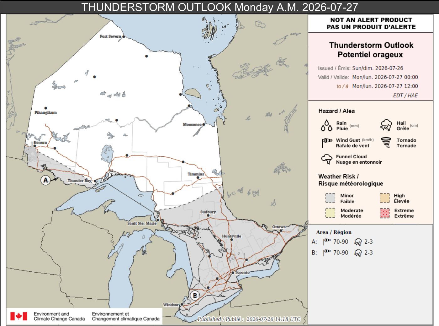
Monday morning's thunderstorm outlook shows risks near the Minnesota border and in southwestern Ontario, with more isolated thunderstorms possible across parts of northeastern and southern Ontario.
Monday afternoon and evening: the strongest storm risk
Parts of southwestern Ontario face the strongest threat for severe thunderstorms. Isolated to scattered thunderstorms may develop during the afternoon and evening, and some could become severe. The strongest storms may produce wind gusts up to 100 km/h, hail up to 4 cm in diameter and rainfall totals up to 50 mm. As much as 40 mm could fall within one hour.
Broken branches, downed trees, power outages, flash flooding, water pooling on roads, property damage, and dented vehicles are all possible in the strongest storms.
Scattered thunderstorms are also expected across portions of northeastern Ontario. Some could produce wind gusts up to 90 km/h, hail up to 2.5 cm and local rainfall totals near 30 mm, with as much as 25 mm in one hour.
There is lower confidence that thunderstorms will develop in parts of northwestern Ontario. Any storms that do form could still produce wind gusts up to 90 km/h, hail up to 2.5 cm and local rainfall totals near 30 mm.
Elsewhere in southern Ontario, isolated to scattered thunderstorms may produce wind gusts up to 90 km/h, hail up to 2 cm and rainfall totals up to 40 mm. More isolated thunderstorms are possible across other parts of northern and southern Ontario.
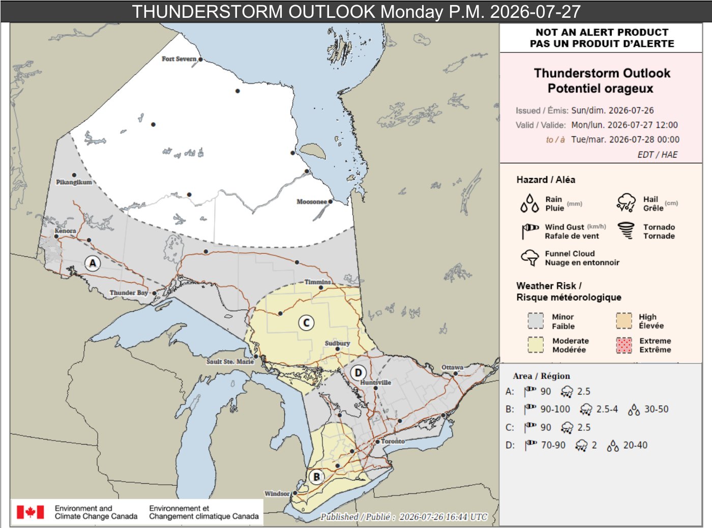
Environment Canada's Monday afternoon and evening thunderstorm outlook highlights the most significant severe-weather risk in southwestern Ontario, with additional storm areas across northeastern, northwestern and ALL OF southern Ontario.
Tuesday, July 28th
Tuesday keeps both heat and thunderstorms in the forecast, but the main concern shifts toward the potential for torrential rainfall in parts of southern Ontario.
Parts of northwestern Ontario may again reach 27 to 29°C, with overnight lows near 18°C.
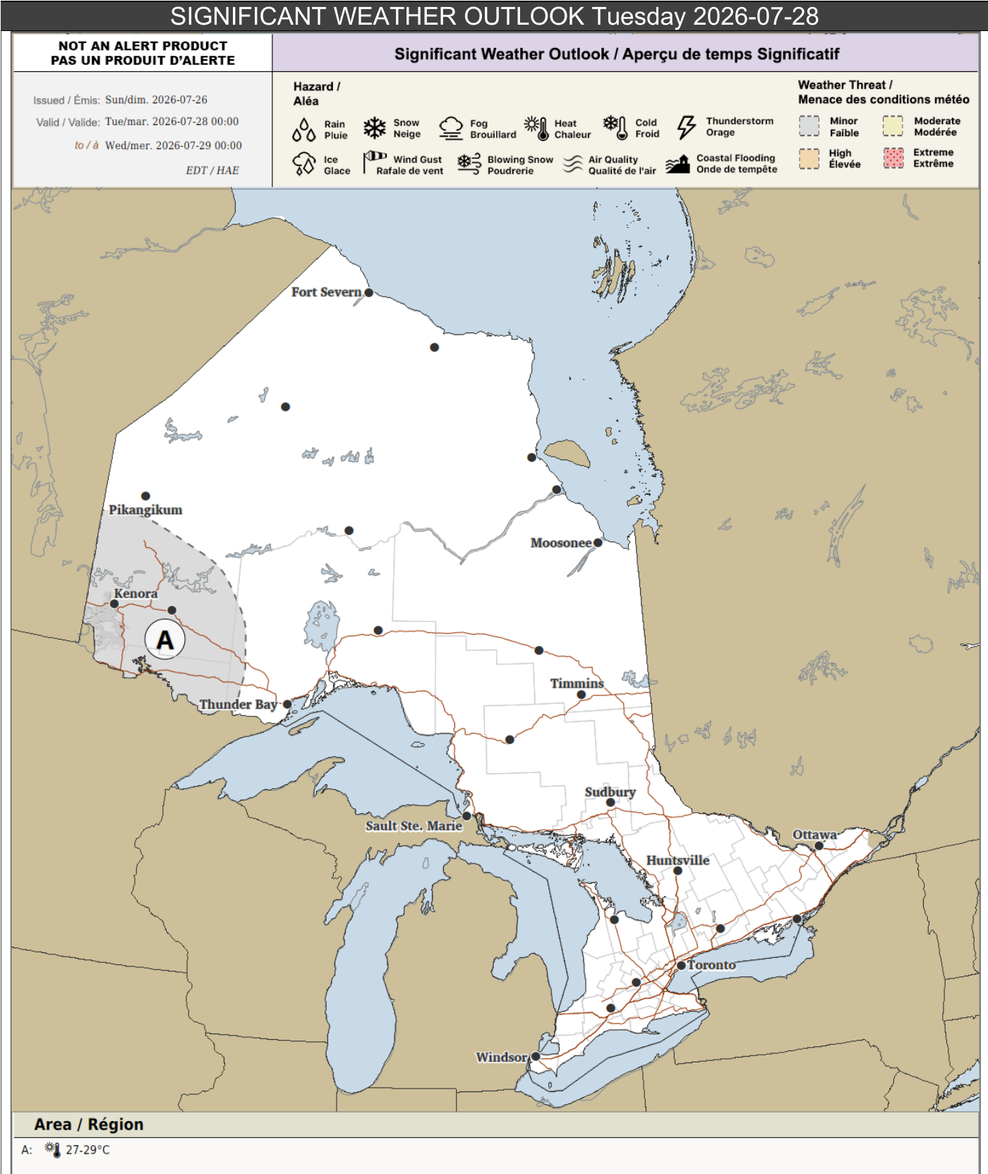
Tuesday's significant weather outlook continues the heat risk in northwestern Ontario, with highs of 27 to 29°C and overnight lows near 18°C.
Heavy rainfall possible in southern Ontario
Scattered thunderstorms are expected across portions of southern Ontario on Tuesday. These storms could produce rainfall totals up to 60 mm, with locally higher amounts possible. Up to 50 mm could fall within one hour, creating a risk of flash flooding and water pooling on roads. However, there is still considerable uncertainty about exactly where the highest rainfall amounts will occur.
Across northwestern Ontario, isolated to scattered thunderstorms may develop Tuesday afternoon and evening. Some could produce wind gusts up to 80 km/h, with local rainfall totals near 30 mm and up to 25 mm in one hour.
More isolated thunderstorms are possible across other portions of northern and southern Ontario.
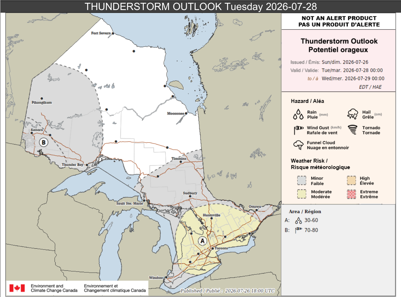
Tuesday's thunderstorm outlook highlights a heavy-rain risk in southern Ontario and a separate wind risk in northwestern Ontario.
Wednesday, July 29th
A hotter stretch may begin Wednesday across northwestern and far northwestern Ontario.
In the warmest area, a two-day heat event is possible, with daytime highs of 29 to 31°C and overnight lows of 18 to 20°C. Surrounding areas may see maximum temperatures of 27 to 29°C and overnight lows near 17°C.
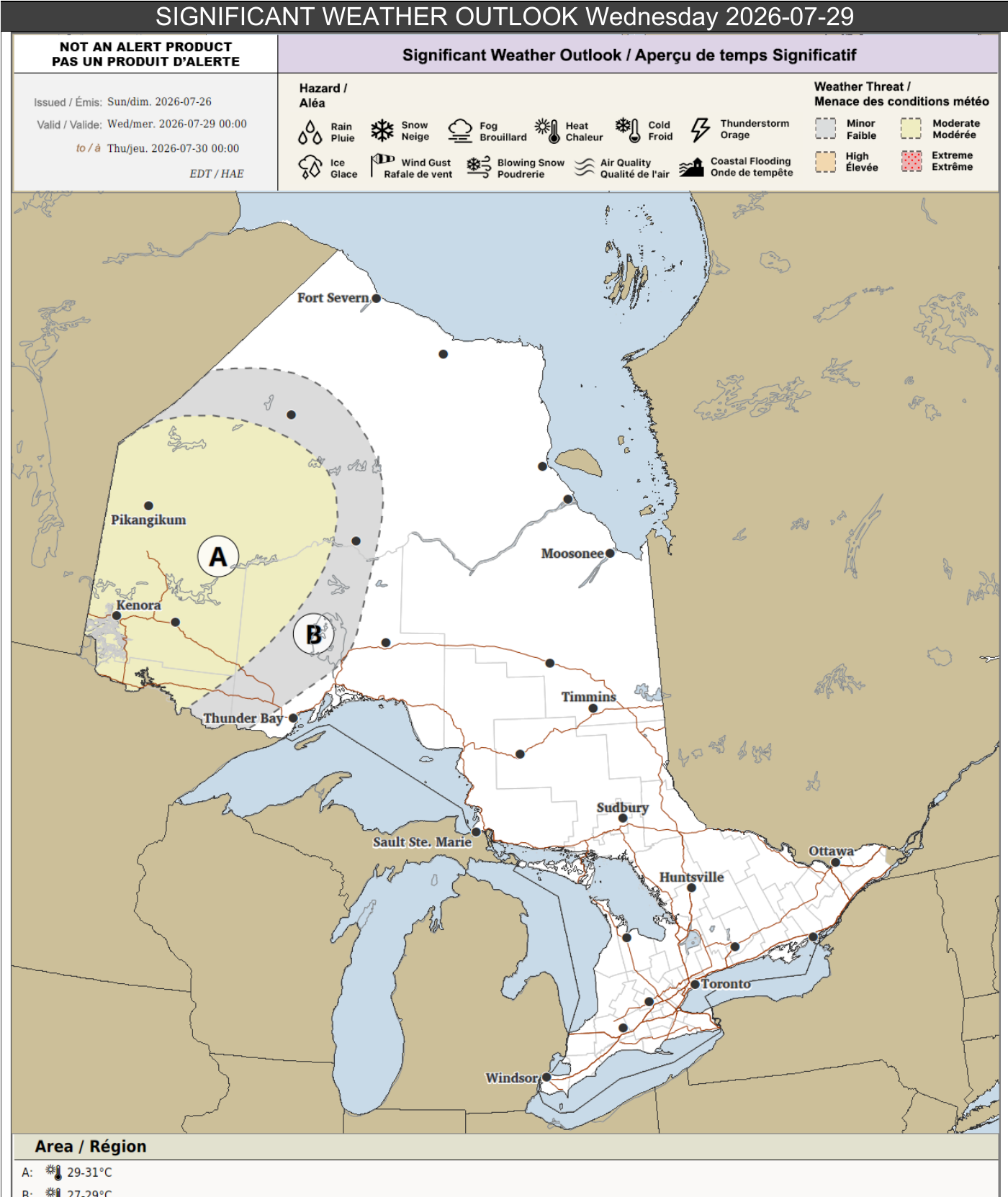
Wednesday's significant weather outlook shows the hottest conditions in northwestern and far northwestern Ontario, where temperatures could reach 31°C.
Thursday, July 30th
The heat may continue Thursday across northwestern and far northwestern Ontario.
The warmest locations could again reach 29 to 31°C, with overnight temperatures only falling to between 18 and 20°C. A broader surrounding area may reach 27 to 29°C, with overnight lows near 17°C.
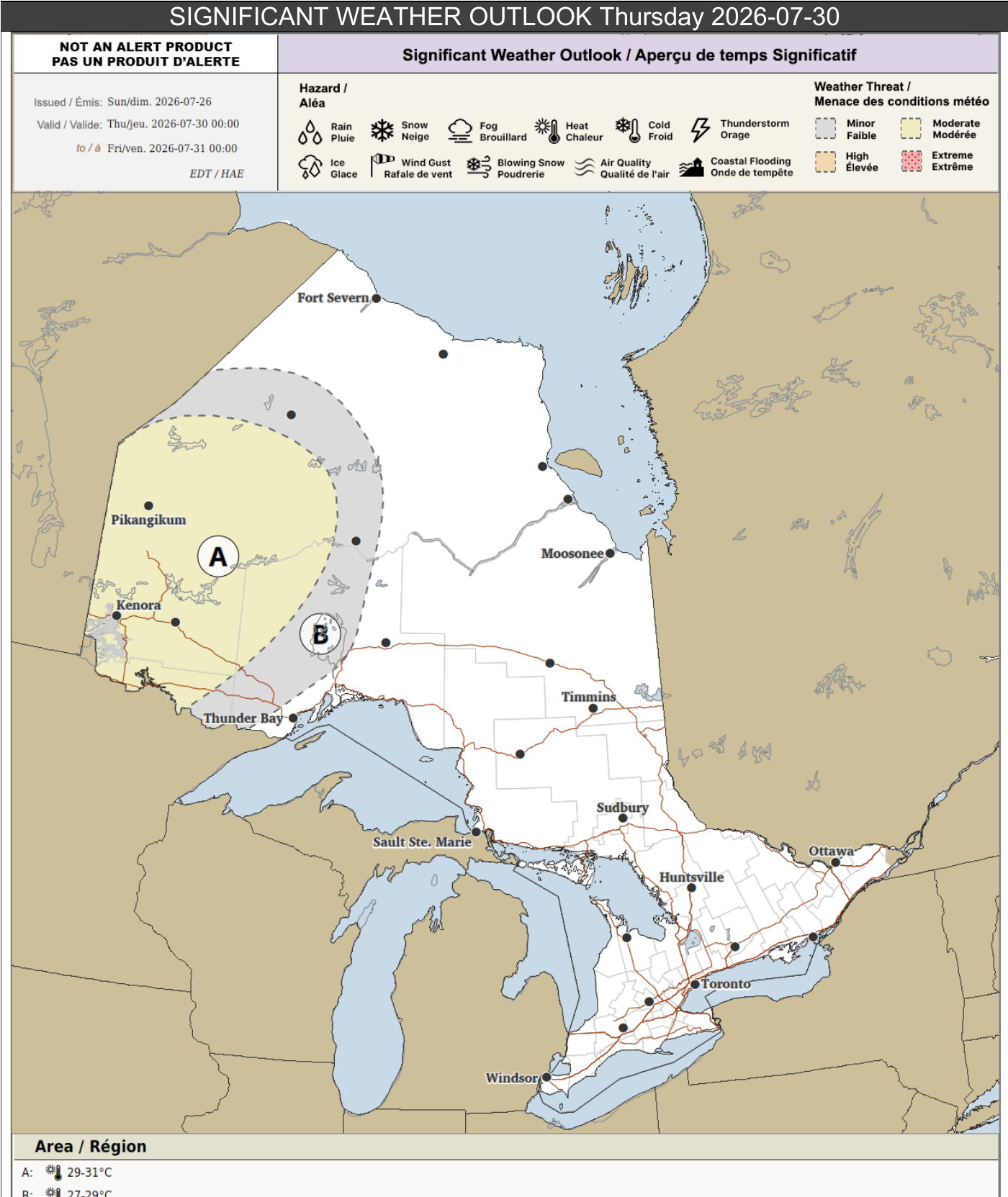
Thursday's significant weather outlook keeps the heat focused on northwestern and far northwestern Ontario, including an area where highs of 29 to 31°C are possible.
Source: This article is based on Environment Canada's forecast email, issued Sunday, July 26th, 2026.



