🔔⛈️ Severe Thunderstorm Risk Today Focused on Southwestern Ontario with Damaging Winds, Large Hail & an Isolated Tornado Cannot be Ruled Out
/
NOTE: YOU CAN CLICK ON THE MAP TO OPEN A ZOOMABLE IMAGE
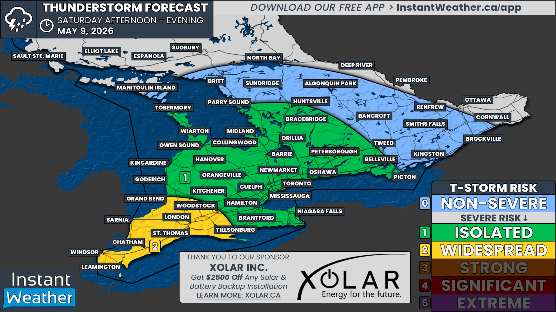
Southern Ontario is facing a fairly widespread thunderstorm risk this afternoon and evening, Saturday, May 9, 2026 with the potential for isolated severe thunderstorm activity.
The strongest potential for severe thunderstorms will be in the yellow region, especially between roughly 3 and 7 PM across deep Southwestern Ontario. Storms in this area could bring damaging wind gusts, large hail around 1 to 3 cm in size, frequent lightning, and localized flooding. Isolated tornado activity cannot be ruled out in the yellow region today as well, so we’ll be live streaming on our YouTube channel to monitor for any signs of organized rotation.
In the green region, the main threats will be strong wind gusts, hail, frequent lightning, and torrential rainfall, which could create difficult travel conditions for many. There is a small chance that wind gusts or hail in the green region could briefly reach severe limits, which is why we’ve highlighted it for an isolated severe risk.
We’ll also be sending out Environment Canada’s official watches and warnings through our free InstantWeather app, along with possible custom notifications if we spot anything worth notifying.
And in some exciting news, we’re planning to launch our completely revamped free app on June 1st! It includes dark mode, a widget, and a full rebuild from the ground up for better performance, reduced battery usage, and an improved experience overall. We’ve also built the original app experience into the new version for those who prefer it. :)
More details coming ASAP. Woohoo!


