EF0 Tornado Confirmed South of Hamilton, Ontario on Saturday Morning
/
The Northern Tornadoes Project (NTP) has officially verified the occurrence of a tornado near Caledonia, Ontario, during the morning hours of Saturday (August 12, 2023, at 10:15 AM EDT). The tornado's impact resulted in EF0 damage, primarily affecting trees within the vicinity.
The visual evidence captured by witnesses, including images and videos of the funnel cloud, prompted the NTP to launch an investigation into the event. Their findings unveiled a narrow path of damage situated to the northeast of Caledonia. This affected area showcased characteristics of snapped stems and broken branches, along with indications that the tornado had lifted larger branches.
In terms of intensity, the tornado's maximum wind speed was estimated at 115 km/h. It followed a track length of 5 kilometres, with its maximum path width spanning 150 meters.
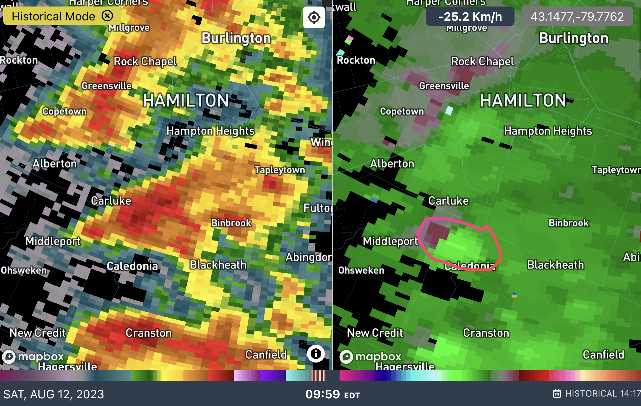
This radar scan at 9:59 AM from the King City radar as shown on IW Pro provided an early indication of potential tornado activity to the northwest of Caledonia. This rotation eventually materialized into the confirmed tornado, which touched down approximately 15 minutes later northeast of Caledonia.

Based on the radar-detected rotation, Instant Weather sent out a ‘Tornado Potential’ notification at 9:53 AM. This advance notification specifically identified Caledonia as an area potentially at risk where the tornado eventually touched down around 20 minutes later:
We've detected tornado potential with this storm near #Middleport, tracking east towards the #Caledonia and #MountHope region. Significant damaging winds are present on radar as well.
Tornado potential means this storm could produce an isolated tornado.
Environment Canada issued a severe thunderstorm warning at 10:18 AM which included Caledonia, however, it didn’t mention any tornado risk.
