Slight and Strong Risk for Severe Thunderstorms Across Southern Manitoba Saturday, Hitting in Multiple Rounds
/
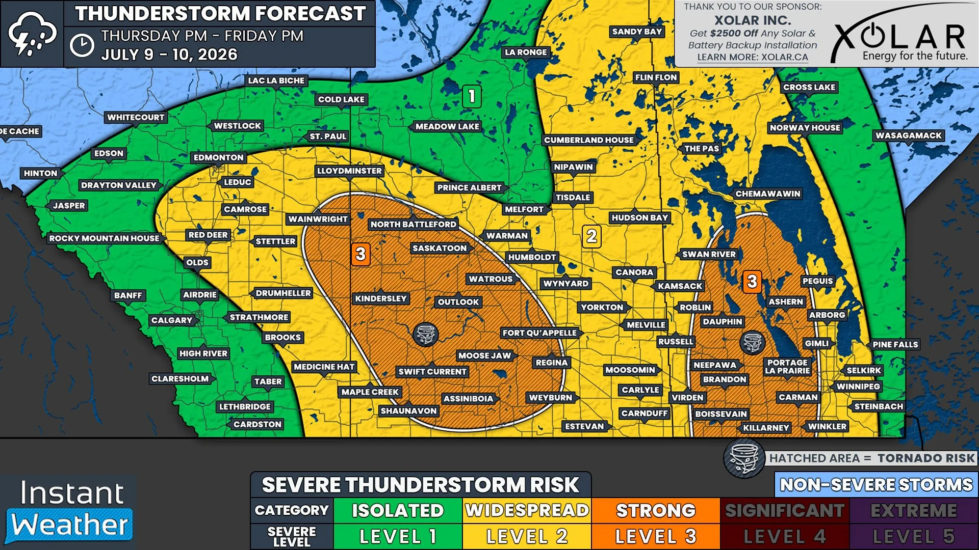
NOTE: YOU CAN CLICK ON THE MAP TO OPEN A ZOOMABLE IMAGE
It will be a hot day across Southern Manitoba on Saturday, but there will be some active weather, in the form of a line of severe thunderstorms, to contend with before the temperatures start to climb. More storms will hit the region later in the day, but the timing remains a little unclear. Regardless, the risk of large hail and damaging wind gusts, along with the possibility of a tornado makes this a Strong Risk for severe thunderstorms in Southwestern Manitoba, including Brandon, and a Slight Risk across much of the rest of Southern Manitoba.
The first line of storms will make their way into Southwestern Manitoba around sunrise Saturday morning, packing a punch with strong winds and large hail. These storms will lose steam as they travel eastward across the width of the province throughout the morning and into the early afternoon. Following this line of storms, it will be a hot day across the region, feeling closer to 40°C with the humidity, which should provide ample fuel for another wave of storms. The exact timing of this second line of storms is still uncertain. Some models are suggesting that the additional storms could start Saturday evening and make their way across Southern Manitoba overnight and into Sunday morning. On the other hand, there are other models that show the second line of storms developing in the early morning hours of Sunday and continuing into the early afternoon, followed by a third line of storms beginning Sunday evening. Due to this uncertainty, we will likely have a revised forecast for the secondary storm development posted Saturday afternoon.

The threats from these storms will be the large hail, with up to golf ball-size possible, as well as widespread damaging wind gusts that could exceed 100km/h and approach 120km/h, along with the possibility of a tornado or two touching down. There will also be a flooding risk, with these storms expected to bring up to 100mm, particularly to areas that will experience multiple rounds of storms.