Risk for Severe Thunderstorms Continues in Saskatchewan Thursday Along with Torndao Threat
/
NOTE: YOU CAN CLICK ON THE MAP TO OPEN A ZOOMABLE IMAGE
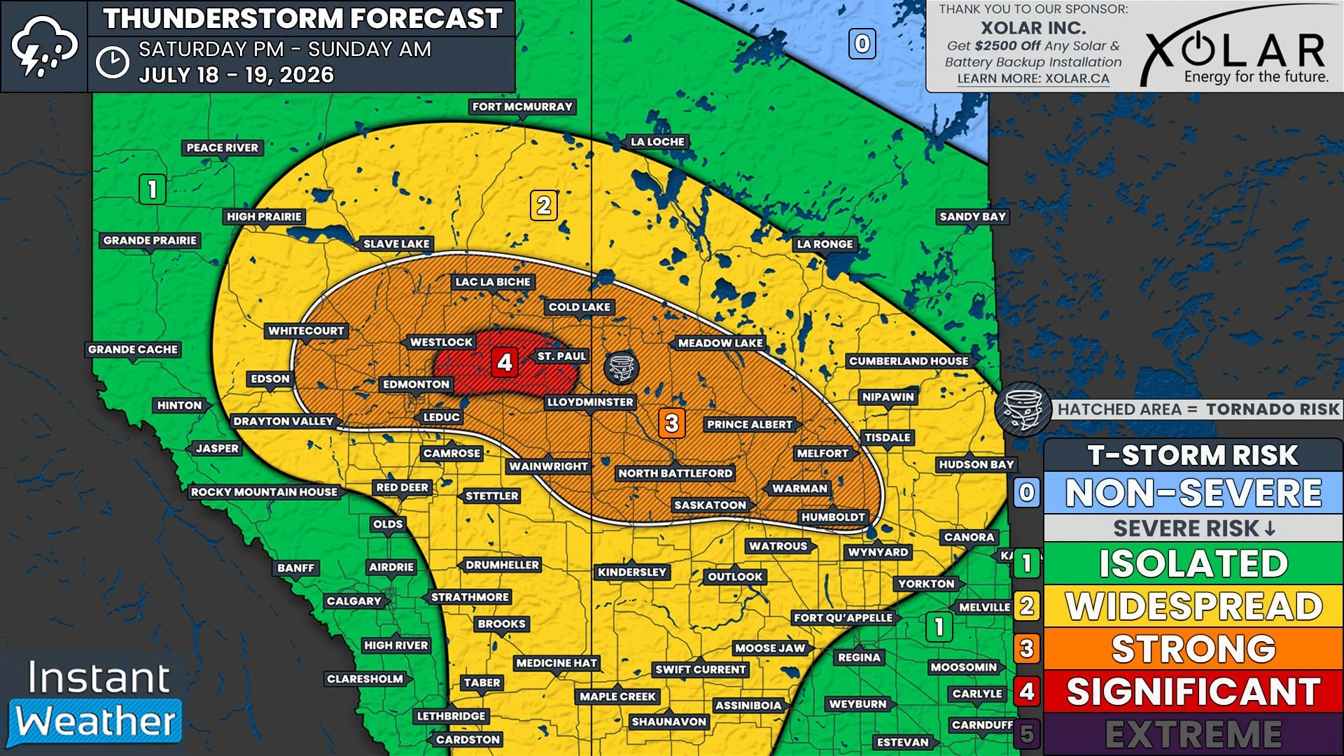
The same low pressure system and warm front that triggered the development of severe storms and multiple tornado warnings yesterday will continue to impact parts of Saskatchewan today. The same severe thunderstorm risk also exists today, but the difference is that there is now a secondary area of low pressure that has built up along the preexisting warm front and a cold front is trailing not too far behind. This means that today’s severe thunderstorm threat is further east than yesterday, and it does not extend quite as far northward.
Despite this, thunderstorms are still expected to once again develop along the length of the warm front, stretching approximately from Saskatoon through Regina and into the US, as the front continues to cross the province today. As with yesterday’s setup, it is looking likely that the thunderstorms today will start off as isolated cells in the mid to late afternoon, around 2-4pm, with a majority of them then merging into northeastward travelling multicellular lines later in the afternoon and through the evening.
The thunderstorms are anticipated to quickly surpass the severe threshold in the late afternoon, with the greatest severe threat expected in the early evening. Today’s severe thunderstorms, much like yesterday, will have the potential to create large hail, which could be as large as golf balls, damaging wind gusts up to 110km/h, and possibly an embedded tornado. At this point, it appears that the tornado risk is lower than yesterday, but the potential still exists. Environment Canada has highlighted around Regina and areas to the northeast, in particular, as a region where the strongest of today’s severe thunderstorms could impact.
Today’s storms are expected to weaken later in the evening, but there is a chance that they could remain severe as they continue tracking northeastward into Manitoba overnight. Futhermore, there could be some stray thunderstorms that develop a bit further west, behind the main line, throughout the evening. These storms will likely be weaker, with the preceding storms taking a lot of energy out of the environment. Nevertheless, they will have the potential to become severe, especially as the storms ahead of them lose strength.