First Significant Snowfall of the Season Expected Across Alberta to Start the Week
/NOTE: YOU CAN CLICK ON THE MAP TO OPEN A ZOOMABLE IMAGE
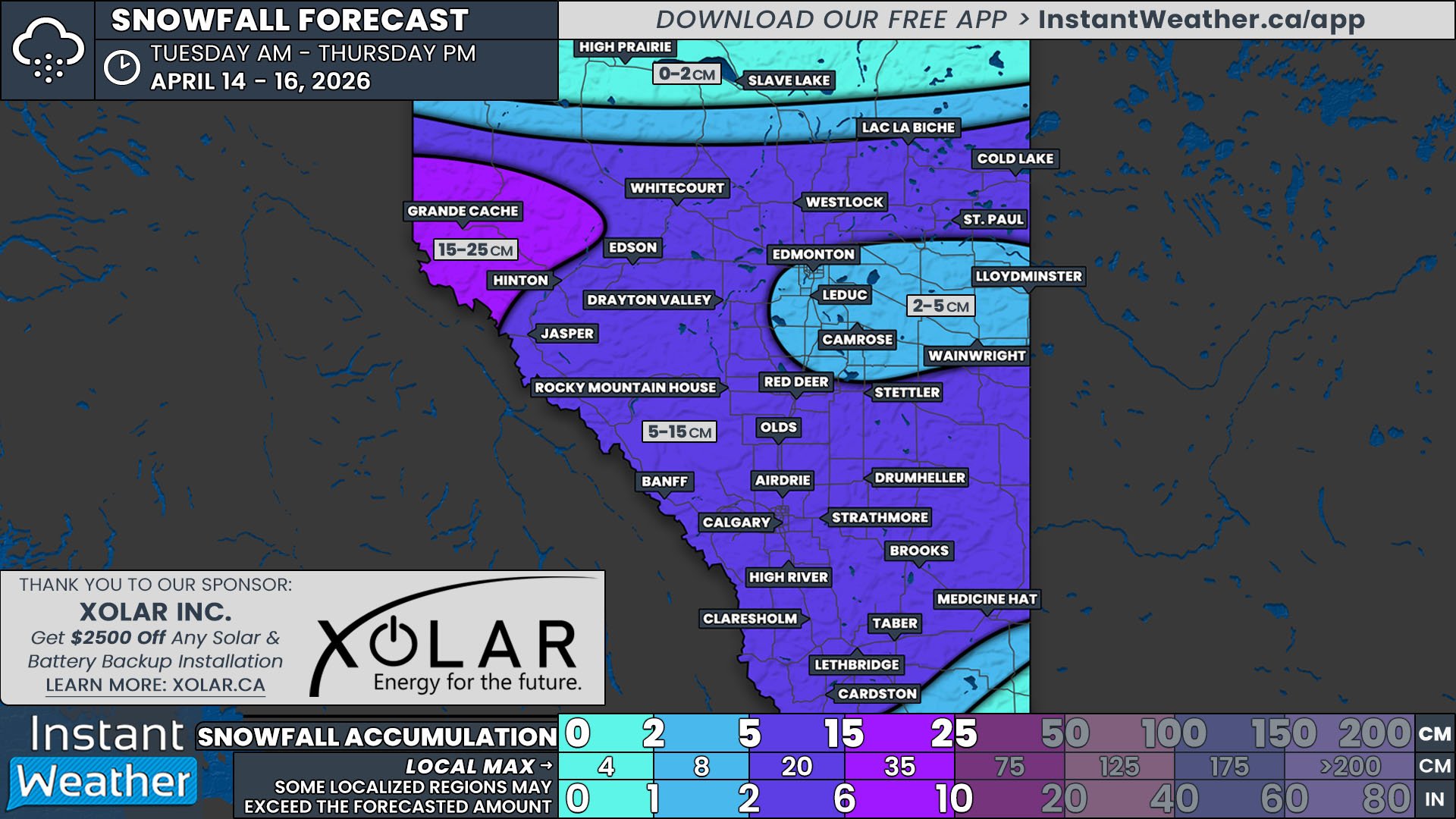
On the heels of some mild temperatures for the past week, a drastic cool down is already on its way courtesy of a strong cold front. Precipitation is expected along this cold front and unfortunately, the temperatures will dip low enough across much of Central and Southern Alberta for some of that precipitation to fall as snow, hitting the region in two rounds.
The cold front has already started to make its way through Alberta from the north, bringing single digit temperatures to areas north of Red Deer and a large band of precipitation behind it spanning the width of the province. Most of this precipitation has been falling as rain, but to the west, through Grande Cache and Grande Prairie, there has been light snow. The rain will transition to snow moving eastwards this evening and overnight as the temperatures continue to fall and a low pressure centre moves in from the west, pushing the front and its associated precipitation towards Saskatchewan.
South of this first round of snowfall, conditions will stay dry until late Monday morning when additional precipitation will push its way into the region from British Columbia, crossing eastward across Alberta through the afternoon and evening. With the passage of the expected low pressure centre and a second cold front, temperatures will actually drop throughout the day so a large swath of Southern Alberta will see precipitation start off as rain, but transition to snow later in the afternoon as the temperature continues to drop. The exception to this will be in the Rockies, where the precipitation is expected to fall predominantly as snow, leading to upwards of 20cm of snowfall accumulation.
Forecasting the exact amount of snowfall for this event has been tough because the temperatures will not fall too far below 0°C, only a few degrees in most places. Furthermore, the ground is still warm across much of the province, meaning that overall accumulation should be limited to just a few centimetres beyond the mountains. Despite this, roadways could still become slick, so make sure to exercise caution when travelling over the next couple of days.


