⛈️ Strong Severe Thunderstorm & Tornado Risk For Ontario on Thursday Evening
/
NOTE: YOU CAN CLICK ON THE MAP TO OPEN A ZOOMABLE IMAGE
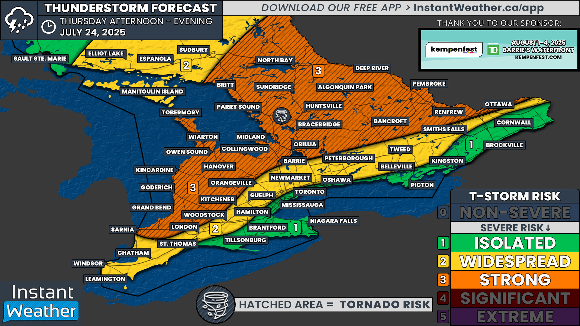
The summertime heat we’ve been experiencing is about to fuel some potentially strong thunderstorms in Ontario on Thursday, July 24, 2025. The main risk is in the evening and overnight hours but some areas could see strong storms in the afternoon as well, especially in Northeastern Ontario.
Some of these storms, particularly from the Bruce Peninsula and east towards Muskoka, Algonquin and potentially through parts of eastern Ontario may see a strong damaging wind storm (MCS), which is showing up on several high-resolution models. The timing looks to be late afternoon into the evening and overnight as it moves east towards Quebec.
Across other parts of Ontario, there is a risk for a cluster or line of storms from as far south as Essex County, all the way up to northeastern Ontario in the late afternoon into the overnight hours. Some models suggest it could arrive in the late afternoon but quite a few are suggesting the storms won’t arrive for most of us until the evening or overnight, especially in the east.
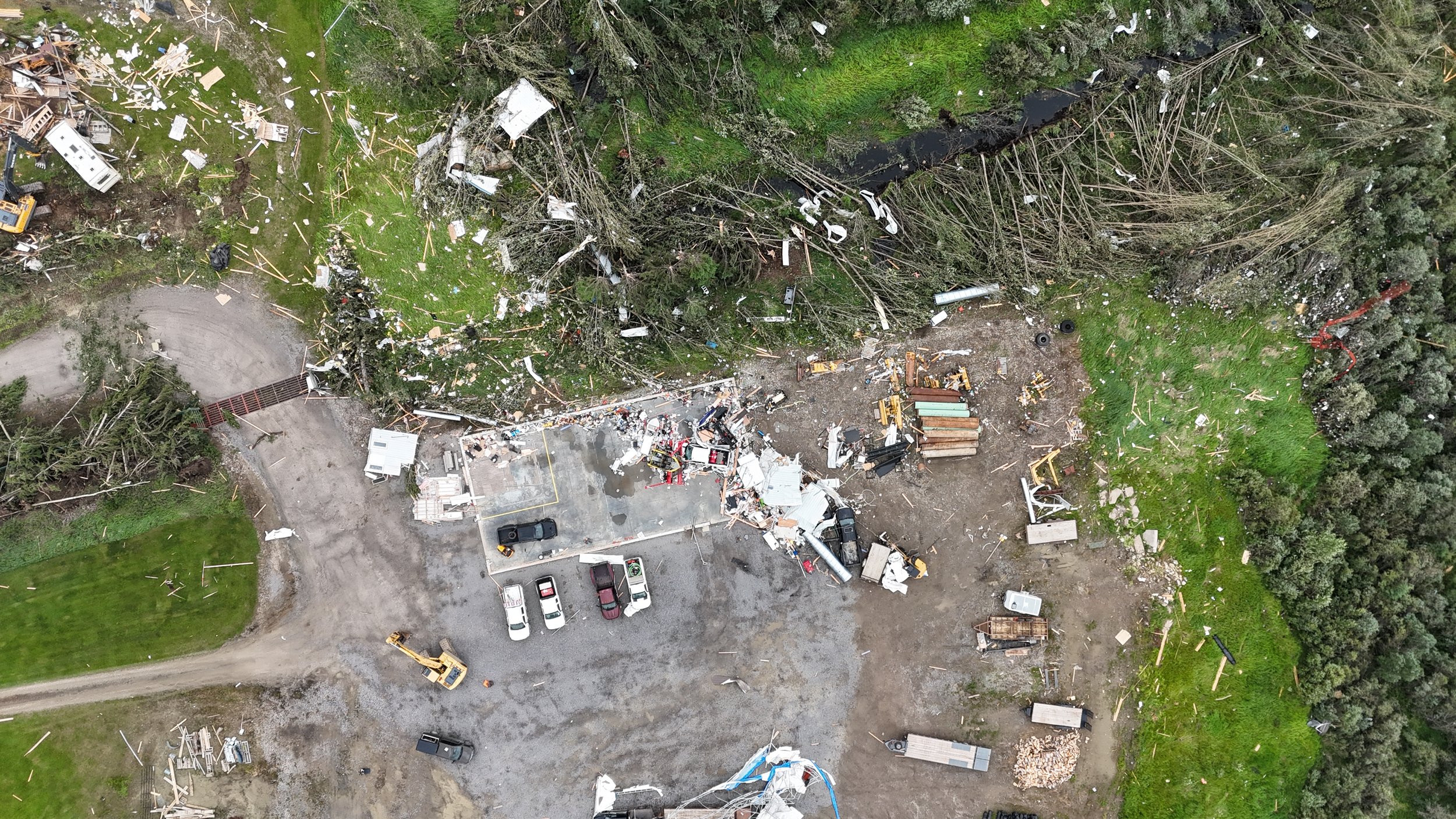
Damaging wind gusts, potentially exceeding 100km/h+, large hail, torrential rainfall with isolated flooding and frequent lightning are the main risks. We’re also seeing the potential for a few isolated tornadoes with this system, especially in orange (3) zone on the forecast map.
STAY AHEAD OF THE STORM
Join us on YouTube as we track any storms that develop on Thursday. Make sure to hit the free Subscribe button and the notification bell icon to get notified when we go live!

NOTE: YOU CAN CLICK ON THE MAP TO OPEN A ZOOMABLE IMAGE
In the image above, Environment Canada has issued their forecast for Thursday, highlighting all of the southwestern, central, golden horseshoe and eastern Ontario regions in a 2/4 “Moderate weather threat”.
Below is a regional breakdown based on Environment Canada’s forecast details:
📍 Location A: Portions of Southern & Northeastern Ontario
Hazards: 🌬️ Wind, 🌨️ Hail, 🌧️ Rain, 🌪️ Tornado, ⛈️ Thunderstorms
Timing: Afternoon and evening
Impacts:
🪁 Loose objects may be tossed
🏚️ Damage to weak buildings
🌳 Broken tree branches and downed trees
🌿 Possible damage to plants and crops
🌊 Flash flooding and pooling on roads
⚡ Power outages likely
Rainfall: Up to 50 mm
Confidence: Moderate
Impact: Moderate
Details:
Storms may bring wind gusts up to 100 km/h, rainfall up to 50 mm, hail up to 2 cm, and the potential for isolated tornadoes. Activity begins in the northwest and tracks southeastward through the day.
📍 Location B: Portions of Southwestern & Eastern Ontario + Greater Golden Horseshoe
Hazards: 🌬️ Wind, 🌧️ Rain, ⛈️ Thunderstorms
Timing: Late afternoon and evening
Impacts:
🌳 Broken tree branches and downed trees
🌊 Flash flooding and pooling on roads
⚡ Possible power outages
Rainfall: Up to 50 mm
Confidence: Moderate
Impact: Moderate
Details:
Scattered thunderstorms may produce wind gusts up to 90 km/h and locally heavy rainfall.
More details ASAP about this storm risk. Stay safe on Thursday, folks!
And a big thanks to the sponsor of this forecast; Kempenfest in Barrie! For those who don’t know, our own Adam Skinner will be performing at Kempenfest this year with his new rock band ‘Face The Lion’! They’ll be opening for the one and only Colin James on Saturday, August 2nd!
Here’s some more details on Kempenfest:
”Kempenfest presented by TD, is Barrie Ontario’s signature festival event, celebrating 53 years Aug 1-4, 2025, located across two-kilometres of Barrie’s beautiful waterfront. The annual event is one of Ontario’s largest waterfront festivals, featuring 300 arts & crafts vendors, a midway, community village, antiques, face painters, buskers, great food, a poutine village, and two stages of live music! Evening concert headliners include Shawn Desman, Colin James, The Washboard Union, and The Practically Hip, with many more!”
We hope to see you there!