Widespread Severe Thunderstorms Possible Across Southern Alberta and into Southwestern Saskatchewan Today with Slight Risk of a Tornado
/

NOTE: YOU CAN CLICK ON THE MAP TO OPEN A ZOOMABLE IMAGE
Severe thunderstorms are going to be likely across Southern Alberta and into parts of Central Alberta and Southwestern Saskatchewan today. A cold front associated with the low pressure system that’s responsible for the heavy rainfall in Central Alberta will be the trigger for thunderstorm development this afternoon and evening.
Temperatures are expected to climb into the low to mid-20s, but dewpoints are expected to be fairly low, barely reaching mid-teens for most of Southern Alberta and Southwestern Saskatchewan. This lack of moisture could hamper thunderstorm development, however some moisture from the north could make its way into the region later today, which would make up for the lower dewpoints.
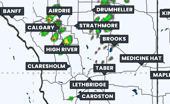
Simulated reflectivity at 3pm MDT, courtesy of weatherbell.
Thunderstorms are expected to develop early this afternoon in the Foothills as individual cells. These storms will likely be severe for most of the region, but there is a more isolated severe risk closer to the low pressure center, in the Edmonton area and westward.
As the storms progress eastward through the afternoon and evening, they are expected to eventually merge into a line. This transition to a linear storm mode will bring a more widespread severe risk across Southeastern Alberta and eventually into Southwestern Saskatchewan later in the evening (around 8-10pm).
The severe risk does not extend too far eastward into Saskatchewan because the storms will weaken later in the evening. This will lead to a more isolated threat into the Swift Current area by around midnight before it’s expected that the storms become non-severe for the rest of the overnight period.
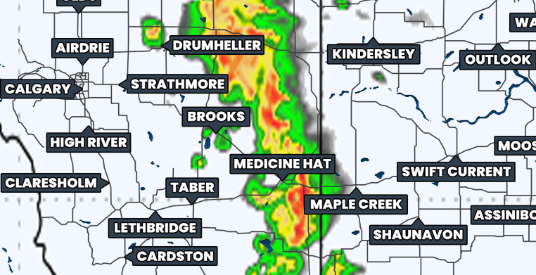
Simulated reflectivity at 9pm MDT, courtesy of weatherbell.
Across most of Southern Alberta and stretching into parts of Central Alberta, including Red Deer, and Southwestern Saskatchewan is where there is the greatest risk for widespread severe thunderstorms today. In this region, the main severe weather threats will be strong wind gusts above 100km/h and large hail that could be as big as ping pong balls. There is also a small risk of a tornado today, but that will be very conditional on there being enough moisture moving into this area from the north ahead of the thunderstorm development.


