Tennis Ball-Sized Hail and Multiple Tornadoes Possible as Severe Thunderstorm Outbreak Targets Southeastern Saskatchewan on Saturday
/

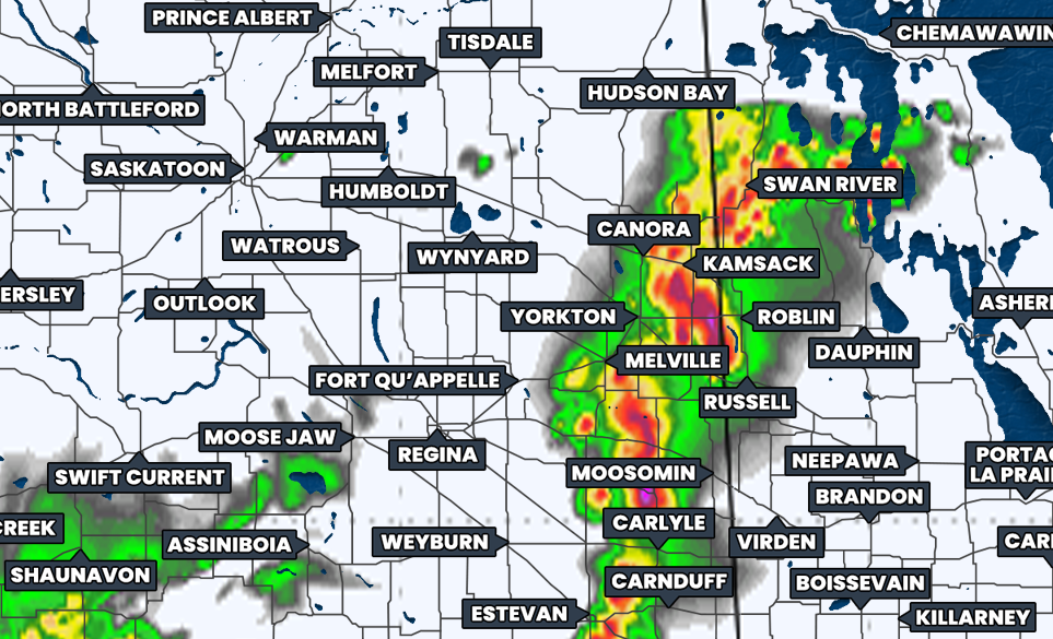
NOTE: YOU CAN CLICK ON THE MAP TO OPEN A ZOOMABLE IMAGE
Over the last several days, we’ve been closely watching the possibility of an intense multi-day setup for this weekend that would impact Southeastern Saskatchewan today and shift into Southwestern Manitoba tomorrow. There has been a lot of chatter online about this severe weather risk and combined with several high-profile storm chasers in the area from the US, it’s easy to say that we’re not looking at your average thunderstorm activity.
Today’s severe thunderstorm threat will be courtesy of a warm and cold front that is poised over Southeastern Saskatchewan and Southwestern Manitoba. The warm sector between the two fronts will see temperatures climb into the upper 20s and low 30s this afternoon, with high humidity.
This will lead to high levels of instability and CAPE (Convective Available Potential Energy) for thunderstorm development. Add in veering winds, changing direction with height, which will create a great amount of shear, and you have the recipe for an outbreak of significantly strong severe thunderstorms.
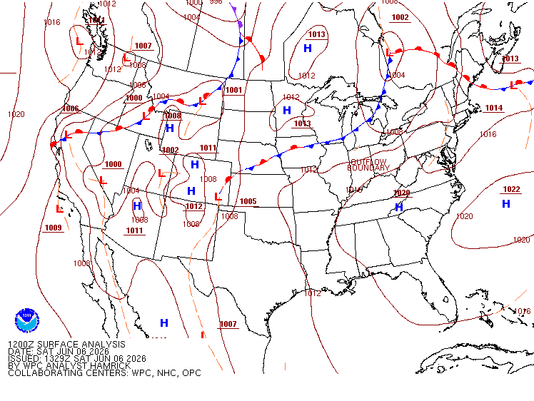
Surface weather map with the positions of highs, lows, and fronts displayed as of 6am cst this morning, courtesy of the national weather service.
There have already been some scattered thunderstorms this morning which will continue through the afternoon across much of Southern Saskatchewan. These storms are expected to stay non-severe for the most part, but there is an isolated severe risk.
The thunderstorms that will be the focus for today aren’t expected to develop until this evening, starting around 5-6pm, to the east of Regina. Weather models are showing that these storms will likely quickly explode into large and dangerous supercell thunderstorms as they track roughly east-northeastward.
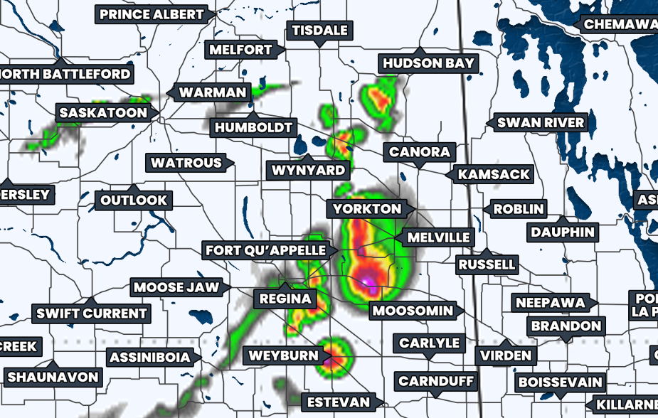
Simulated reflectivity at 6pm CST, courtesy of weatherbell.
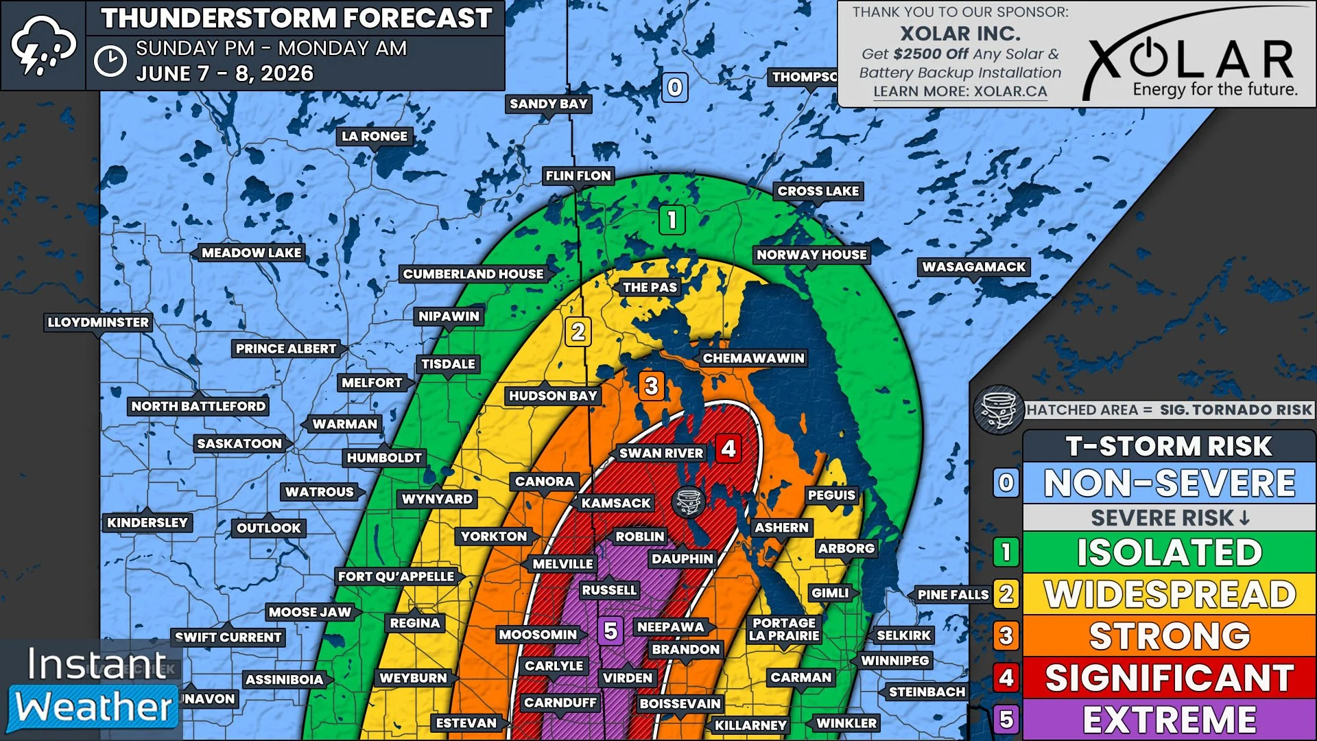
The area highlighted on our map in red that covers a large portion of Southwestern Saskatchewan and into parts of the Parkland Region in Manitoba will be at the greatest risk for the strongest of these severe thunderstorms.
In this region, it’s likely that the storms could produce massive hail as large as tennis balls and possibly even larger, damaging wind gusts up to or exceeding 100km/h, and heavy downpours that could result in localized flooding. There is also a considerable threat that multiple tornadoes could touch down in this region; with the stretch from Weyburn to Yorkton appearing to be of particular concern.
As we progress through the evening, we will see additional thunderstorm development occur, which are expected to merge into a line of storms. This will bring a more widespread threat of the significant and strong storms across the rest of Southeastern Saskatchewan and into Manitoba.
Simulated reflectivity at 8pm CST, courtesy of weatherbell.
The severe weather threat will diminish gradually as the hours tick on in the evening and overnight. The tornado risk is also expected to decrease from its highest point by the mid-evening, but the storms could still be strong enough for the risk to remain through the evening. By midnight, there could still be a widespread risk of some severe storms, but this will quickly turn into a more isolated risk and scattered non-severe thunderstorms through the morning.
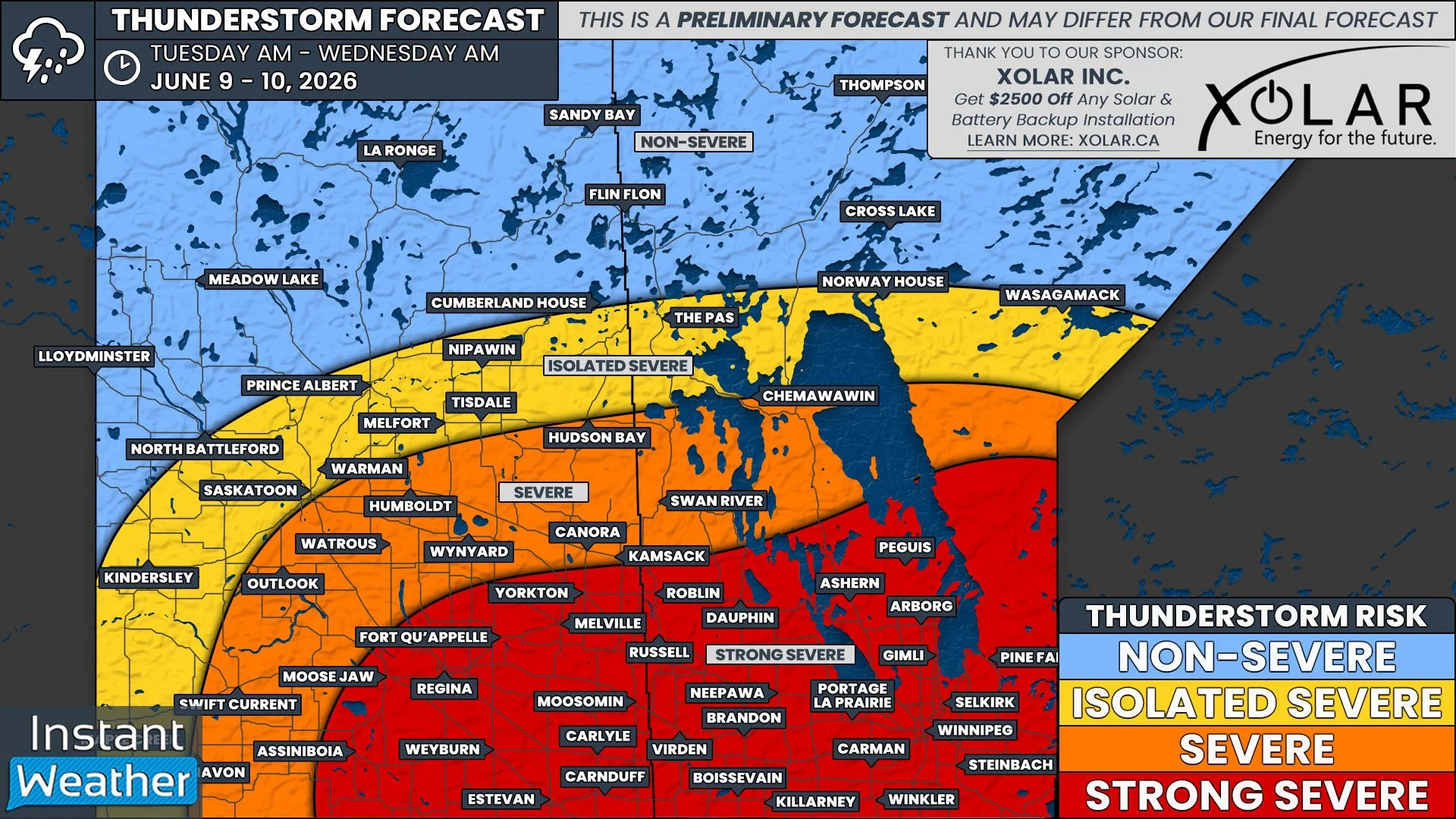
Looking ahead to tomorrow afternoon, we’re looking at another day of possibly strong severe thunderstorms, with the risk pushing further east across Southern Manitoba. What ends up happening tomorrow will really depend on how things unfold today. There’s the possibility that tomorrow could have even stronger storms than what is expected this afternoon, but this will be heavily contingent on how long any overnight storms manage to persist into tomorrow.
If the storms clear during the morning, that will allow for there to be ample surface heating for the development of another significant severe thunderstorm outbreak. However, if the storms continue into the afternoon, the severe thunderstorm risk will be greatly reduced.
We will have more details later today about how tomorrow could shape up. In the meantime, we will be watching today’s development very closely and we will be streaming later to track the severe thunderstorms live. Be sure to tune in!