Update: Wintry Mix Continues, Pocket of Sub-Freezing Temperatures to Increase Snowfall Totals Tuesday
/NOTE: YOU CAN CLICK ON THE MAP TO OPEN A ZOOMABLE IMAGE
It’s been a messy start to the week across parts of Alberta and into Southern Saskatchewan, with a low pressure system bringing mixed precipitation to the region today. This storm has been progressing as expected so far, but the latest data from weather models has resulted in some slight revisions to our forecast for Tuesday.
Throughout the day Monday, we’ve seen temperatures above freezing across most of Southern and Central Alberta, resulting in precipitation falling as a rain-snow mix, and limiting overall snowfall accumulations. The exception to this has been in the Grande Cache area, where the temperatures have remained below 0°C and the precipitation has fallen as snow.
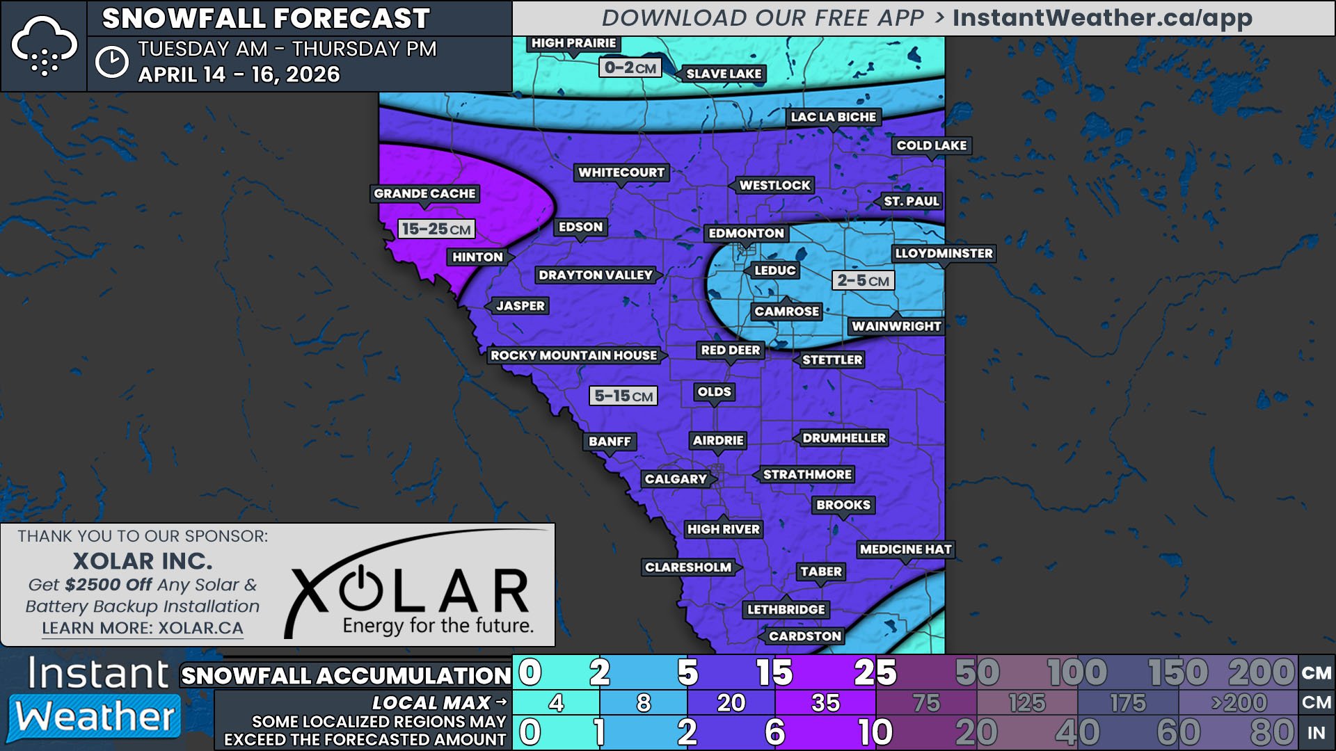
The single digit temperatures will continue overnight across most of Southern Alberta and Saskatchewan, but with being only being a degree or two above, or even at, freezing, we expect there to be a bit more snow accumulating beginning in the early morning hours Tuesday. This has been reflected by an increase in the forecasted snowfall for Taber, Brooks and north towards Strathmore and Drumheller.
As the temperatures begin to climb after sunrise, we will see the transition back to a rain-snow mix across the region. However, there is a small pocket where sub-zero temperatures will persist throughout the day, particularly in Medicine Hat, Maple Creek and the surrounding area. Steady snowfall will increase accumulations amounts to 5-10cm with locally higher amounts of up to 15cm possible in this area by the end of the day.
It is also expected that the precipitation from this system will push further eastward into Saskatchewan Tuesday afternoon and evening. By the late afternoon Tuesday, Arctic air will flood into the Prairies so the remaining light precipitation in Southern Saskatchewan at that point will fall as snow. As a result, we have extended the area covered by the 2-5cm range to include Outlook, Moose Jaw, and Assiniboia. Meanwhile, Saskatoon, Watrous, Fort Qu’Appelle, Estevan, and areas in between can now expect trace amounts (less than 2cm) of snow. The snow will diminish overnight, but scattered light flurries are possible in Southeast Saskatchewan Wednesday morning.


