Mid-March Snowfall Will Help Build Back Some Snowpack With 10-20cm Expected Across a Wide Stretch of Alberta & Saskatchewan
/
NOTE: YOU CAN CLICK ON THE MAP TO OPEN A ZOOMABLE IMAGE
While we’re a little over a week away from the official start of spring, a majority of the snowpack is already gone across parts of Alberta and Saskatchewan. However, winter is still hanging on with more snow incoming over the next couple of days.
This will help to add some much-needed moisture to part of the region, especially since we have seen well below average snowfall since November. Unfortunately for Southern Alberta, the driest part of the Prairies, can expect little to none of this incoming moisture.
The snow will cross through the Rockies and into Alberta at around sunrise on Thursday and spread northeastward deeper into the province throughout the morning and into the afternoon. The snow will intensify starting in the early afternoon and this heavier snowfall will continue straight through overnight. This will lead to a large stretch of Central and Northern Alberta receiving 10-20cm of snow and up to 25cm possible to the north of Lake La Biche and Cold Lake through Friday morning.
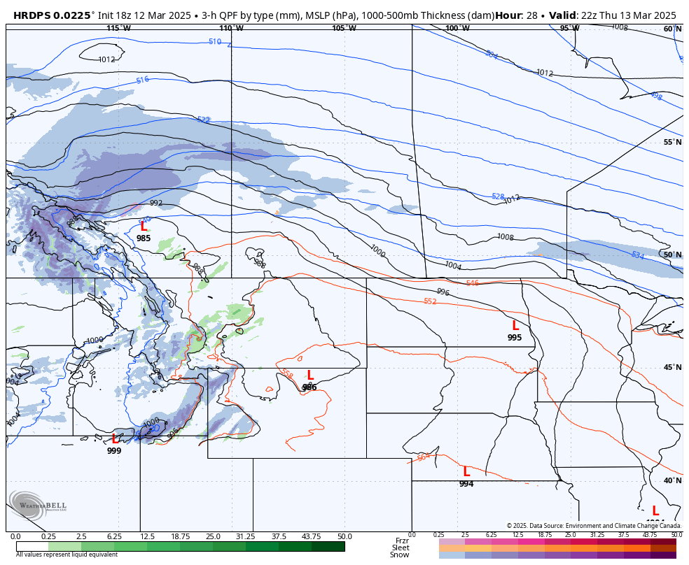
Model Image showing the location and intensity of snow (Blue) and Rain (Green) at 4PM MT on Thursday
Light snow will make its way into Northern Saskatchewan early Thursday afternoon, followed by the more intense snowfall beginning in the early evening. This area of heavier snow will cross through Saskatchewan in an almost due easterly path and similar to in Alberta, it will dump 10-20cm across a large stretch of the province and up to 30cm from the Alberta border to almost La Ronge by Friday afternoon.
The arrival of additional moisture from a separate low-pressure system in the US on Friday morning makes the forecast in Central and Southern Saskatchewan a bit more complicated. This appears to be bringing a combination of rain, freezing rain, ice pellets, and snow to most of the southern half of the province throughout the morning as it merges with the system from the west.
There is still some uncertainty regarding the precipitation type and the area that could be impacted by the arrival of the secondary system. Therefore, for this forecast, we are only focusing on the snow coming from Alberta and we will cover this additional precipitation in a separate forecast that will be issued later in the day on Thursday

Model Image showing the location and intensity of snow (Blue), Rain (Green), Freezing rain (pink), and ice pellets (orange) at 2aM MT on Friday


