Strong Severe Thunderstorm and Tornado Risk Bring August to a Close in Saskatchewan & Manitoba
/
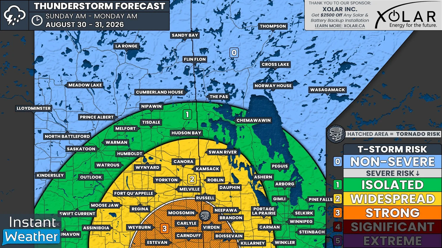
NOTE: YOU CAN CLICK ON THE MAP TO OPEN A ZOOMABLE IMAGE
The risk for strong severe thunderstorms returns to Southeastern Saskatchewan and Southwestern Manitoba today, just in time to say goodbye to the month of August.
It’s already been an active morning in parts of Southern and Central Saskatchewan, with widespread, mostly sub-severe, thunderstorms having been triggered by an occluded front that is tracking across the province.
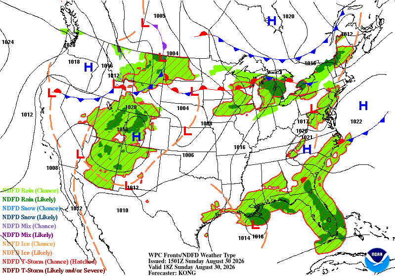
Future Surface weather map with the positions of highs, lows, and fronts displayed for 12pm CST/1PM CDT on Sunday, courtesy of the national weather service.
The morning storms will continue into the afternoon and we will likely see some strengthening begin to occur beginning in the early afternoon hours.
As we get later into the afternoon, around 3-5pm CST, additional thunderstorms are expected to develop in Southeastern Saskatchewan and extending into North Dakota. These additional storms are expected to start off as discrete supercells, but will quickly experience upscale growth into a strong line of thunderstorms by the evening. There is also the possibility of multiple training lines of storms forming.
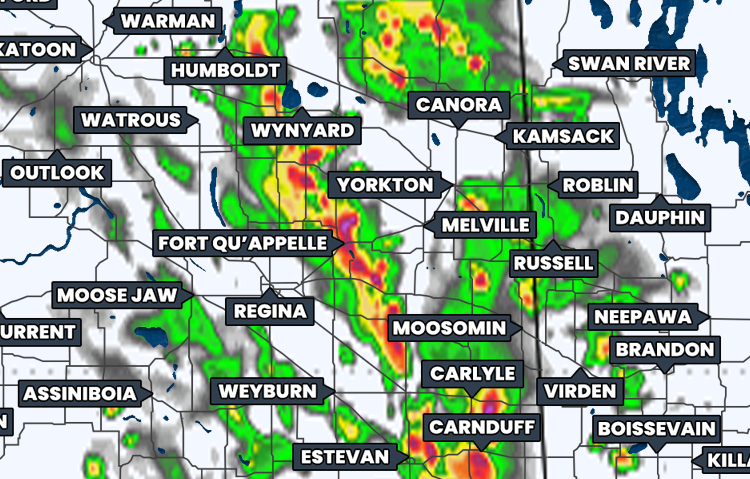
Simulated reflectivity at 6pm CST/7pm CDT, courtesy of weatherbell.
This line, or lines, of storms will track northeastward through the evening and cross into Manitoba as early as 6pm CDT, possibly preceded by some small leading storms, which weather models are showing would be quickly engulfed by the main linear complex.
The storms will track deeper into Manitoba through the evening hours and they will gradually lose strength as the hours progress, but there will still be a widespread severe risk that will continue until around midnight. Beyond that point, the severe threat is expected to become more isolated, as the storms persist through the early morning hours of Monday.
All severe weather threats will be on the table with today’s environment and set up. The supercell thunderstorms that are expected later this afternoon will be associated with the threat of large hail, which could be larger than golf balls, and damaging winds in excess of 100km/h.
These supercell storms will also have the potential to produce an isolated tornado or two, but as these individual storms merge into a line, the tornado risk diminishes. However, the risk does not completely disappear until the line begins to weaken in the late evening hours.
The greater concerns from the linear thunderstorms will be widespread damaging winds, that may easily surpass 100km/h, and intense rainfall, especially from training thunderstorms. There is quite a bit of moisture in the environment today and with the possibility of multiple rounds of storms, some areas could easily see more than 50mm of rain fall by tomorrow morning.
The Instant Weather team will definitely be live streaming this afternoon and evening so be sure to tune in at instantweather.ca/live!