Early Morning Strong Severe Risk Followed by Widespread Threat Later in Day on Monday for Southern Ontario
/A complex weather situation is set to unfold across Southern Ontario over the next 24 hours as heat-fueled severe threats bring multiple rounds of storms on Monday.
We are already seeing the formation of what will be the first round of storms, expected to track into Southwestern Ontario early Monday morning. A cluster of intense storms began taking shape over Wisconsin and Illinois late Sunday evening. The Chicago area took a direct hit, prompting a tornado warning to be issued with multiple visible areas of rotation on radar over the city.
The environment is building ahead of the storms, and models agree that it will maintain its strength through the overnight hours as it tracks eastward through Michigan. Based on this, we feel that the Windsor and Chatham areas could face a strong risk of severe weather starting around 4-5 a.m. on Monday. The exact arrival of this storm and its strength remain somewhat uncertain.
The main concern is the potential for destructive wind gusts exceeding 100 km/h. As seen in Chicago, brief spin-ups aren’t out of the question, so an isolated tornado threat could also be present. The hail risk will be lower, likely maxing out at around nickel to quarter-sized hail.
The first round of storms will come to an end by the late morning hours as the decaying line of storms moves out over Lake Erie and south of the border. However, this won’t be the end of the risk for Monday. Additional storms could follow in the wake of that main line through Southwestern Ontario around the noon hour.
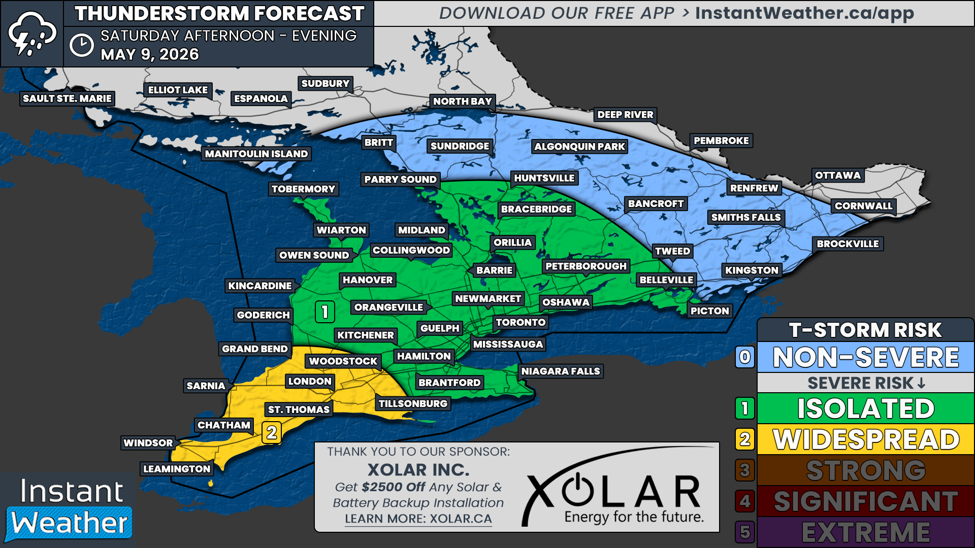
A more widespread threat of severe weather is expected to develop during the early afternoon hours in the Niagara region and to the northeast of Lake Simcoe. All severe hazards could be on the table, including hail up to the size of toonies, damaging wind gusts, and an isolated tornado.
Starting with the Niagara region, the latest model data shows the development of a cluster of strong storms somewhere around London and Brantford during the early afternoon. The environment is favourable for this cluster to become severe as it tracks along the Lake Erie shoreline into the Niagara region and crosses the border into New York by the mid to late afternoon.
Further north, storms are likely to bubble up along a corridor stretching from Lake Simcoe through Bancroft and into the Ottawa Valley starting around 2 to 4 p.m. and continuing into the early evening hours. This activity is expected to be fairly isolated, and not everyone will see a storm, but the potential is there for anywhere in Central and Eastern Ontario.
We have opted for a ‘strong’ (level 3 out of 5) severe risk for Deep Southwestern Ontario, including Windsor and Chatham. This is driven by the destructive wind gust threat early Monday morning with the expected line of storms around 4 to 6 a.m.
Outside of the strong risk, we have a ‘slight’ (level 2) severe risk for the Niagara region along with parts of Central and Eastern Ontario. A few storms could reach the severe threshold with toonie-sized hail, damaging wind gusts, and an isolated tornado.
The rest of Southern Ontario is in the ‘marginal’ (level 1) severe risk, as it can’t be ruled out that any storms that pop up could present some severe hazards. It’s important to note that it’s hard to pinpoint where these storms will appear, so you are not guaranteed a storm even if you are in a risk zone on our map.
We have our eyes on Tuesday, which could see a fairly strong risk of severe storms during the afternoon and evening hours. At this point, Central and Eastern Ontario appear to be in the bullseye for a second day, with the threat likely ranging from a ‘slight’ (level 2) to a ‘strong’ (level 3) risk. This could also extend into parts of the Golden Horseshoe. A more detailed forecast for Tuesday will be issued by late Monday.


