Up to 75mm of Rain for Parts of Southern Saskatchewan & Manitoba, Along with Worsening Air Quality, Expected to End the Work Week
/It is certainly shaping up to be a roller coaster of a week, weather-wise, across Saskatchewan and Manitoba. The week began with record-breaking heat and relentless winds, which made things feel exceptionally dry and were the catalyst for the spread of multiple wildfires across both provinces. Now, cool Arctic air has flooded south and a low pressure system is pushing its way northward from the Dakotas, which will bring significant rain to parts of Southern Saskatchewan and Manitoba on Thursday and Friday.
Pockets of rain on the leading edge of this system have been pushing northward into Southeast Saskatchewan and Westman already Wednesday evening. This will be followed by a large area of steady, heavier rain moving into this region shortly after midnight and continuing through most of the day Thursday.
The rain will gradually spread further northward Thursday morning and by the afternoon, it should also start to cross the border into the rest of Southern Manitoba. This delay in the start of the precipitation will lead to slightly less rain falling overall, but it’ll be fairly steady for the remainder of the event so a widespread 25-50mm can be expected.
In Southeast Saskatchewan and Westman, the earlier start to the precipitation will lead to this area receiving upwards of 75mm of rain. Considering this region already received a fair bit of rain Wednesday morning, this much additional rainfall could very easily lead to some localized flooding.
The center of this system will stay south of the border and will start making its way eastward early Friday morning. The rain will start to taper off, from west to east, beginning Friday morning, before it completely exits the region Saturday morning.
As far as the wildfire situation is concerned, this rain will definitely help containment and suppression efforts in some areas, but it likely won’t be enough to completely douse the flames. In Southeast Manitoba, where several out-of-control fires are burning as of Wednesday evening, 10-25mm is expected to fall with this system, which will be welcomed support.
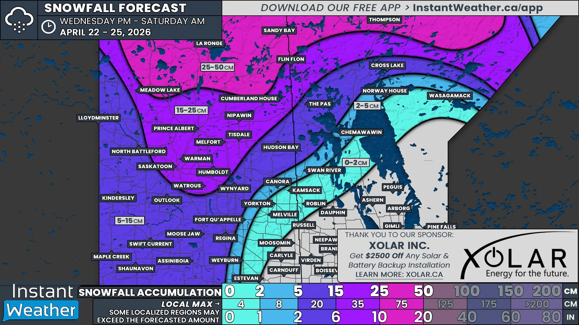
In Saskatchewan though, the rain will unfortunately not push deep enough into the province to impact the fires that have been burning near Narrow Hills Provincial Park, to the north of Nipawin, so hopefully the cooler temperatures will be enough to help crews in this area.
The arrival of this low pressure system will also have a negative impact, mostly in Southern Manitoba, but also in Western Saskatchewan. As the low approaches, the wind direction will shift, causing wildfire smoke to start moving westward in Manitoba and southward through Saskatchewan.
But why does this happen? To explain, we need to dig a bit deeper into the science of meteorology.
Modelled low-level Wildfire Smoke Concentration at 12pm CT on Thursday, May 15th. Note: this particular model only extends so far into Canada, but it shows the movement of smoke in both Manitoba and Saskatchewan.
One of the fundamental rules in meteorology is that air will always want to flow from areas of high pressure to areas of low pressure. This is actually the main driver behind wind.
Air doesn’t take a straight path from high pressure to low pressure, though. Thanks to the Coriolis Effect, caused by the spinning of the planet, air travels towards a low pressure center in a more counter-clockwise fashion, as shown below.
diagram showing how air moves around both high pressure and low pressure centers, courtesy of NOAA.
Putting this all together, as the low pressure center gets closer to us, air will naturally travel towards it and this will pull the wildfire smoke along with it. With where the low will be positioned over North Dakota, this means that smoke will travel westward from the fires burning in Southeast Manitoba and Northwestern Ontario and southward from the fires in Northern Saskatchewan.
This is expected to begin early Thursday morning in Manitoba and after sunrise in Saskatchewan, continuing through the day. On Friday morning, as the low pressure center begins its trek eastward, the wind will start to shift direction. This will be much more noticeable in Manitoba, being closer to the low, with the smoke travelling southwestard during Friday morning and then southward by the afternoon.
Given the number of nearby active fires and their sizes, especially the Nopiming Fire, there is already more smoke in the air in Southern Manitoba than in Northern Saskatchewan. This means that greater concentrations of smoke will move into Winnipeg and the Interlake Region on Thursday and it will diffuse along its path southwestward as it curves towards the low. Then, as the winds shift direction, the thickest smoke will still be found closest to the fires and becoming more diffuse the further away.
In Saskatchewan, the smoke from the two fires near Narrow Hills Provincial Park will travel south-southwestward, into Prince Albert and Saskatoon. Given the distance from the low pressure center, the wind shift is expected to be minimal on Friday.
If the wildfire smoke moves into your area, especially at higher concentrations, try to limit your time spent outside, if possible. We certainly hope that with the arrival of the cooler air and the rain in some areas, that firefighter crews will be able to make considerable progress battling these fires and we will soon have some reprieve from the smoke.


