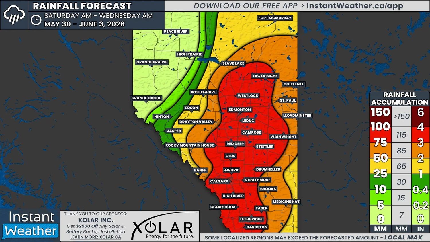
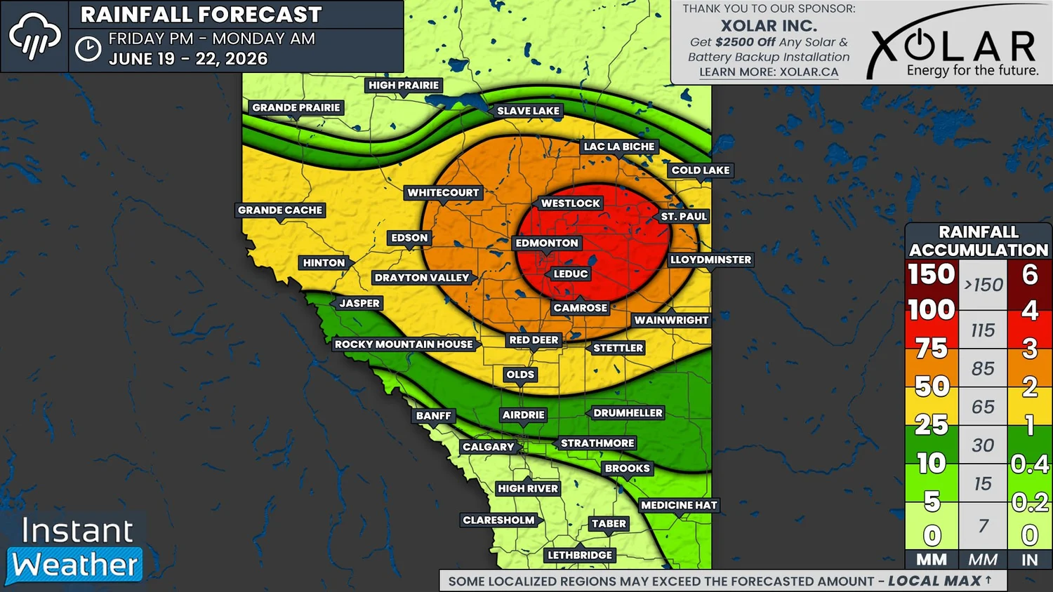
Another Soggy Weekend for Central Alberta as we Welcome Summer with a Widespread 25-100mm of Rain
/
NOTE: YOU CAN CLICK ON THE MAP TO OPEN A ZOOMABLE IMAGE
It’s been a very wet few weeks, which started off during the last weekend of May when over 75mm of rain fell across a significant swath of Central and Southern Alberta. This rainy trend will continue this weekend, as we welcome the first day of summer on Sunday, and by Monday morning, some areas could once again receive up to 100mm of rain.
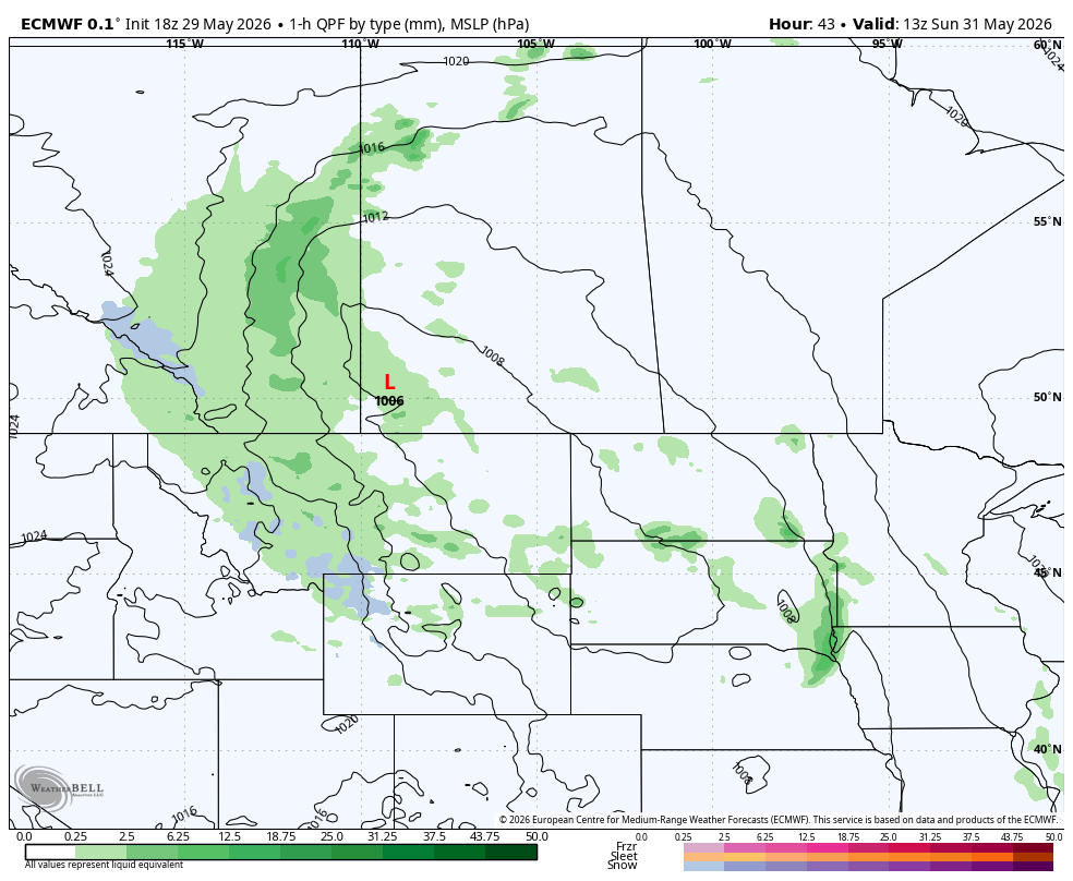
Rain will begin to fall in parts of West Central Alberta Friday evening and overnight as a low pressure system from British Columbia starts to move into the province. Through Saturday morning, the rain will gradually spread east and should reach the Saskatchewan border during the early afternoon.
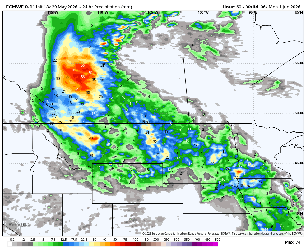
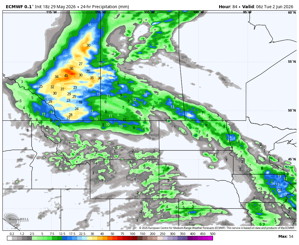
Once the rain sets up over Central Alberta and into parts of Northern Alberta, the system is expected to stall and bring continuous rain through to Sunday evening. At that point, the system will start to break down and the rain will taper off overnight Sunday and through Monday morning. It’s likely that a bit of rain will spread into Southeastern Alberta Monday morning before it completely dissipates by the afternoon.
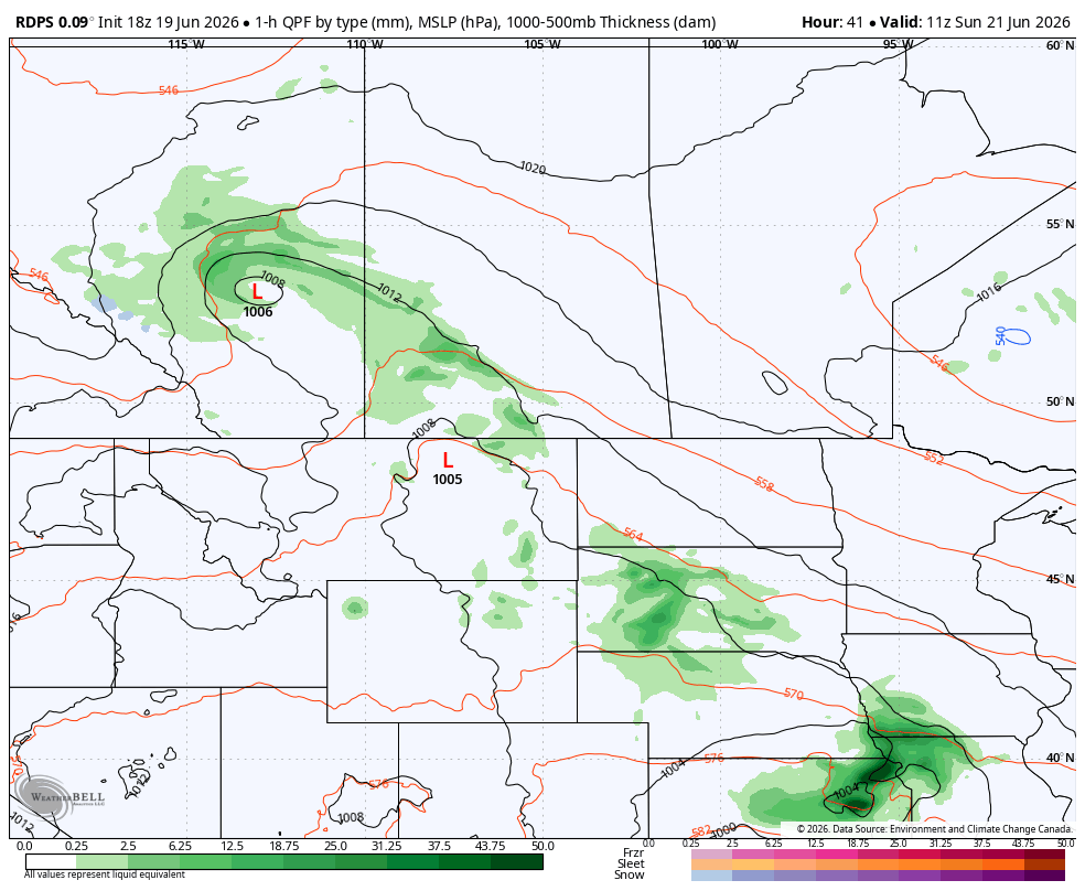
The RDPS model showing precipitation type and intensity at 5AM MDT on Sunday, courtesy of WeatherBell.
By the time the rain comes to an end Monday afternoon, more than 25mm of rain is expected to have fallen over much of Central Alberta and into Northern Alberta. Areas to the east of Edson will likely receive 50-75mm, while the City of Edmonton and eastward could see upwards of 100mm of rain.
The heaviest rain will fall at an average of 3-5mm/hr throughout the weekend, but there could possibly be pockets of intense rain from embedded thunderstorms, which could drive the rainfall totals beyond 100mm locally.
Considering how much rain we’ve already seen this month that has kept the ground fairly saturated, this much additional rainfall will very likely lead to localized flooding, especially near bodies of water. Please be sure to avoid any moving water for the next few days and if you come across a flooded roadway, do not attempt to drive through. Turn around, don’t drown.