Winter Storm Could Dump Over 20cm of Snow on Parts of the Prairies Starting Wednesday
/The latest winter storm set to impact the Prairies will bring heavy snow across a wide stretch of the region, from Grande Prairie into Southwestern Manitoba, over the next two days. The storm will also bring strong wind gusts, particularly in Southern Alberta, and the threat of mixed precipitation in Southwestern Saskatchewan.
Alberta
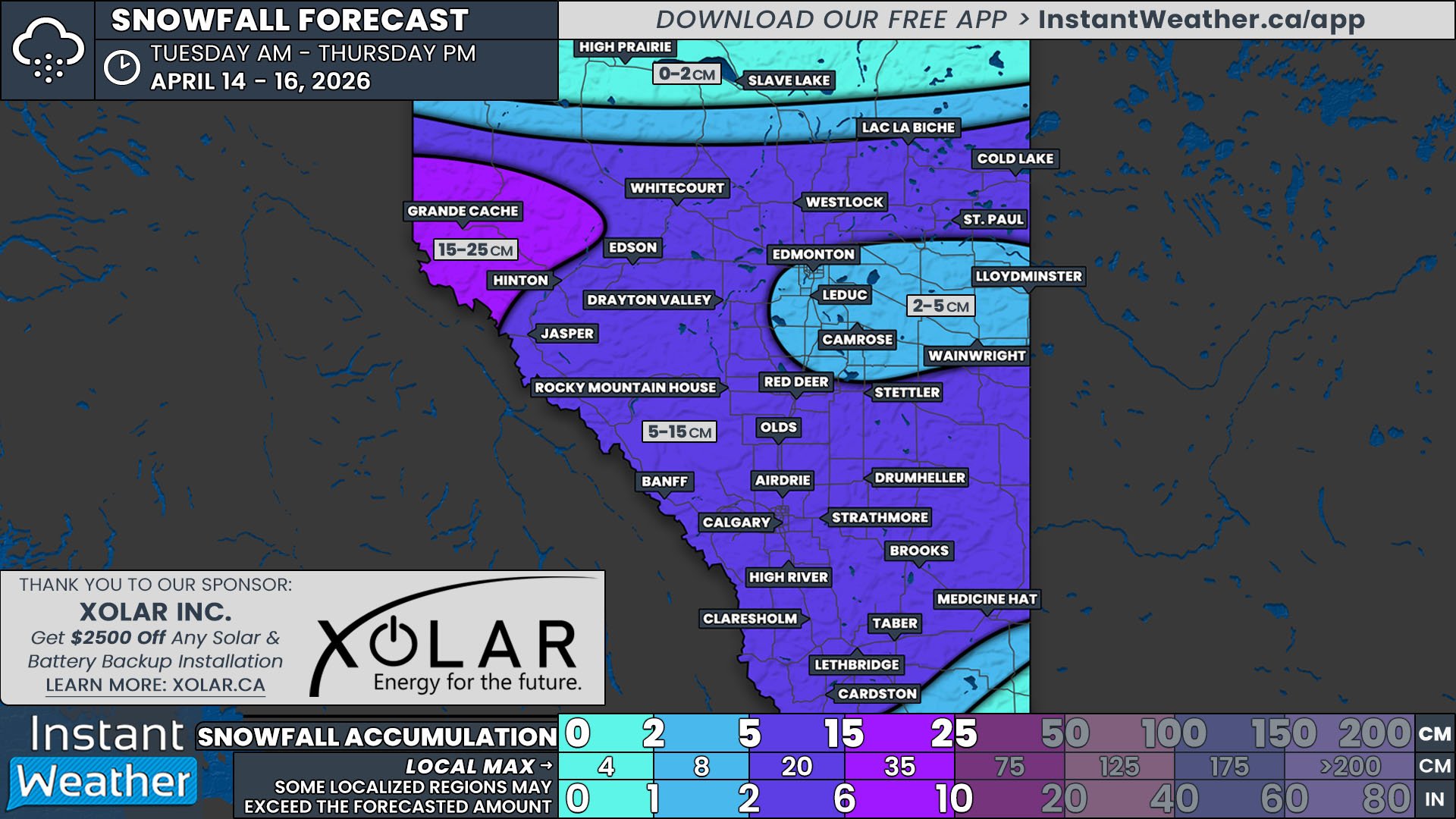
The storm will cross into Alberta through the Rockies early Wednesday morning. The snow will chart a continuous path as it pushes through the Rockies in the north, however to the south it will start to develop further east of the Mountains and while a few centimetres may fall, it will essentially skip over parts of Southern Alberta, including Calgary.
By around sunrise, the snow will spread across Central Alberta and into the Southeast corner of the province, where it will sit throughout the afternoon. The snow will be heavy at times, falling at up to 2cm per hour, which will lead to a widespread 10-20cm of snow falling by the end of the day from Grande Prairie, southeastward through Edmonton, and beyond the Saskatchewan border.
The snow will start to taper off from west to east in the late afternoon as the storm continues to track eastward and eventually ending in the evening, aside from some lingering scattered flurries.
There will be some strong wind gusts associated with this storm, up to 100km/h, but they are expected to be mostly isolated to the Southern Rockies and the Foothills, away from the heavy snow. Gusts of 40-60km/h are likely across the rest of Southern Alberta so blowing snow may be a concern, especially closer to the Saskatchewan border.
Saskatchewan
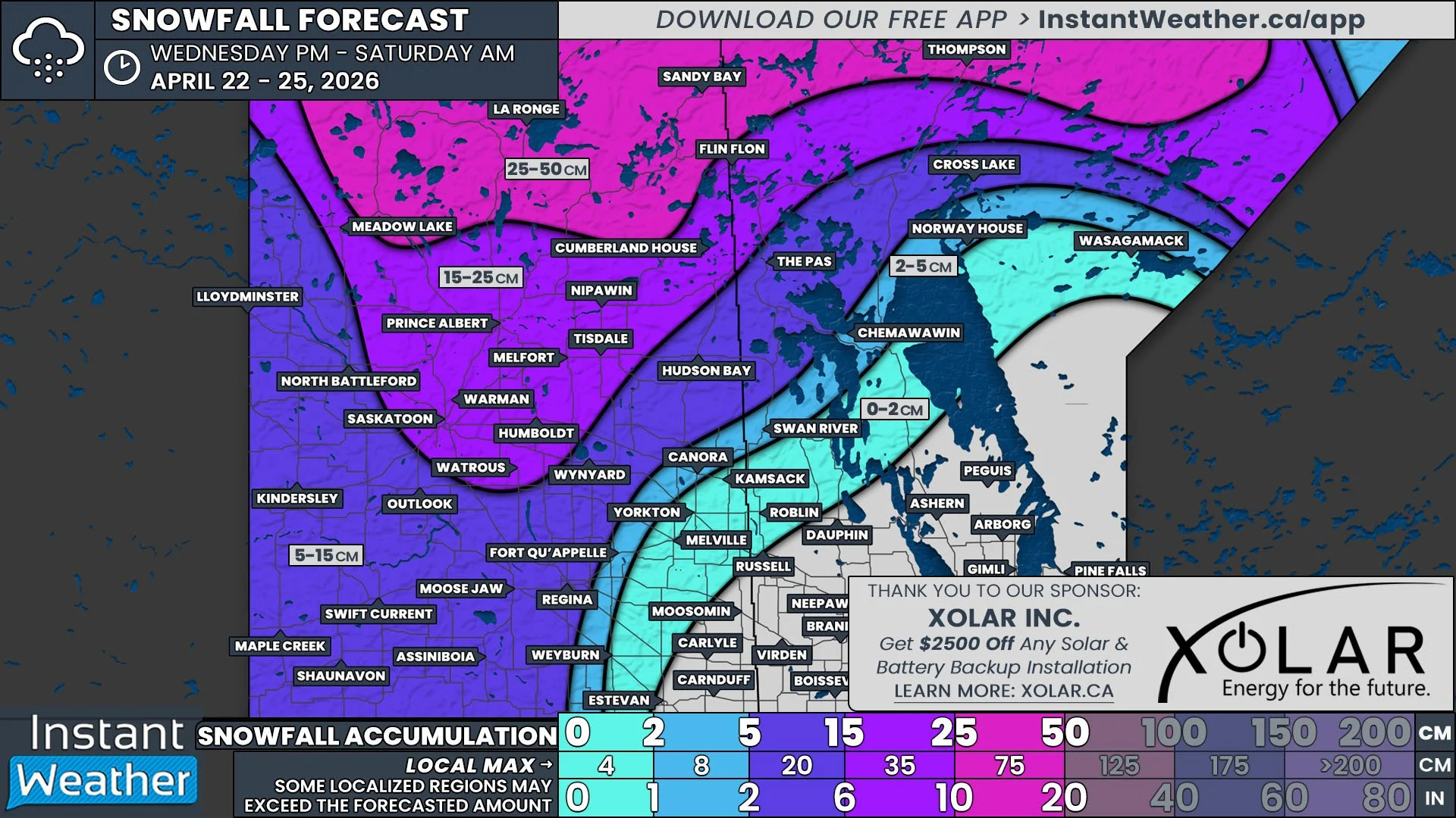
The leading edge of the snow will push its way into Southwestern Saskatchewan before sunrise Wednesday and it will spread eastward into the province through the morning and early afternoon. At that point, the band of snow will remain relatively stationary for several hours. It will also intensify over parts of Southern and Central Saskatchewan, leading to snowfall rates up 3cm per hour that will result in an area from Kindersley to Estevan seeing over 20cm of snow. Outside of this swath of the heaviest snow, much of the southern half of Saskatchewan can expect at least 5cm of fresh snow.
In the early afternoon, as the backside of the band of snow crosses into the province, some warm air will push in from the south. Temperatures on the ground will remain below freezing, but it will be warm enough aloft to result in freezing rain and/or ice pellets in Southwest Saskatchewan through the afternoon and into the evening.
The wind will also be a concern across Southern Saskatchewan and could result in reduced visibility due to blowing snow in the evening as gusts approach 80km/h. These conditions could very likely lead to highway closures across the region so keep that in mind when travelling in the area. The snow will start to make its way out of Saskatchewan in the evening and gradually diminishing across the province overnight and into the morning.
Manitoba
The storm will reach Manitoba by Wednesday evening, with snow starting in the Westman Region and extending deeper into the province through the rest of the evening and overnight.
Given the storm’s overall southeastward trajectory, the Southwestern portion of Manitoba can expect to be the most impacted. The snow will remain steady across this area overnight and into the morning, resulting in 5-20cm of snowfall. The greatest snowfall is expected in the southwest corner of the province and includes Boissevain, Killarney, and Virden. During the morning, the snow will start to spread further eastward towards the Ontario border, briefly bringing some light snow into the Winnipeg area before the storm completely exists the region by the lunch hour.


