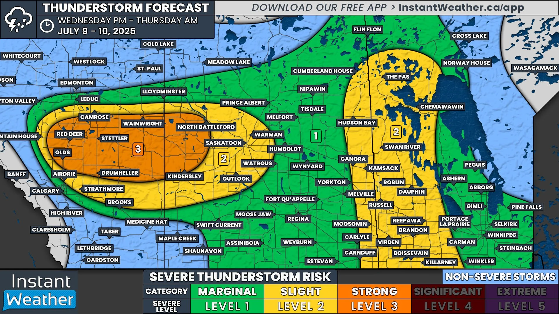
Strong Severe Storms Possible in Central Alberta & Saskatchewan, Uncertainty Further East and into Manitoba
/
NOTE: YOU CAN CLICK ON THE MAP TO OPEN A ZOOMABLE IMAGE
There are two areas across the Prairies where there is the risk of severe thunderstorms today. The difference between these two areas, however, is the likelihood of storm development, with storms in Central Alberta and Saskatchewan looking much more likely to occur than those in Eastern Saskatchewan and into Manitoba.
A cold front that will track through Alberta and Saskatchewan today is expected to begin triggering thunderstorm development early this afternoon in West Central Alberta. These storms should intensify into a line of strong severe thunderstorms as they approach the QE2 corridor, particularly around Red Deer.
This line of storms should maintain its strength for several hours, travelling eastward across Alberta through the afternoon. The storms will then cross into Saskatchewan by the late afternoon/early evening and continue their eastward trajectory, gradually weakening later into the evening and overnight.
Borderline destructive wind gusts of up to 120km/h are possible from Red Deer eastward towards Saskatoon as the line of severe thunderstorms move through the region. Furthermore, hail as large as golf balls and localized flooding are concerns, along with the possibility of one or two embedded tornadoes.
Additional scattered thunderstorms could pop up behind the main line in both Alberta and Saskatchewan throughout the day and continuing overnight, but these storms are expected to be weaker. For those attending the Stampede today, there is the chance for an isolated storm, but the greatest risk for severe weather will remain to the north.
Meanwhile, there is also the risk of severe thunderstorms in Eastern Saskatchewan, along the Manitoba border, and eastward into Manitoba as the cold front makes its way into this area. In particular, parts of Southern Manitoba could be the main target of these storms.
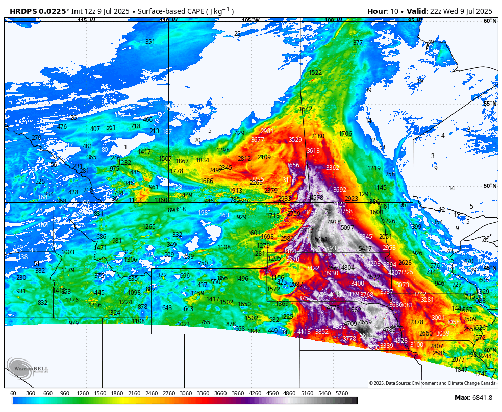
Modelled CAPE (Convective available potential energy) as of 5PM CT highlighting southwestern Manitoba as the area with the most energy
All the ingredients for severe thunderstorms are expected to be in place today in this area, with heat and energy funnelling northward throughout the day ahead of the arrival of the front. Despite this, a strong cap will also be in place, so whether or not storms actually form remains questionable. Short-term weather models are not even showing any thunderstorms developing in this area, further cementing the uncertainty here.
IF thunderstorms end up breaking through the cap, it’s not expected to occur until the evening, but the storms could become quite strong. Large hail will be the main concern with these potential storms, with golf ball-sized or larger appearing possible. Strong wind gusts and torrential rainfall, possibly leading to localized flooding, could also be associated with storms that develop. This situation will certainly bear monitoring throughout the day.
It’s also worth noting that temperatures across the Prairies, with the exception of most of Southern Manitoba, can expect to see more comfortable temperatures tomorrow following the passage of the cold front today.


