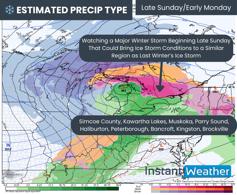
Up to 100 cm of Snow Possible as Blockbuster Winter Storm Targets Northern Ontario Starting Sunday With Blizzard Conditions and Ice Storm Risk
/
NOTE: YOU CAN CLICK ON THE MAP TO OPEN A ZOOMABLE IMAGE
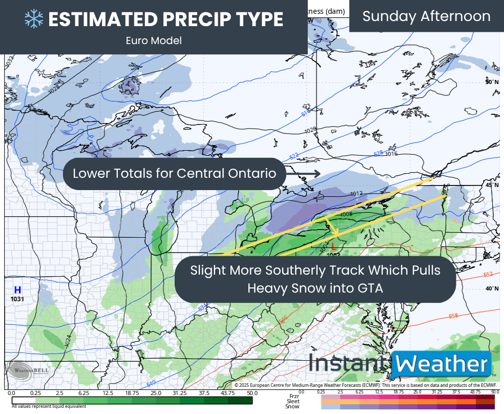
A powerful and complex storm system is set to impact Ontario beginning Sunday and continuing into early next week. While Southern Ontario will mainly deal with a messy mix of precipitation and rain for much of the event, the situation will be far more serious across parts of Northeastern Ontario, where extremely heavy snowfall, strong winds, and freezing rain could create dangerous travel conditions.
The system will evolve in several phases as it tracks through the region. Snow will initially spread into Northeastern Ontario on Sunday before an influx of warm air begins pushing northward and creating a zone of freezing rain. As the storm gradually moves out of the region on Monday, attention will then turn to the potential for lake effect snow developing late Monday into Tuesday.
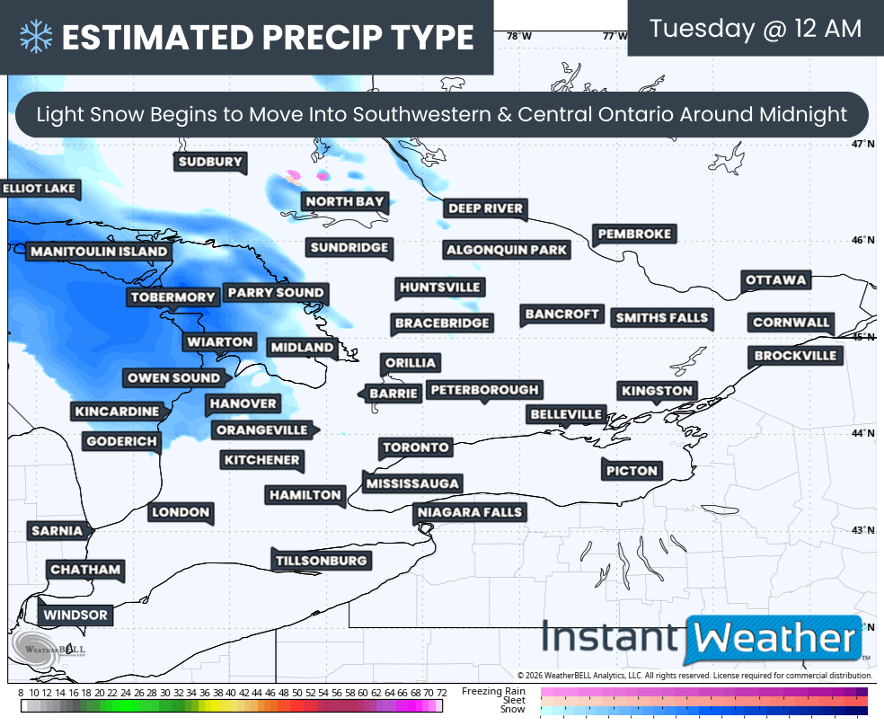
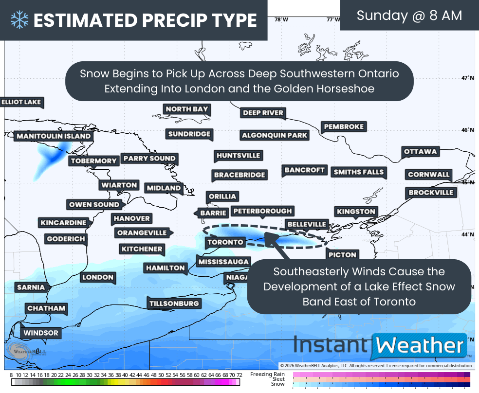
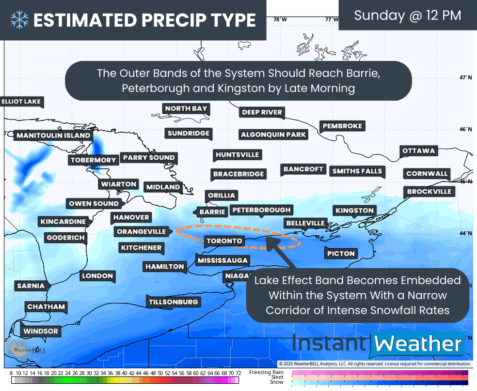
Snow will begin spreading into Northeastern Ontario from the southwest during the morning and early afternoon hours on Sunday. At first, the snow may be somewhat light and patchy as the leading edge of the system arrives, but conditions will steadily deteriorate through the afternoon as more intense bands move into the region.
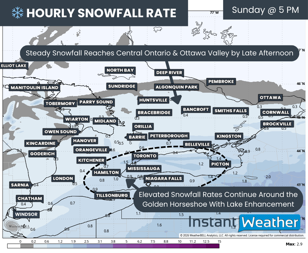
These bands will become particularly strong late Sunday afternoon and evening as the storm reaches peak intensity. Within the heaviest bands, snowfall rates could exceed 5 cm per hour. These intense bursts of snow will quickly overwhelm roads and dramatically reduce visibility.
Strong winds will also play a major role in this storm. Wind gusts of 60 to 90 km/h are expected to develop Sunday afternoon and continue into the overnight hours. When combined with the intense snowfall, these winds will lead to widespread blowing snow and periods of blizzard conditions.
Travel could quickly become extremely hazardous across parts of Northeastern Ontario. Visibility may frequently drop to near zero in the heaviest snow bands and blowing snow. There is a strong likelihood that highways could become impassable at times, and widespread highway closures are possible in the hardest hit regions.
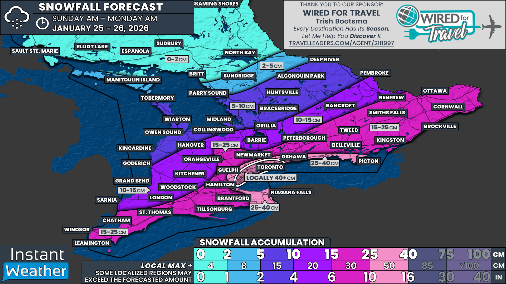
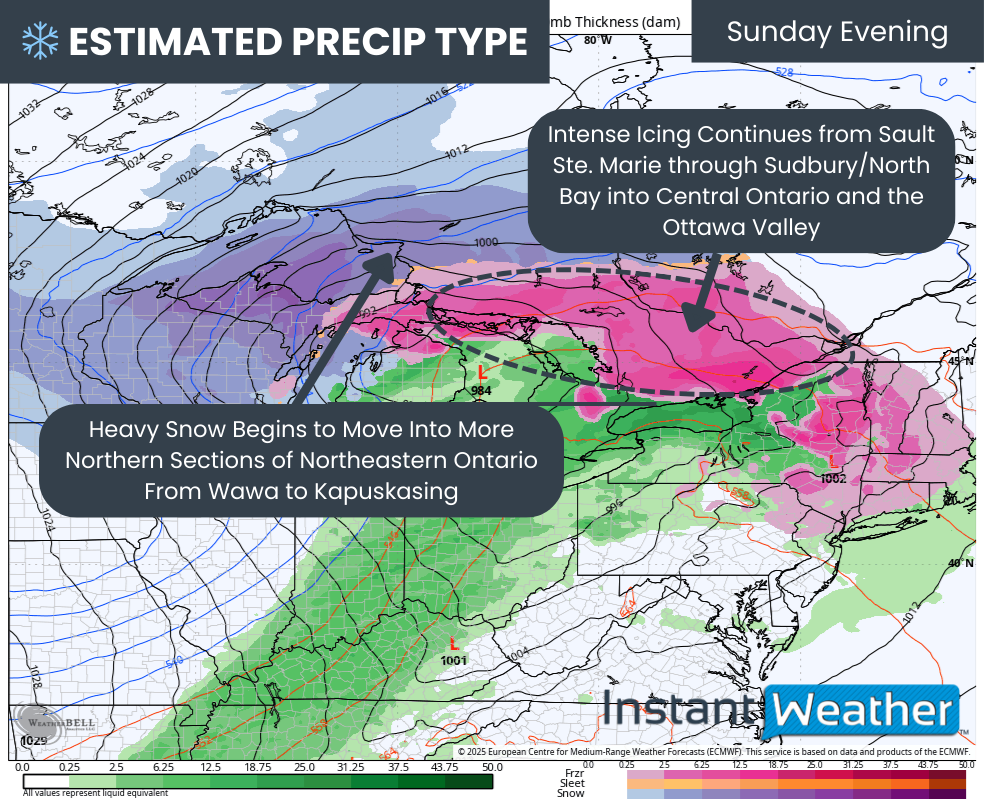
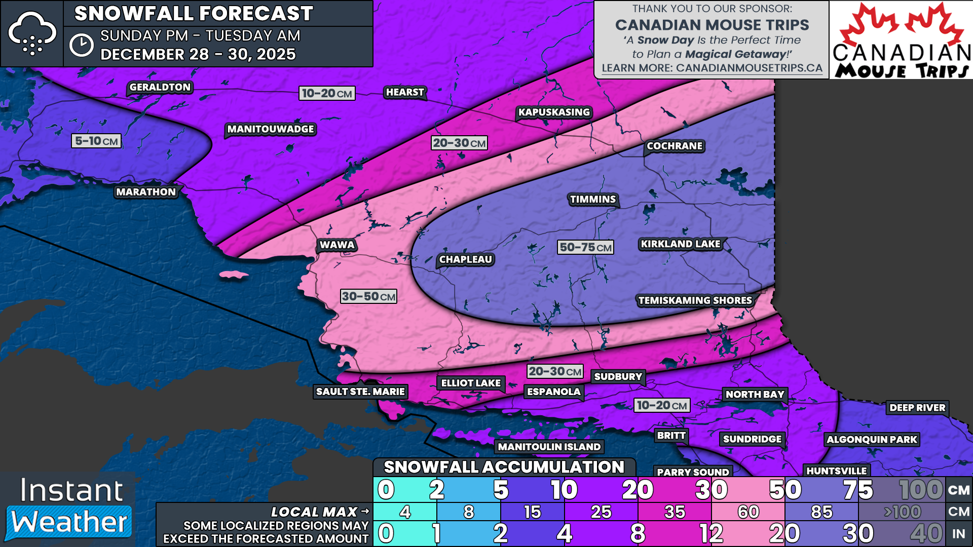
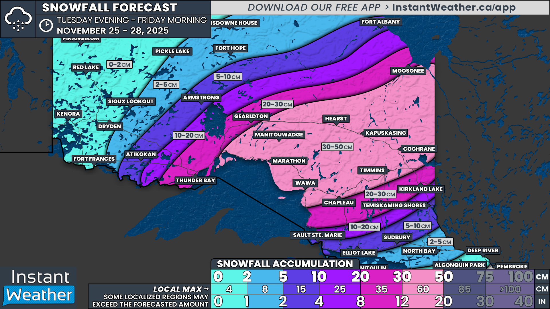
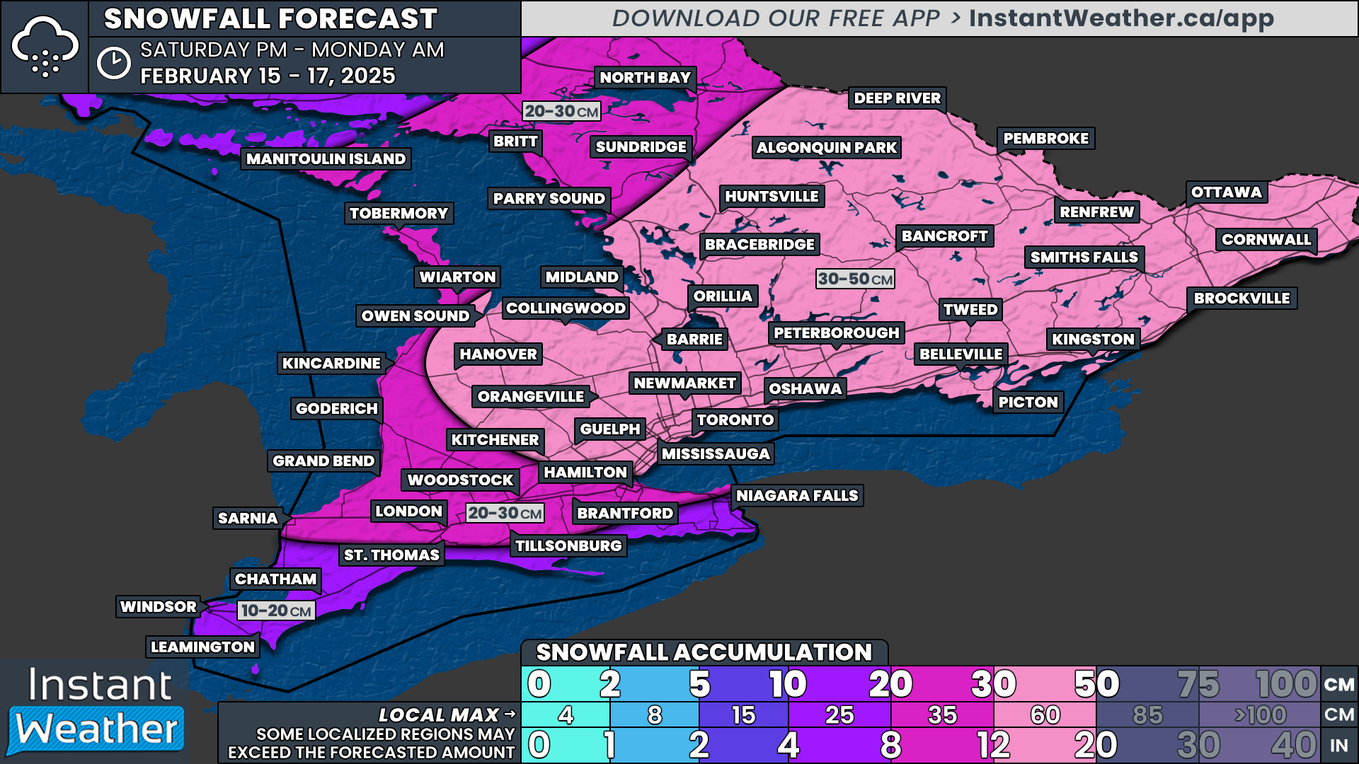
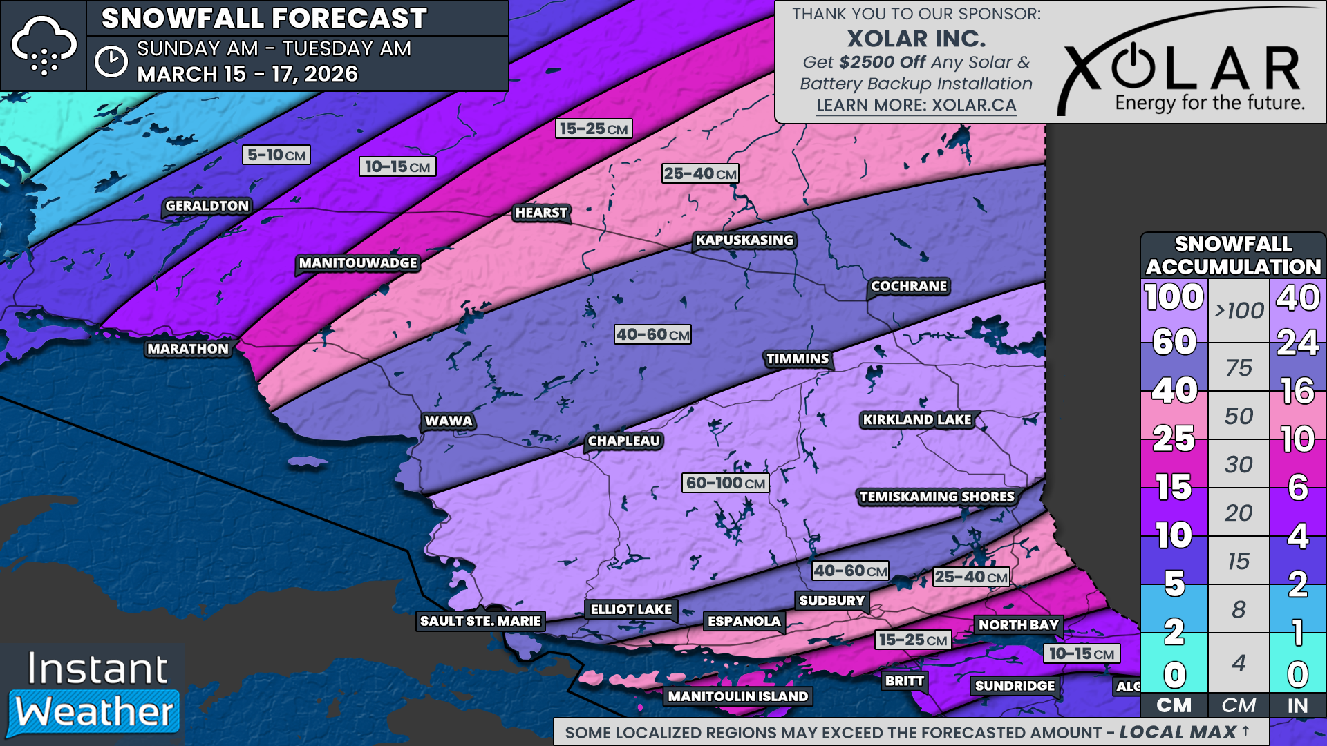
Looking at the snowfall totals, the highest accumulations are expected across parts of central Northeastern Ontario. Areas stretching from Sault Ste. Marie, through Chapleau, Timmins and Kirkland Lake could see between 60 and 100 cm of snow.
Totals will gradually drop off to the north as the core of the system remains farther south. This means communities such as Wawa, Kapuskasing and Cochrane could see between 40 and 60 cm of snow by the time the storm begins to wind down.
Farther south, the story becomes more complicated as ice pellets and freezing rain begin mixing in and reducing snowfall totals. A narrow corridor from Elliot Lake to Temiskaming Shores is currently expected to see between 40 and 60 cm of snow before the changeover occurs.
For areas from Espanola through Sudbury, snowfall totals will likely be closer to 25 to 40 cm. North Bay is expected to see around 10 to 15 cm of snow, most of which will fall during the afternoon on Sunday, before precipitation transitions over to ice pellets and freezing rain.
While snowfall will gradually lighten during the day on Monday across Northeastern Ontario, conditions may still remain difficult in many areas due to deep snow on the ground and lingering blowing snow.

NOTE: YOU CAN CLICK ON THE MAP TO OPEN A ZOOMABLE IMAGE

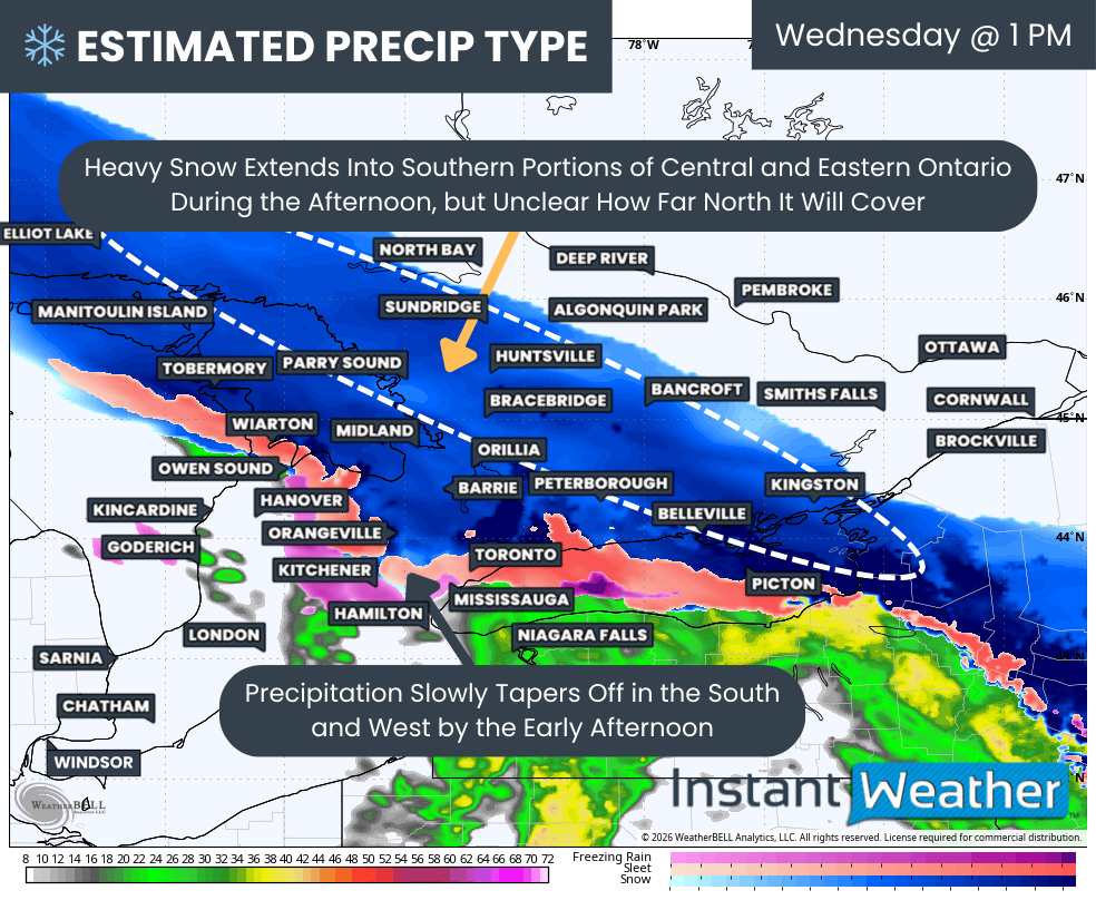
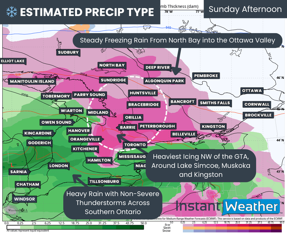
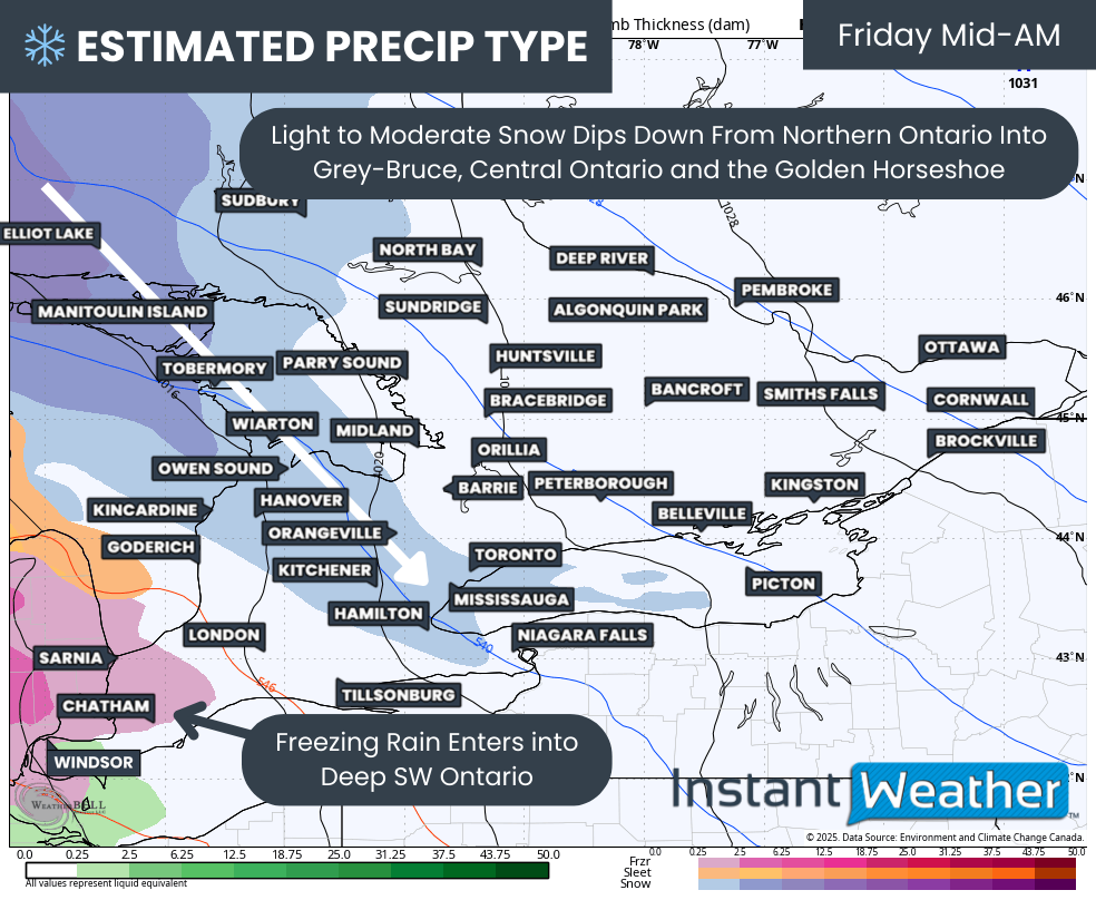
While heavy snow dominates the northern portion of the storm, the next major concern will be the development of freezing rain as warmer air begins pushing northward Sunday evening.
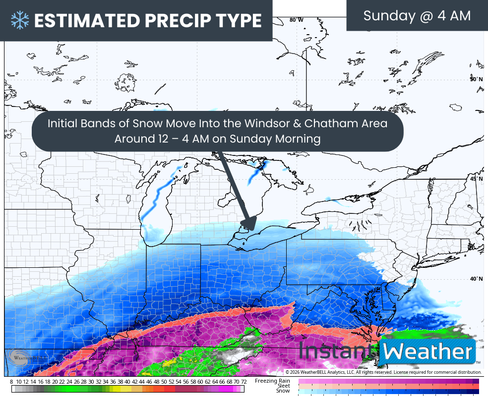
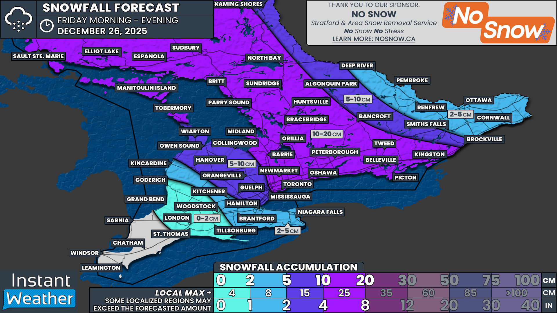
The leading edge of the system will first sweep across Southern Ontario early Sunday, bringing a light mix of wet snow, freezing rain and ice pellets. This initial wave is not expected to produce significant accumulation, but it could still create slippery road conditions during the morning and afternoon as it moves through.
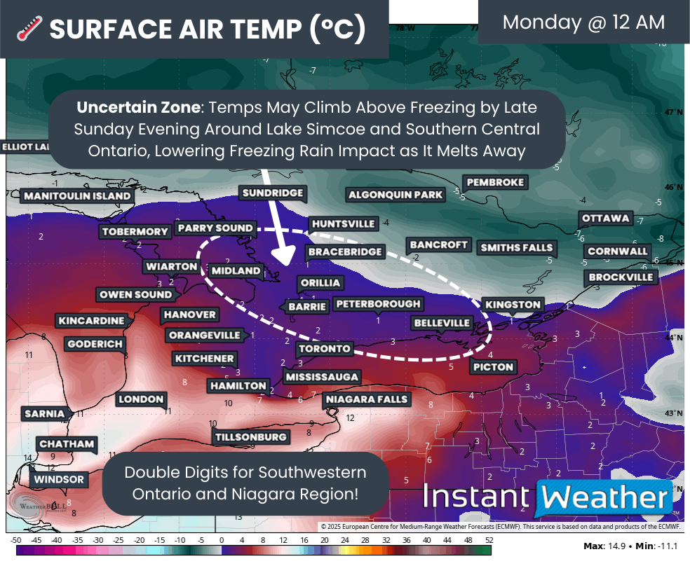
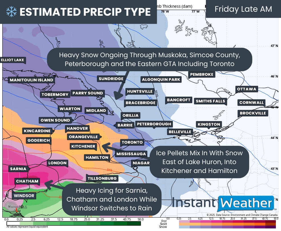
Behind this initial batch of precipitation, much warmer air will surge northward into Southern Ontario through Sunday afternoon and evening. This will transition most areas over to plain rain while the storm continues to produce heavy snow farther north.
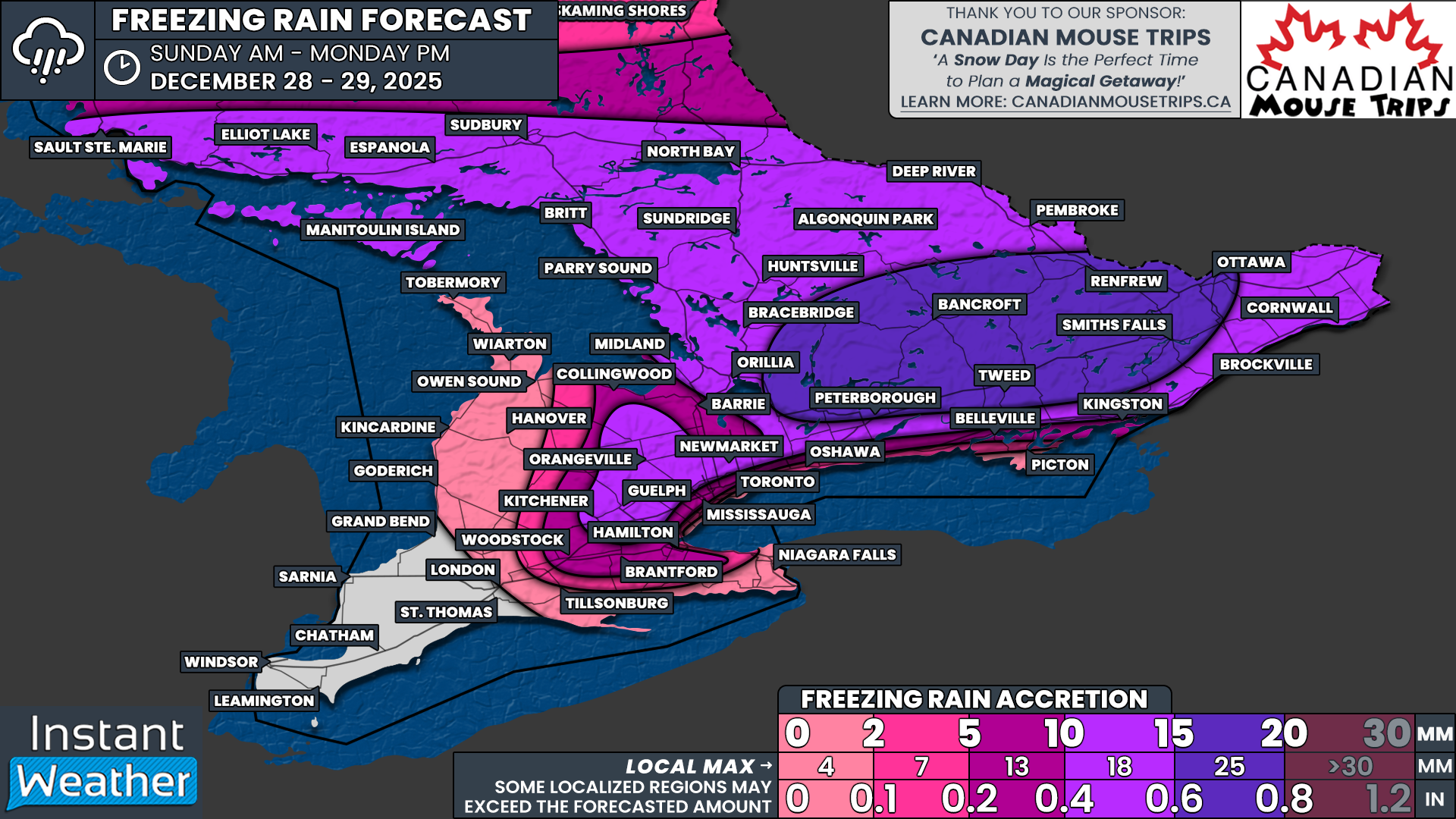
As this warm air pushes into the colder air mass across Northeastern Ontario, it will create a corridor favourable for freezing rain. By Sunday evening, a swath of freezing rain is expected to develop, extending from Manitoulin Island through the North Bay region.
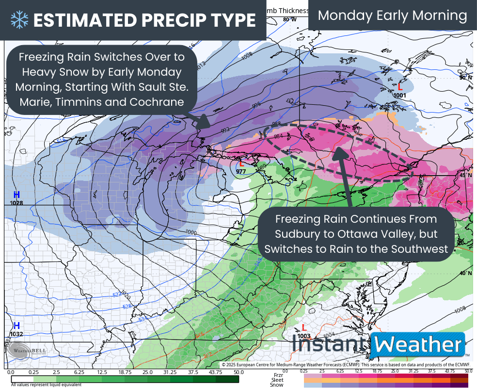
Through the late evening and overnight hours, this freezing rain zone is expected to gradually spread northward. Communities, including Elliot Lake and Sudbury, could transition from heavy snow to freezing rain by late Sunday evening.
Within this corridor, freezing rain could become quite significant in some areas, with ice accretion totals potentially reaching 10 to 20 mm. That may lead to power outages and tree damage, especially with the strong wind gusts.
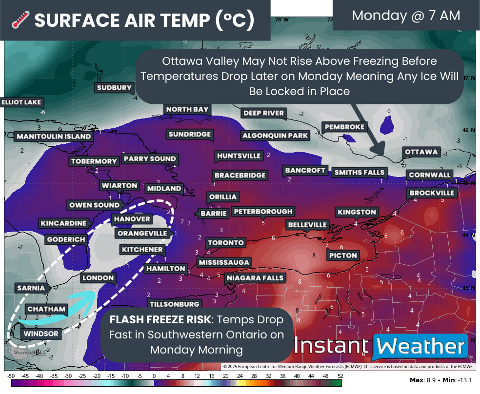
Freezing rain may continue through much of the overnight period and into the morning hours on Monday before temperatures gradually begin to rise.
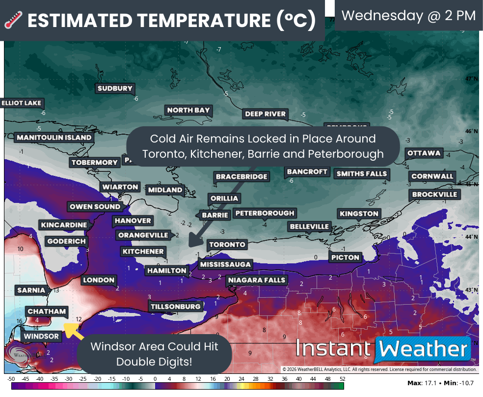
Across Southern Ontario, the story will shift again on Monday as milder air remains in place for much of the day.
Scattered rain showers and even a few thunderstorms are possible across parts of the region on Monday. However, temperatures may begin to cool later in the day, which could allow precipitation to transition back to snow in some areas.
Exactly how much snow may develop during this transition remains uncertain. A separate detailed forecast will be issued for Southern Ontario once forecast models provide better clarity on how persistent this snow could be and whether meaningful accumulation is likely.
One additional feature we will be watching closely is the potential for lake effect snow developing late Monday into Tuesday.
As colder air moves back into the region behind the storm system, lake effect snow bands could begin forming off Lake Huron and Georgian Bay. These bands may bring an additional 10 to 20 cm of snow to parts of the traditional snowbelt regions, depending on how long they persist.