The First Day of Spring Won’t Feel Spring-Like in Southern Ontario as Snow Returns on Thursday
/

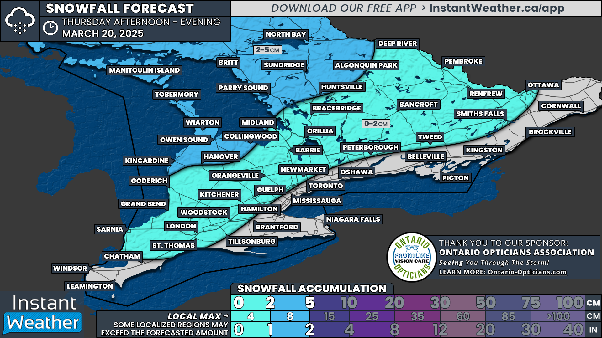
NOTE: YOU CAN CLICK ON THE MAP TO OPEN A ZOOMABLE IMAGE
Although we’ve had an early taste of spring across Southern Ontario, the first official day of astronomical spring arrives Thursday morning. But don’t put that shovel away just yet! The mild temperatures we’ve been enjoying are about to be replaced by a surge of colder air over the next 24 hours.
Unfortunately, this means temperatures will drop back into the single digits, and in some cases, below freezing. Along with the cooler temperatures, scattered flurries are expected to develop in parts of Southern Ontario starting Thursday afternoon. While we aren’t anticipating significant accumulation, some areas could see a few slushy centimetres of snow on the roads. This could pose a challenge for those who have switched to summer tires a little too soon.
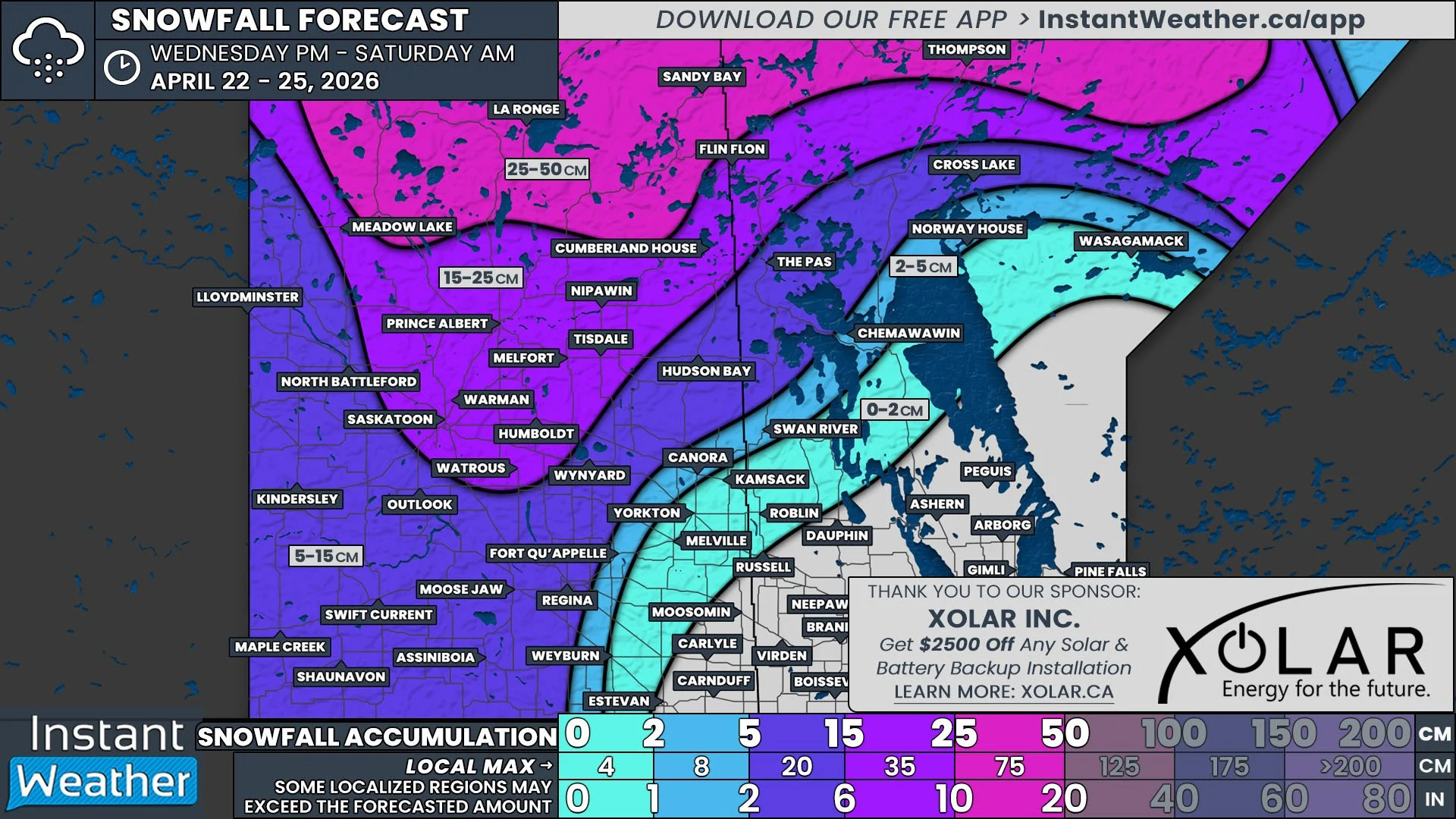
Looking ahead, it appears this below-seasonal trend will continue through the weekend and into early next week, bringing several chances for snow. Some of these systems could produce notable snowfall accumulation, especially for more northern sections of Central and Eastern Ontario over the weekend.

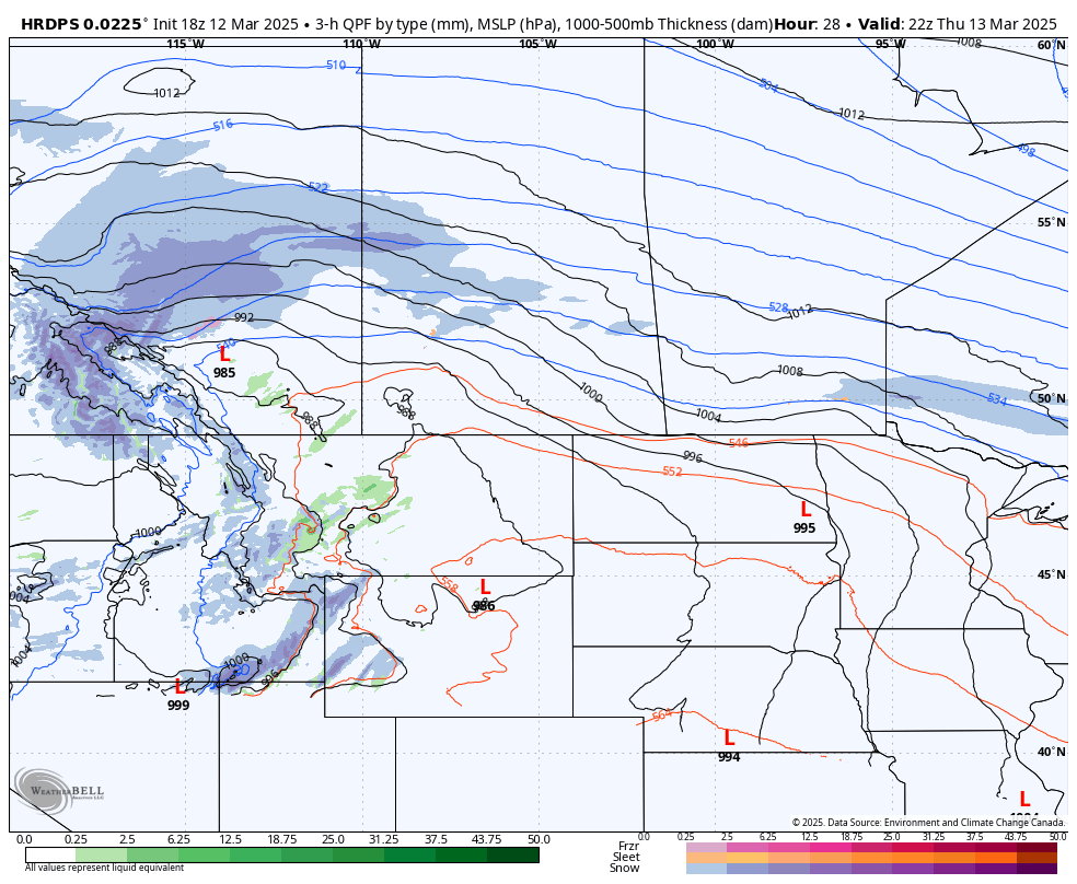
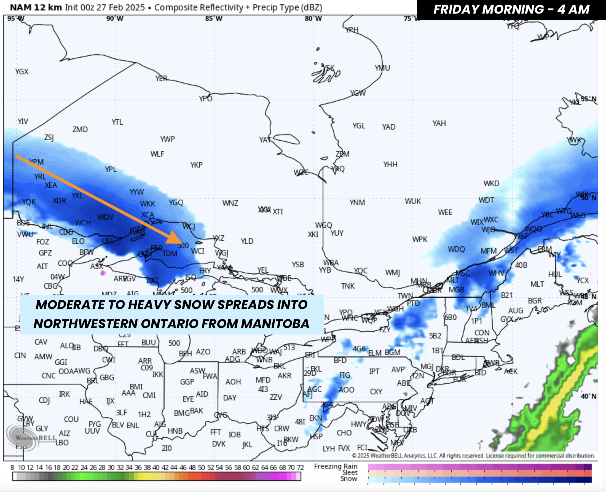
PRECIPITATION TYPE - MAP FROM WEATHERBELL
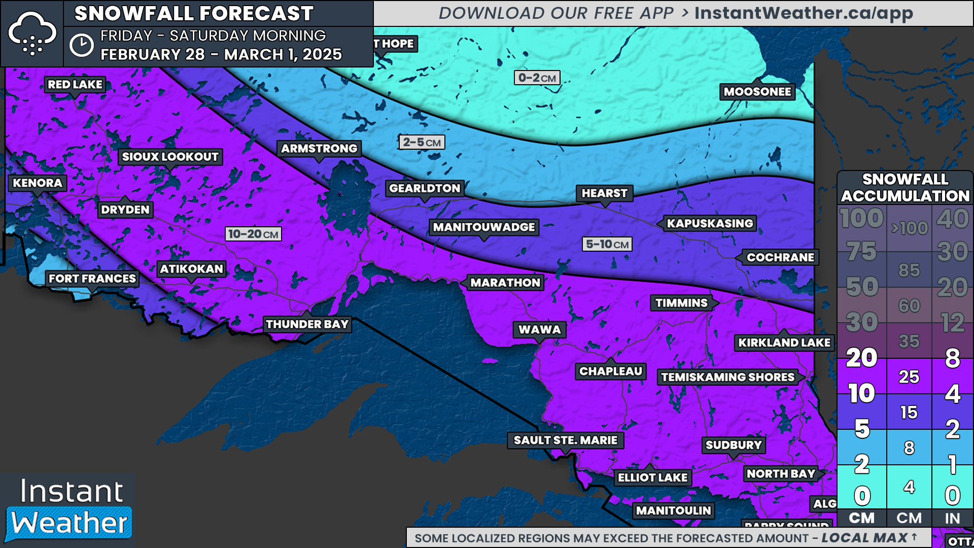
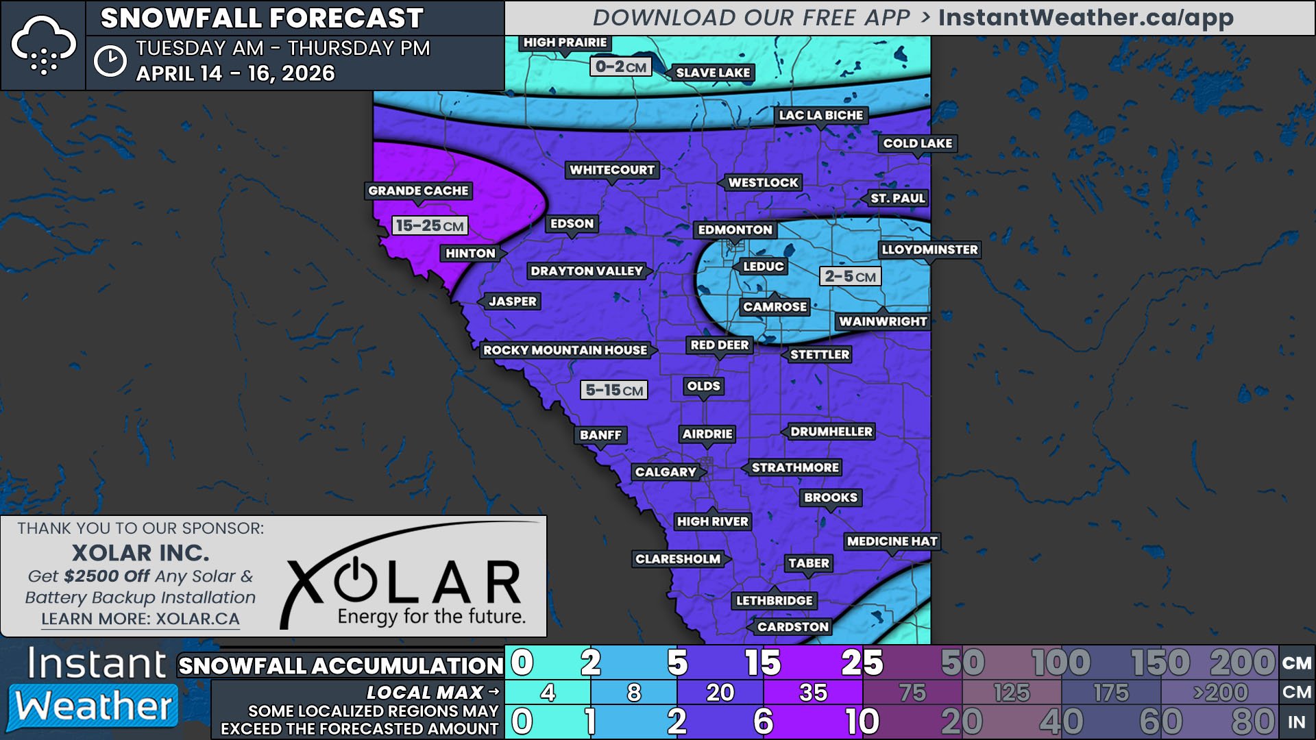
Right now, a storm system is affecting Northeastern Ontario, with snow expected to continue overnight into Thursday morning. Areas including Sault Ste. Marie, Elliot Lake, and Timmins are on track to see heavy snow, with totals ranging from 20 to 40 cm in the hardest-hit locations.
For the most up-to-date details on the impacts on Northern Ontario, please refer to Environment Canada’s latest alerts by downloading our free weather app here.
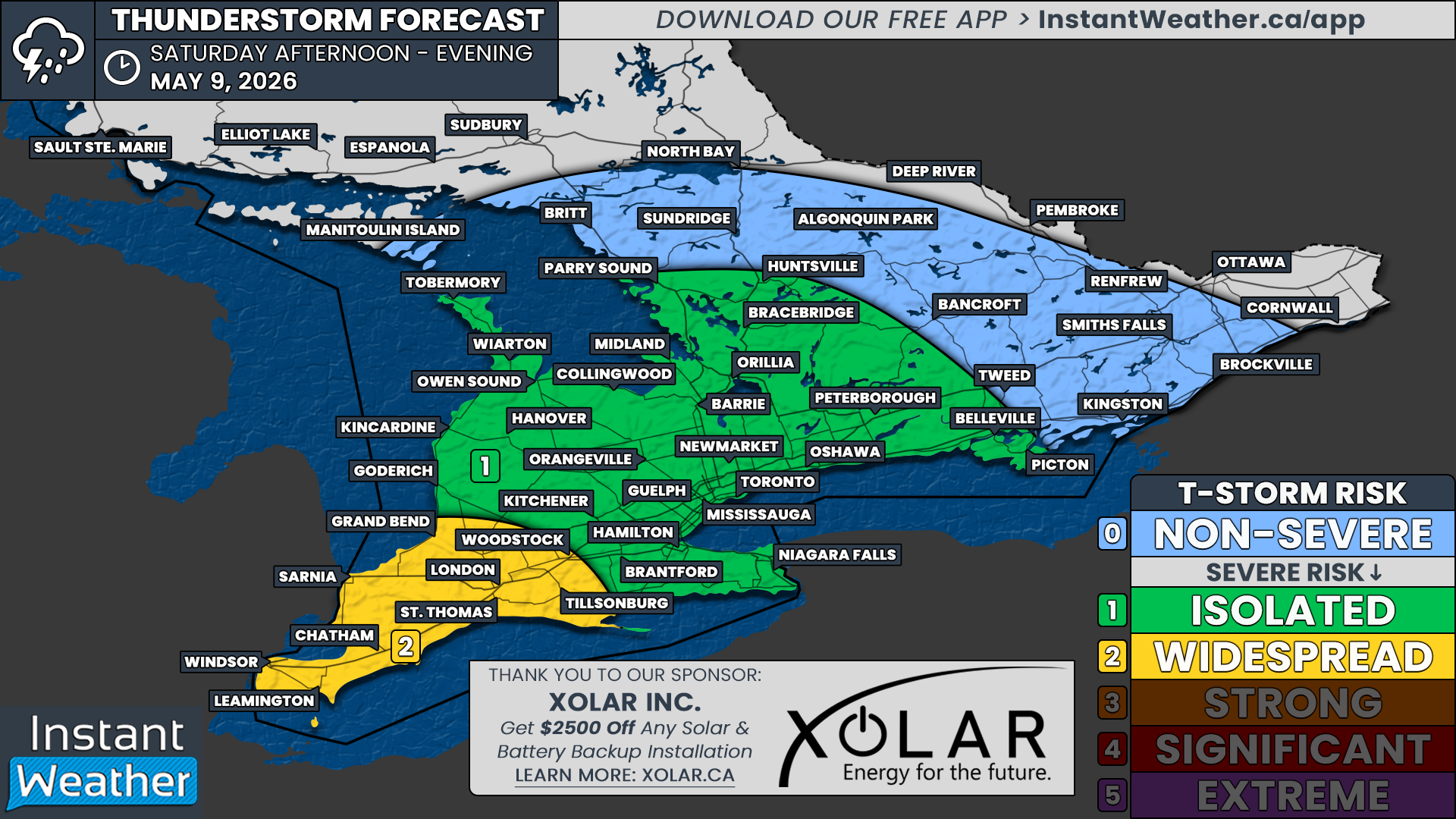
Meanwhile, over Southern Ontario, a weakening line of thunderstorms is expected to push through during the pre-dawn hours of Thursday. When you wake up, it may still feel like spring, with temperatures near double digits in the morning. However, don’t be fooled—a sharp drop in temperatures is expected later in the day. If you’re heading out, it’s definitely a day to layer up!
Rainfall amounts will likely be fairly insignificant, with around 5 to 10 mm expected. However, localized areas could see higher amounts if they experience heavier thunderstorms.

PRECIPITATION TYPE - MAP FROM WEATHERBELL

By Thursday afternoon, cold air will begin filtering into western sections of Southern Ontario, leading to a rain-to-snow transition starting as early as 1 to 3 PM for regions near Lake Huron and Georgian Bay.
With temperatures dropping close to the freezing mark and residual moisture from earlier rainfall, icy conditions could develop on untreated surfaces. While it doesn’t look like a true flash freeze, it could still result in hazardous travel conditions Thursday evening and into the overnight hours.
The snow is expected to persist into the evening, with the heaviest precipitation focused on Southwestern and Central Ontario. Areas in Eastern Ontario and around the Golden Horseshoe will likely avoid the transition to snow, as temperatures won’t drop enough before the precipitation exits.

temperature - MAP FROM WEATHERBELL
Friday, the first full day of spring, will start on a chilly note, with most of Southern Ontario waking up to temperatures at or slightly below freezing. This also means a risk of frost, so if you’ve started gardening early, you may want to bring in or cover any sensitive plants.
Factoring in the wind chill, some parts of Central and Eastern Ontario could experience feels-like temperatures in the -10s—a sharp contrast to the 20°C+ highs that many regions enjoyed on Wednesday!
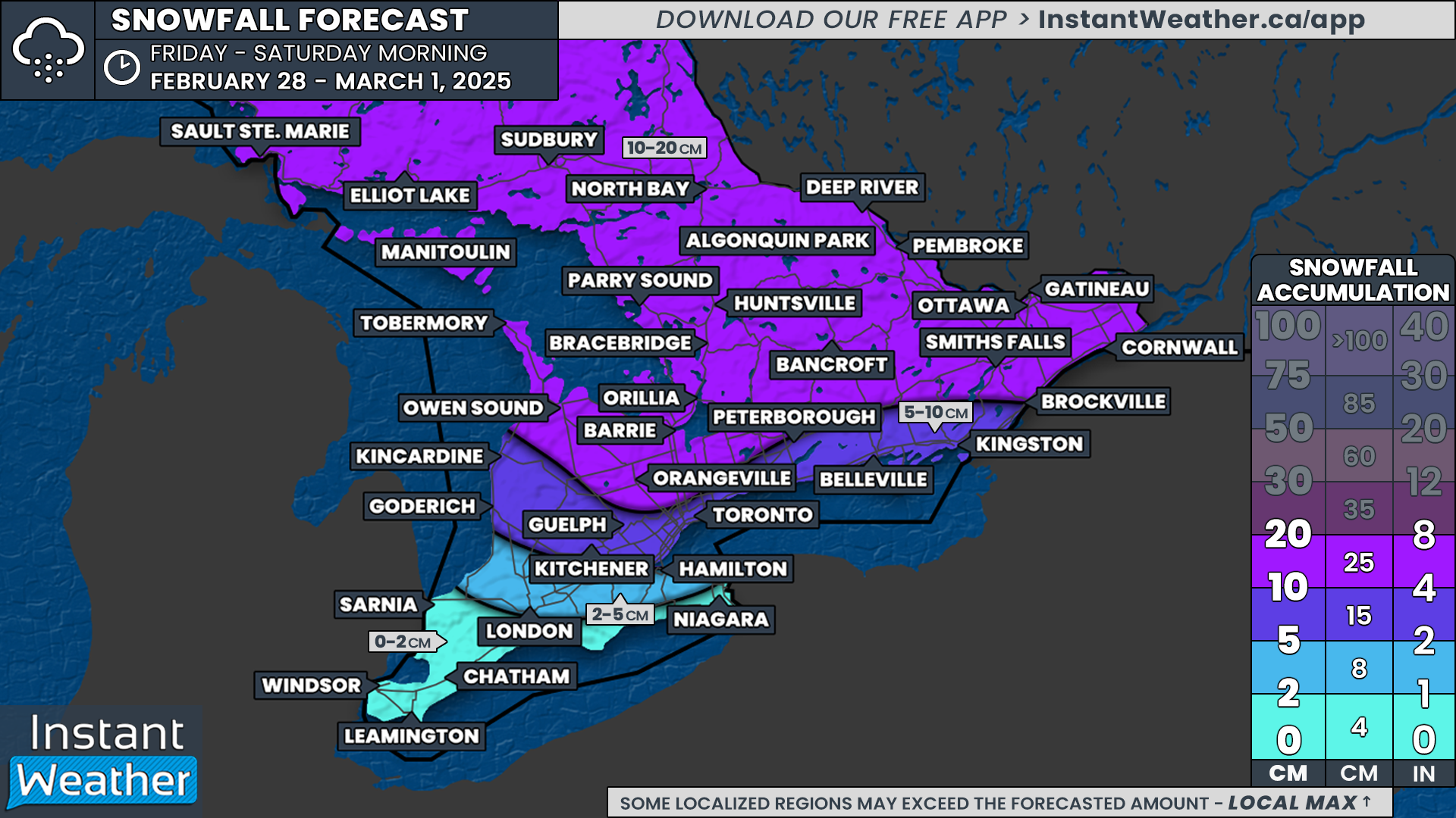
NOTE: YOU CAN CLICK ON THE MAP TO OPEN A ZOOMABLE IMAGE
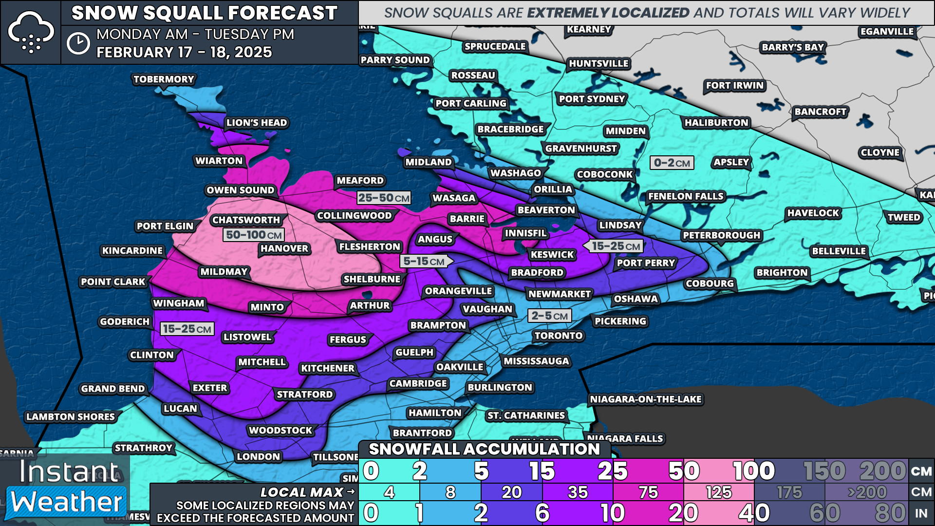
Despite this blast of colder air, we aren’t expecting significant snowfall accumulation on Thursday, especially compared to what Grey-Bruce and Muskoka have endured this winter.
However, there could still be some travel impacts, with 2 to 4 cm possible in areas including Kincardine, Hanover, Owen Sound, Wiarton, Tobermory, Parry Sound, Huntsville, Sundridge, and North Bay. Due to wet surfaces from earlier rain, some of this snow may melt on contact, leading to lower actual snowfall totals.
Elsewhere across Southwestern Ontario, Central Ontario, and the Ottawa Valley, a few flurries could fall Thursday afternoon into the evening, but accumulation will be minimal—at most 2 cm, and in many cases, it may not even stick to the ground.
This won’t be our last chance for snow in the coming days. We are closely monitoring a weak system that could bring a few centimeters of snow to Southern Ontario on Saturday.
Another system, arriving Sunday night into Monday, could be more significant. Early model data suggests it may bring over 10 cm of snow to parts of the region. However, the exact snowfall amounts will depend on the storm’s track, as it also appears to include freezing rain and mixed precipitation. We’ll be watching this closely and will have more details as we get closer.