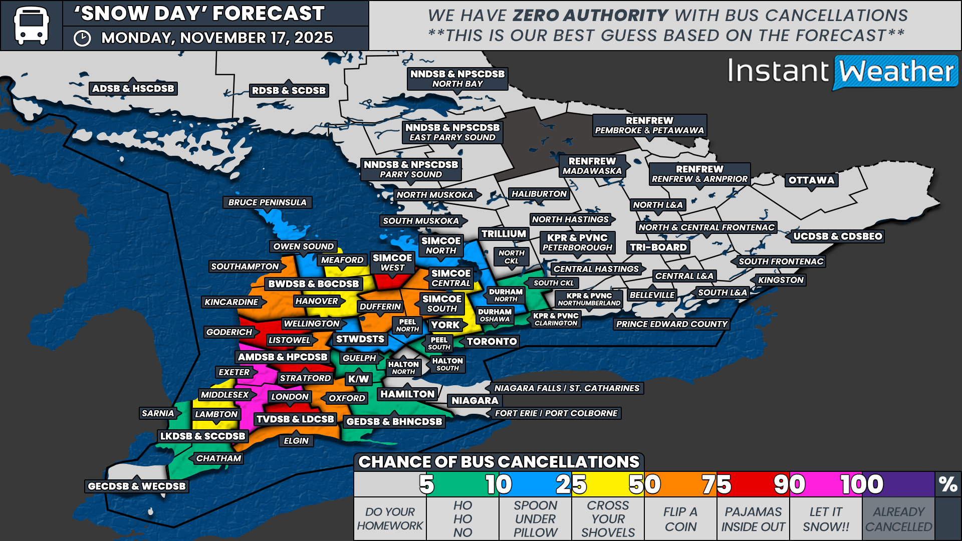
Dangerous Snow Squalls Target Southern Ontario’s Snowbelt Starting Thursday With Up to 75cm of Snow Possible
/
NOTE: YOU CAN CLICK ON THE MAP TO OPEN A ZOOMABLE IMAGE
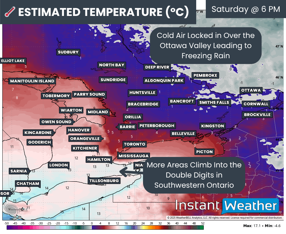
Confidence continues to grow in what is shaping up to be a potentially dangerous snow squall event for regions east of Lake Huron and southeast of Georgian Bay as we wrap up the week.
Temperatures are expected to drop sharply overnight Wednesday, which will help kick the lake effect snow machine into gear as early as Thursday morning.
At first, the activity should be fairly limited. Scattered pockets of lake effect snow are expected to develop east of Lake Huron and Georgian Bay as a westerly wind pattern holds through the morning. Impacts will be minor at this stage, but this early activity will set the stage for a much more intense setup later in the day.
Rapid changes are expected by late Thursday morning and especially into the afternoon. This is when more organized squalls will begin to form.
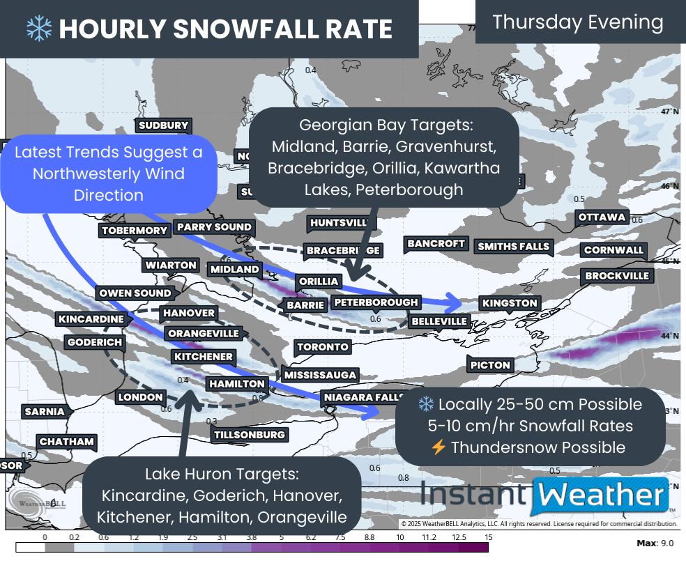
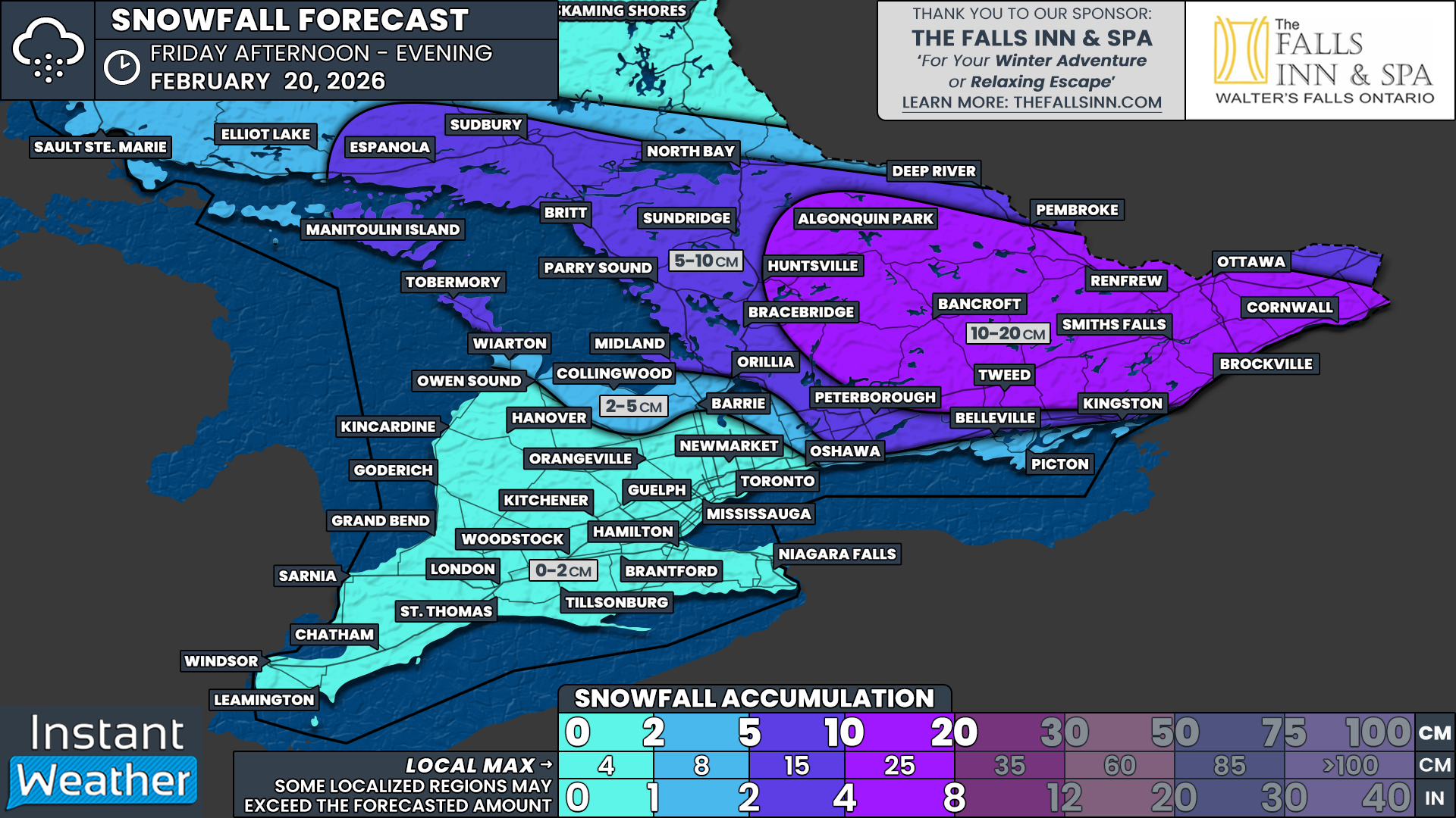
The worst conditions are expected to develop late Thursday and last into Friday morning. A brisk northwesterly wind will allow narrow but powerful bands of snow to strengthen off both Lake Huron and Georgian Bay. These bands will be capable of producing snowfall rates near 5 to 10 cm per hour at times, along with near-zero visibility.
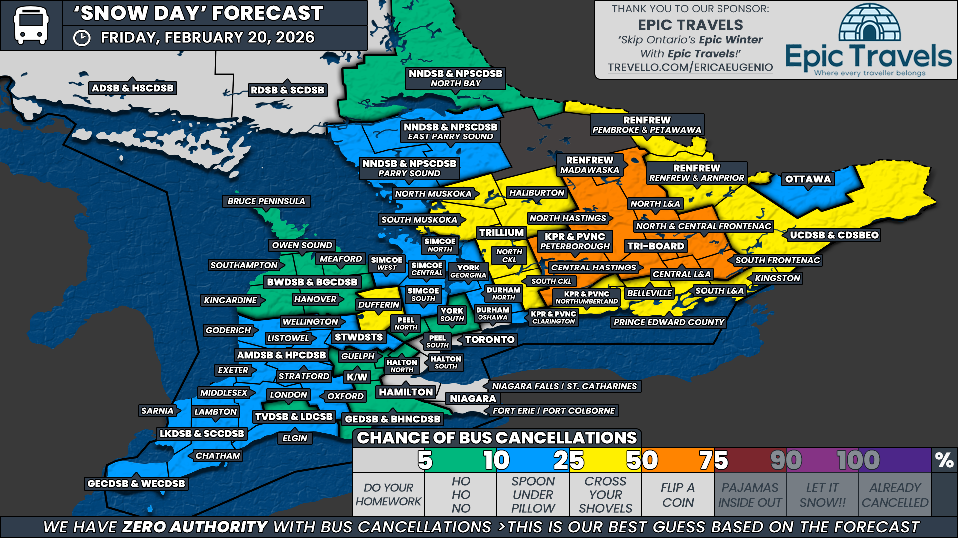
Travel will likely become extremely difficult through the hardest hit regions. Strong winds will create blowing snow and possibly even brief blizzard conditions. Road closures are possible, and anyone with non-essential travel plans should consider postponing. School bus cancellations appear likely for Friday, and there is even some potential for cancellations on Thursday, depending on how quickly conditions deteriorate.
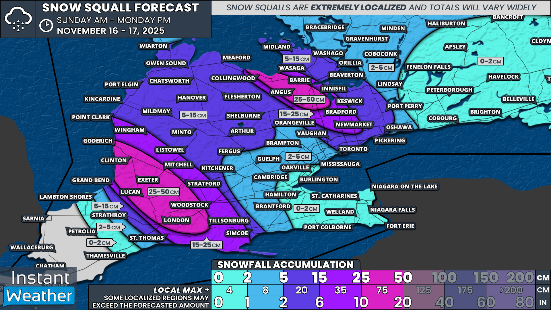
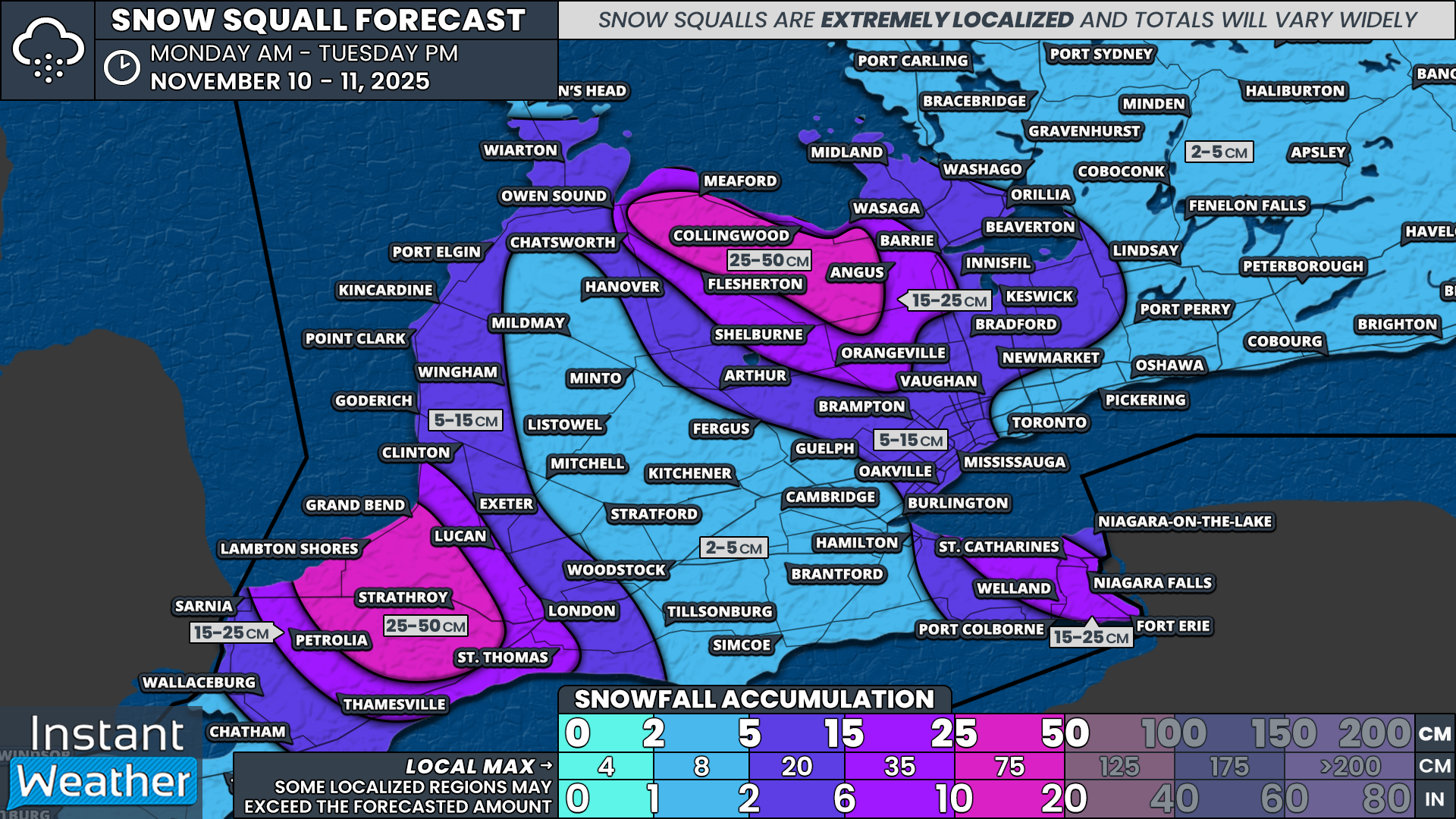
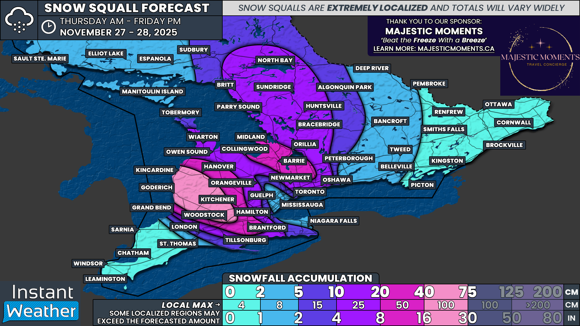
The main snow squall activity is expected to taper off throughout the day on Friday, although some scattered bands could linger into Saturday. By the end of the day Friday, some areas east of Lake Huron, such as Goderich, Kincardine and Stratford, may be digging out from more than 40 cm of snow. Other parts of the snowbelt may see anywhere from 10 to 40 cm, depending on how close they are to the core of the activity.

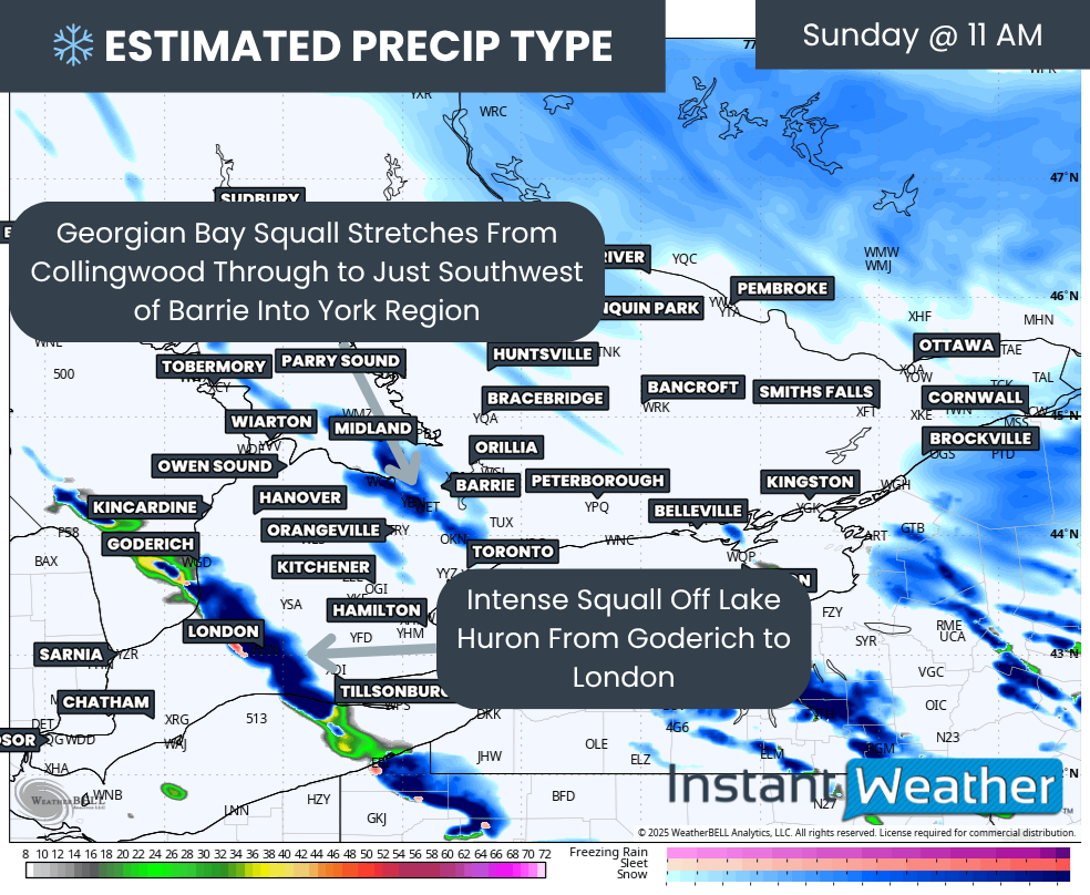
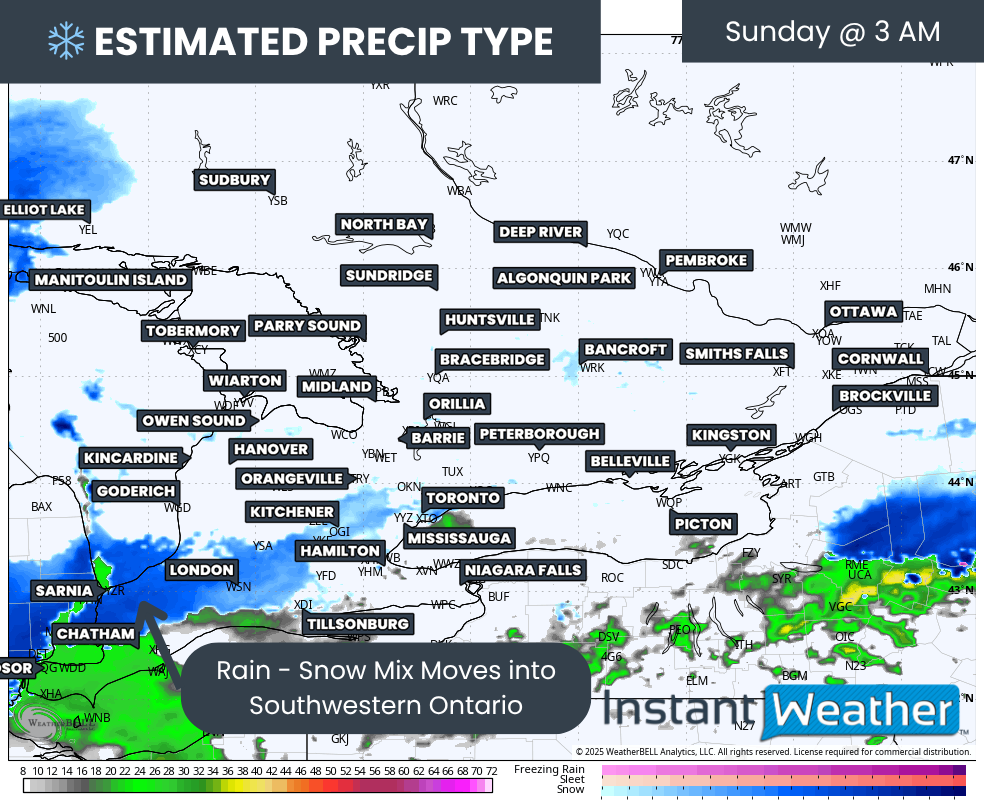
PRECIP TYPE - MAP FROM WEATHERBELL
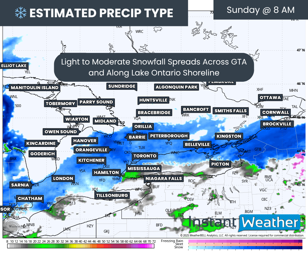
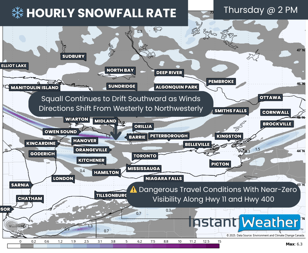
As mentioned earlier, Thursday morning will start with some light to moderate activity east of Lake Huron and Georgian Bay. This includes Grey Bruce, Parry Sound and Muskoka.
Impacts should be limited at first since the snow will be fairly light, but Environment Canada currently has a snow squall watch in effect for this entire region due to what will likely unfold later in the day.
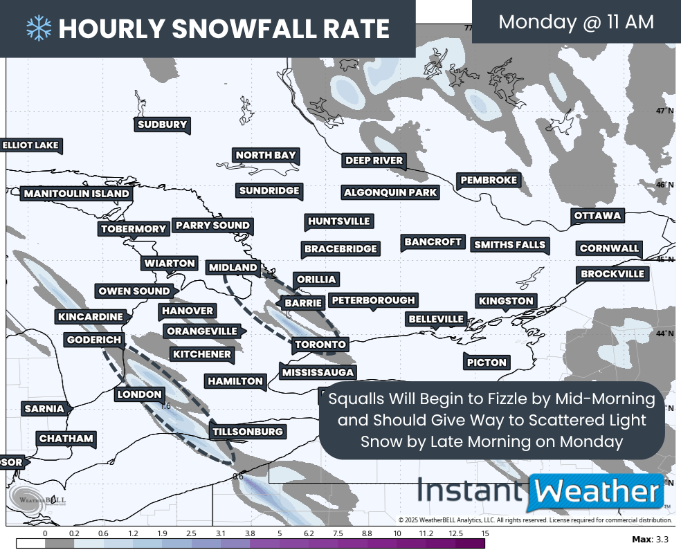
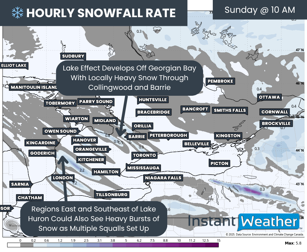
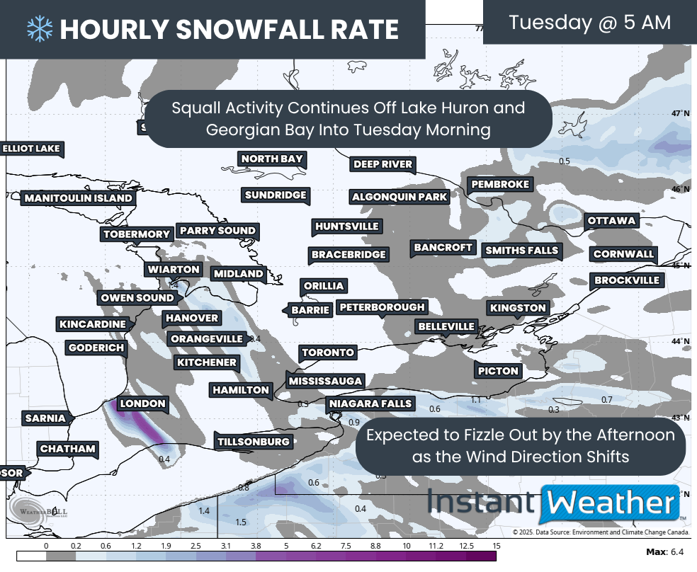
Hourly snowfall rates (cm) - MAP FROM WEATHERBELL
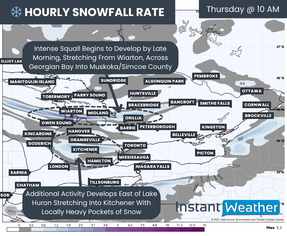
Conditions will escalate quickly heading into the late morning and afternoon as scattered flurries begin organizing into more defined bands. We expect a fairly long squall to develop over Lake Huron, cross the Bruce Peninsula and come onshore east of Georgian Bay. This could bring a few hours of heavy snow to the Muskoka region.
Additional pockets of lake effect snow may also fire up further south off Lake Huron, affecting areas like Goderich, Hanover, Stratford and Kitchener.
Hourly snowfall rates (cm) - MAP FROM WEATHERBELL
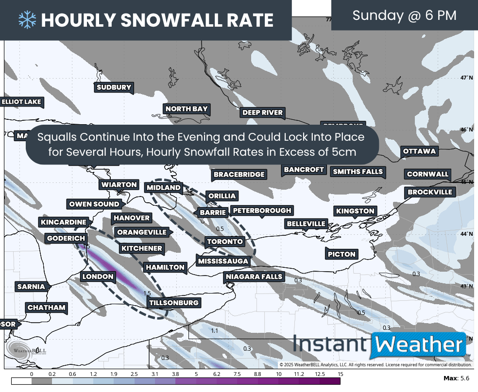
That Georgian Bay squall is expected to gradually sink southward as the wind shifts from westerly to northwesterly. This will cause a swath of intense snow to drift across the Highway 11 and 400 corridor between Bracebridge and MacTier, down toward Barrie.
A few hours of rapid whiteout conditions are possible during the afternoon. Even though temperatures may hover near the freezing mark, which slows accumulation, visibility will still be extremely poor and blowing snow will create dangerous travel conditions.
Hourly snowfall rates (cm) - MAP FROM WEATHERBELL
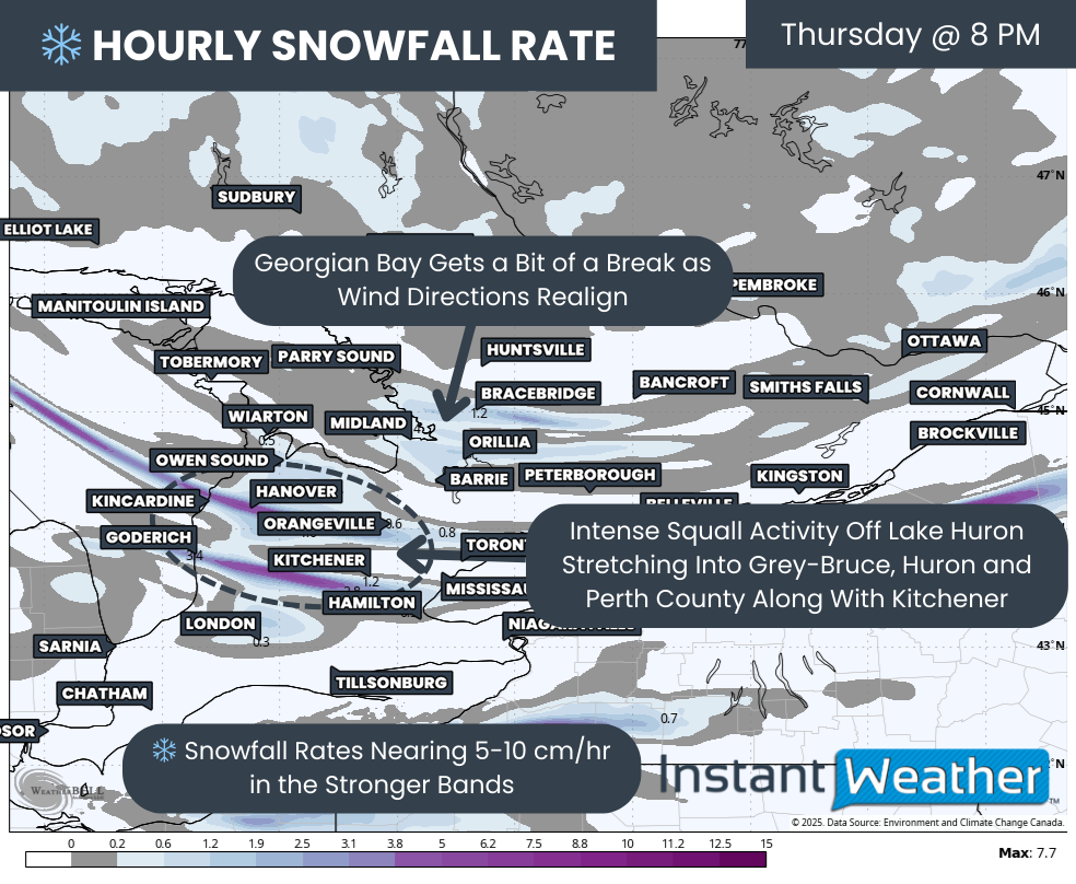
Conditions will worsen significantly into the evening as the squall drifts far enough south to draw its full moisture supply from Lake Huron instead of Georgian Bay. This new orientation will allow the band to tap into a longer stretch of open water, which increases its intensity.
At this point, several intense bands could stretch inland between Kincardine and Goderich and reach as far east as Kitchener and even the western GTA at times.
There is still some uncertainty in how these bands will align. A slight shift in wind direction can cause a squall to lock in place further north or drift south. This will dramatically affect who sees the heaviest snow. Regardless, conditions will be poor even in areas that are not directly underneath a streamer due to the blowing snow.
Within the core of the squalls, snowfall rates of 5 to 10 cm per hour will be possible. Thundersnow and lightning cannot be ruled out, given the strength of the setup.
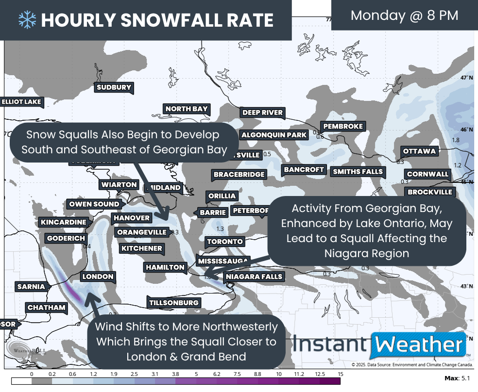
Georgian Bay will see a brief lull with lighter pockets of snow affecting the South Muskoka to Simcoe County corridor. This break will be short-lived as winds shift yet again heading into the overnight hours.
Hourly snowfall rates (cm) - MAP FROM WEATHERBELL
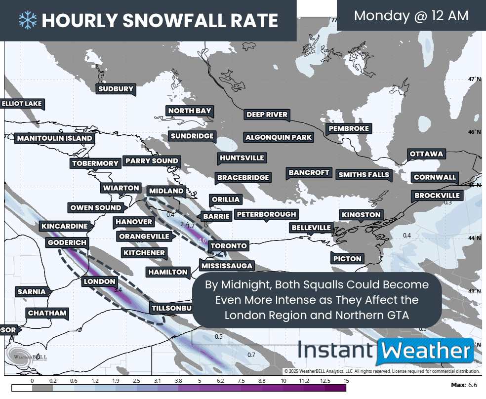
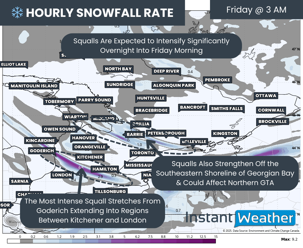
The most dangerous conditions are likely overnight Thursday into Friday morning. A very intense squall off Lake Huron is expected to set up somewhere between Goderich and Kincardine and stretch inland toward regions between Kitchener and London.
There is still uncertainty about the exact placement. Even a tiny shift in wind direction could pin this band farther north or push it farther south. At times, it may also extend into Hamilton and the Niagara region with quick bursts of heavy snow and whiteouts.
Southeast of Georgian Bay, more organized bands are likely to develop from Barrie into Kawartha Lakes. Some of this activity may also clip the northern GTA, including York and Durham. The Georgian Bay squall will likely be weaker than the Lake Huron band, but model trends have strengthened it slightly in the latest data. Peak snowfall rates will likely sit around 3 to 6 cm per hour in the strongest areas.
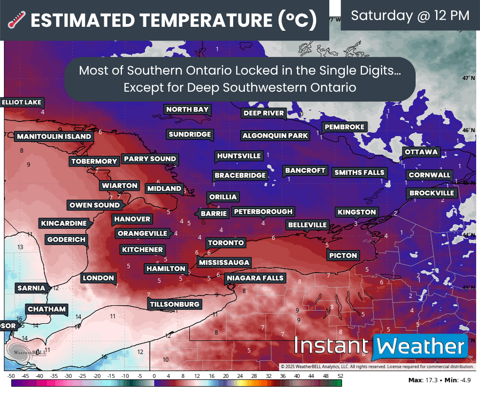
Temperatures will plunge well below freezing overnight which will help snow accumulate far more efficiently.
Most model data suggests that the lake effect bands will remain locked in place through Friday morning, although the intensity may gradually decrease during the afternoon as winds begin to ease. Snow squalls could continue into Saturday, but confidence drops for the weekend pattern since the bands may become more fragmented and less organized.
NOTE: YOU CAN CLICK ON THE MAP TO OPEN A ZOOMABLE IMAGE

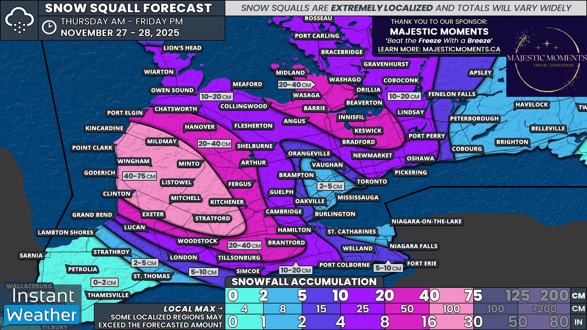
As always with lake effect snow, exact totals are extremely difficult to predict. These events can produce huge differences over very short distances. One community could pick up 50 cm while another, only a few kilometres away, sees barely any accumulation.
Even with this uncertainty, the most consistent model signal points toward a high-impact zone east of Lake Huron, picking up a general 40 to 75 cm of snow by Friday evening. This includes Goderich, Point Clark, Kincardine, Mildmay, Wingham, Clinton, Mitchell, Listowel and Stratford.
Localized totals near 100 cm cannot be ruled out, although these would be isolated pockets rather than widespread amounts.
A wider zone east of Lake Huron that stretches into the Kitchener area has the potential to see 20 to 40 cm of snowfall accumulation.
For Georgian Bay, the squall should be weaker than the Lake Huron band. We are going with 20 to 40 cm for regions like Collingwood, Wasaga Beach, Midland, Orillia, Barrie, Innisfil, Angus and Keswick. This may end up being a slight overestimate if the squall fails to organize as we saw in the last event, which significantly underperformed.
Muskoka, Parry Sound, Kawartha Lakes and parts of the eastern GTA may see 10 to 20 cm depending on how far the bands push inland.
Less than 10 cm is expected for the rest of Southern Ontario, including Eastern Ontario, the Golden Horseshoe and deep Southwestern Ontario, since they will be far enough removed from the main lake effect activity.